
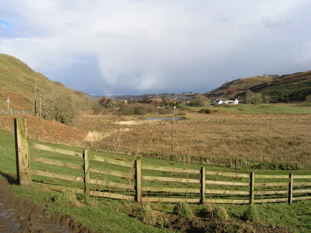
Expansion of Oban into Gleann Sheileach, Scotland: a comparative example of urban land-use change.
Credit: Peter Amsden · CC BY-SA 2.0 · sourceResized and converted to WebP; uncropped.
1. Meaning and measurement of urbanisation
Urbanisation denotes an increase in the proportion of a country’s population living in urban settlements. Urban growth, by contrast, is an increase in the absolute number of urban residents. A country can experience urban growth without a rise in its urban share if rural population grows equally fast or faster. Urbanism refers to the associated way of life, including occupational specialisation, greater social heterogeneity and dependence on extensive service networks.
The Census of India distinguishes statutory towns from census towns. Statutory towns are places with a municipality, municipal corporation, cantonment board, notified town area committee or equivalent statutory urban institution. They qualify through legal status, regardless of whether they meet the demographic and occupational tests used for census towns. Census towns satisfy the population, density and male-main-worker criteria but lack statutory urban status; many remain governed by gram panchayats.
An urban agglomeration is a continuous urban spread consisting of a town and adjoining outgrowths, or two or more physically contiguous towns with or without their outgrowths. It must include at least one statutory town, and its combined population should be at least 20,000 according to the preceding Census. Outgrowths include identifiable railway colonies, university campuses or port areas outside statutory town limits but possessing urban features. Consequently, municipal boundaries and the actual built-up settlement need not coincide.
- The occupational criterion applies to male main workers, not all workers or the entire male population.
- Census Class I towns have populations of 100,000 or more; Classes II to VI cover progressively smaller settlements.
- The UN commonly uses a population threshold of 10 million for a megacity; this is not synonymous with a million-plus city.
Timeline
1992–1993
The 74th Constitutional Amendment was enacted in 1992 and came into force on 1 June 1993.
2005
Jawaharlal Nehru National Urban Renewal Mission introduced a major programme of urban infrastructure investment and governance reforms.
2011
The Census recorded an urban population share of 31.16% and 7,935 towns.
2015
AMRUT, Smart Cities Mission and PMAY–Urban were launched.
2021
AMRUT 2.0 and Swachh Bharat Mission–Urban 2.0 were launched.
2024
PMAY–Urban 2.0 was approved to support urban housing.
2. India’s urban transition and regional geography
India possesses a long urban history, from Harappan planned settlements to temple towns, administrative capitals and trading centres. Colonial port cities such as Bombay, Calcutta and Madras developed through overseas trade, railway connections and administrative functions. After Independence, industrial centres such as Bhilai and Rourkela, planned capitals such as Chandigarh, and later information-technology hubs diversified the urban system.
Between 2001 and 2011, India’s urban population rose from about 286.1 million to 377.1 million. Its share increased by approximately 3.35 percentage points. The number of census towns rose from 1,362 to 3,894, underlining the importance of settlement reclassification alongside migration and natural increase. A settlement becoming a census town changes its statistical category but does not automatically bring municipal government or adequate services.
Urbanisation is geographically uneven. In 2011, Goa was about 62.2% urban, Tamil Nadu 48.4%, Kerala 47.7% and Maharashtra 45.2%, whereas Bihar was about 11.3% and Himachal Pradesh 10.0%. Delhi and Chandigarh had exceptionally high urban shares, but comparisons should recognise their territorial and administrative character. Maharashtra had the largest absolute urban population among states, illustrating that urban share and urban population size measure different things.
Ports, industrial belts, transport corridors, administrative centres and service clusters explain many concentrations. The Mumbai–Pune region, National Capital Region, Ahmedabad–Vadodara belt and Bengaluru–Chennai corridor exemplify interconnected urban economies. Kerala’s dispersed settlement pattern illustrates a rural–urban continuum rather than urbanisation dominated exclusively by a few compact cities.
- Always attach a reference year to urban population figures: Census observations and subsequent projections are not interchangeable.
- Urban agglomeration rankings may differ from rankings based only on populations within municipal limits.
How an urban fringe transforms
- 1. Improved accessibility and nearby employment raise demand for peripheral land
- 2. Agricultural land shifts towards housing, industry and services
- 3. Population density and non-agricultural employment increase
- 4. Eligible settlements may be classified as census towns
- 5. Infrastructure and governance gaps emerge if municipal arrangements lag
- 6. Integrated planning and statutory recognition can improve service coordination
3. Drivers, economic functions and settlement processes
Urban population expands through natural increase, migration and administrative or statistical changes. Natural increase is the excess of births over deaths among existing urban residents. Migration includes rural–urban and urban–urban movements; it should not be treated as the sole cause of India’s urban growth. Reclassification incorporates formerly rural settlements, while boundary extension brings peripheral populations within an existing urban unit.
Rural push factors include insecure farm incomes, land fragmentation and limited local employment. Urban pull factors include manufacturing and service jobs, educational institutions, healthcare and social networks. Circular and seasonal migrants frequently retain rural households while working in construction, transport or informal services. Their mobility may therefore be more complex than permanent relocation captured at one reference date.
Agglomeration economies arise when firms and workers benefit from proximity. They include shared infrastructure, specialised suppliers, larger labour markets and knowledge exchange. Bengaluru’s technology ecosystem and Surat’s textile and diamond industries illustrate these advantages. However, congestion, high land prices, pollution and infrastructure shortages can create agglomeration diseconomies.
Suburbanisation shifts people and activities towards metropolitan edges. Peri-urbanisation transforms the mixed rural–urban fringe through housing, warehouses, factories and institutions, often ahead of municipal services. A conurbation forms when expanding settlements merge into a continuous built-up area. Satellite towns are intended to accommodate activities outside a core city, but weak local employment or services can make them heavily dependent on commuting.
- Transport accessibility and employment location jointly shape urban land values and expansion.
- Compact development can reduce travel distances, but density must be supported by affordable housing, public transport and adequate utilities.
| Category | Defining feature | Common examination trap |
|---|---|---|
| Statutory town | Recognised through a statutory urban institution | Need not meet the three census-town criteria |
| Census town | Meets population, density and occupational criteria | Does not necessarily have a municipality |
| Urban agglomeration | Continuous spread of towns and eligible adjoining outgrowths | Not identical to a municipal corporation |
| Million-plus city or agglomeration | Population of at least one million | Not automatically a UN-defined megacity |
| Metropolitan area under Article 243P | At least ten lakh people, specified territorial conditions and Governor’s notification | A constitutional planning category, not merely a Census label |
4. Social and environmental consequences
Urbanisation can improve access to jobs, education, healthcare and social mobility. Yet benefits are unevenly distributed. High formal housing costs and insecure incomes encourage informal settlements, overcrowding and peripheral residence. Slums and informal settlements are related but not identical categories: legal notification, housing quality and tenure status vary. Informal workers sustain urban economies but often face insecure livelihoods and inadequate social protection.
Urban sprawl converts agricultural land and fragments habitats. Construction over wetlands, floodplains and drainage channels increases flood exposure, while impervious surfaces reduce infiltration and accelerate runoff. Water shortages can coexist with flooding because rainfall capture, storage, distribution and wastewater reuse remain inadequate. Groundwater extraction and distant water transfers can also impose ecological costs beyond city boundaries.
Urban heat islands result from heat-absorbing surfaces, limited vegetation, urban geometry and waste heat from vehicles and buildings. Air pollution arises from combinations of transport, industry, construction dust, waste burning and regional sources. Effective responses include watershed-sensitive planning, wetland protection, shaded public spaces, clean public transport, source-segregated waste management and accessible early-warning systems.
Resilience and inclusion should be pursued together. Affordable housing far from employment can raise commuting costs and undermine livelihoods. In-situ upgrading, rental housing near workplaces and universal basic services may therefore be preferable to indiscriminate relocation.
- Flood risk combines the hazard itself with exposure and vulnerability; intense rainfall alone does not explain urban disaster losses.
- Transit-oriented development integrates relatively dense, mixed-use development with accessible public transport and walking networks.
5. Governance, planning and policy
The 74th Constitutional Amendment provides for Nagar Panchayats in transitional areas, Municipal Councils in smaller urban areas and Municipal Corporations in larger urban areas. The Twelfth Schedule lists 18 matters, including urban planning, water supply, public health and slum improvement. Actual powers depend on state legislation and devolution; constitutional listing does not automatically transfer functions, finances and staff.
Article 243ZE provides for Metropolitan Planning Committees to prepare draft development plans for metropolitan areas. Constitutionally, a metropolitan area has a population of at least ten lakh and satisfies specified territorial and notification conditions. Fragmented authority among municipalities, development authorities, utilities and state departments frequently complicates integrated planning. Property taxation, user charges, transfers and municipal borrowing influence urban financial capacity.
Major policy instruments address complementary needs. AMRUT, launched in 2015, focused on urban infrastructure and was followed by AMRUT 2.0 in 2021 with emphasis on water security. Swachh Bharat Mission–Urban 2.0 targets garbage-free cities and sustainable sanitation. The Smart Cities Mission, launched in 2015, selected 100 cities for area-based development and pan-city solutions. PMAY–Urban and PMAY–Urban 2.0 address housing needs, while PM SVANidhi supports street vendors through working-capital credit.
A balanced urban strategy combines empowered local governments, metropolitan coordination, serviced land, affordable housing and support for small and medium towns. Planning should follow functional settlement regions rather than stop at municipal boundaries.
- The 73rd Amendment concerns Panchayats; the 74th concerns municipalities.
- Census towns demonstrate the potential mismatch between statistical urbanisation and administrative urban governance.
Urban expansion and the urban fringe
The supplied description links Gleann Sheileach to housing development associated with Oban’s expansion. This makes it a comparative example of urban land-use change, not evidence about Indian urbanisation. The description’s expectation that development would eventually cover the glen does not establish that this occurred. More importantly, outward construction alone cannot demonstrate urbanisation in its demographic sense: an increase in the proportion of a population living in urban settlements.
In India, similar questions arise at the peri-urban fringe, where built-up areas may extend beyond municipal boundaries into settlements undergoing changes in employment and land use. This creates challenges for coordinated water supply, drainage, transport and land-use regulation across jurisdictions. Expansion may accommodate population and economic activity, but dispersed development can increase infrastructure costs, commuting distances and pressure on agricultural land. Assessing these effects requires population data, settlement classifications, land-use evidence and information on service provision; an image description cannot establish their scale or causes.
- Urban growth is an increase in urban population; urbanisation is an increase in its population share. Physical expansion is a related but distinct process.
- India’s Census distinguishes statutory towns from census towns. A settlement can qualify as urban statistically without having an urban local government.
- Do not attribute all urban change to migration: natural increase, settlement reclassification and boundary changes also affect measured urban population.
Real-world case studies
Chennai floods, 2015
Exceptional rainfall caused severe flooding in Chennai in late 2015. Urban expansion over low-lying areas and water bodies, constrained drainage and reservoir-management challenges compounded losses. The case demonstrates why metropolitan planning must protect interconnected wetlands, tanks, floodplains and drainage routes rather than rely only on larger stormwater drains.
Ahmedabad Heat Action Plan
Following the severe heatwave of 2010, Ahmedabad introduced a Heat Action Plan in 2013. Its approach combined heat alerts, public communication, health-system preparedness and coordination between agencies. It illustrates how urban adaptation can prioritise vulnerable groups, including outdoor workers, older people and residents of poorly ventilated housing.
Previous year questions
- 2025 · Mains GS I — How does smart city in India, address the issues of urban poverty and distributive justice?
- 2024 · Mains GS I — Why do large cities tend to attract more migrants than smaller towns? Discuss in the light of conditions in developing countries.
Source-linked detailed analyses are available above.
Practice questions
Practice MCQ 1
A settlement has 6,200 residents, a density of 520 persons per square kilometre, and 78% of its male main workers engaged in non-agricultural pursuits. It has no statutory urban institution. Under Census criteria, which classification is appropriate?
- A. Statutory town
- B. Census town
- C. Metropolitan area automatically
- D. Rural settlement because it has no municipality
Practice MCQ 2
Consider the following statements: 1. Urban growth and urbanisation necessarily mean the same thing. 2. Reclassification of rural settlements can increase the recorded urban population. 3. Natural increase contributes to urban population growth. Which statements are correct?
- A. 1 and 2 only
- B. 2 and 3 only
- C. 1 and 3 only
- D. 1, 2 and 3
Practice MCQ 3
With reference to urban governance in India, consider the following statements: 1. The Twelfth Schedule contains 18 matters relating to municipalities. 2. Every census town must be administered by a Municipal Council. 3. Article 243ZE provides for Metropolitan Planning Committees. Which statements are correct?
- A. 1 only
- B. 1 and 2 only
- C. 1 and 3 only
- D. 2 and 3 only
Mains practice · India’s urban transition extends beyond municipal boundaries. Explain with reference to census towns and peri-urban growth, and suggest measures for inclusive and environmentally sustainable urbanisation. Answer in 250 words.
- Distinguish statistical, administrative and functional urban boundaries.
- Explain the role of settlement reclassification, commuting and peripheral land-use change.
- Discuss fragmented governance, infrastructure deficits and loss of wetlands or agricultural land.
- Examine housing affordability, migrant livelihoods and access to basic services.
- Recommend metropolitan coordination, local fiscal capacity, public transport and watershed-sensitive planning.
- Use Kerala’s settlement continuum or Chennai’s flooding as an illustration.
Further reading
- NCERT, India: People and Economy, Class XII: Human Settlements.
- NCERT, Fundamentals of Human Geography, Class XII: Human Settlements.
- Census of India 2011, Rural–Urban Distribution and Primary Census Abstract: censusindia.gov.in.
- Constitution of India, Part IXA and Twelfth Schedule: Legislative Department, Ministry of Law and Justice.
- Ministry of Housing and Urban Affairs: official mission guidelines and annual reports, mohua.gov.in.
- UN DESA, World Urbanization Prospects: definitions and internationally comparable urban estimates.
- https://commons.wikimedia.org/wiki/File:Urbanisation_of_Gleann_Sheileach_-_geograph.org.uk_-_353041.jpg
Preparing for UPSC Civil Services? Get classroom teaching, answer-writing evaluation and mentorship at Pragnya IAS Academy, Ashok Nagar — see why aspirants choose us for IAS coaching in Hyderabad.