
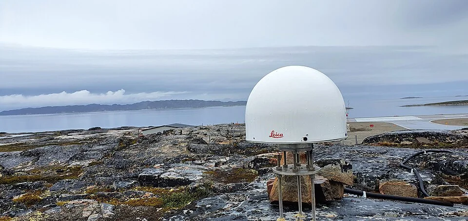
GNSS antenna used for geodetic measurements in Greenland; a comparative example of satellite-navigation ground equipment.
Credit: Karlbrix · CC BY-SA 4.0 · sourceResized and converted to WebP; uncropped.
1. How satellite navigation works
A satellite-navigation system enables a receiver to estimate its position, velocity and time from radio signals transmitted by satellites. Each signal carries a precise transmission time and information about the satellite’s orbit. By comparing transmission and reception times, the receiver estimates signal travel time. Multiplying this by the speed of light gives an apparent distance, called a pseudorange. It is not an exact geometric distance because clock offsets, atmospheric delays and other errors affect the measurement.
The receiver combines pseudoranges from several satellites using trilateration, rather than measuring directions through triangulation. In a normal three-dimensional solution, there are four principal unknowns: latitude, longitude, altitude and receiver-clock offset. Consequently, signals from at least four satellites are ordinarily required. Additional satellites improve geometry, reliability and resistance to individual signal failures. Satellite atomic clocks provide exceptionally stable timing, while the inexpensive receiver clock is corrected through the positioning calculation.
The system has three segments. The space segment consists of satellites; the control segment tracks them, estimates their orbits and maintains clock corrections; the user segment comprises receivers and processing software. Ordinary navigation receivers only receive signals: they do not need to transmit their location to navigation satellites. Internet connectivity is therefore not essential for basic positioning, although assisted navigation, map downloads and traffic information may require a communications connection.
- Positioning answers ‘Where am I?’; navigation supports movement between locations; timing provides a shared, precise time reference.
- Relativistic effects on satellite clocks must be accounted for to maintain accurate ranging.
- Satellite navigation and satellite imagery are different services: a navigation receiver calculates location from timed signals, not from photographs.
Timeline
1 July 2013
IRNSS-1A, the first satellite of India’s regional navigation system, was launched.
2015
GAGAN received DGCA certification for APV-I service, supporting aviation approaches with vertical guidance.
28 April 2016
IRNSS-1G was launched, completing deployment of the original seven-satellite constellation; the system was named NavIC.
2020
The International Maritime Organization recognised NavIC as a component of the World-Wide Radio Navigation System.
29 May 2023
NVS-01, the first second-generation NavIC satellite, was launched.
2. Global and regional navigation systems
The principal operational global constellations are the United States’ GPS, Russia’s GLONASS, the European Union’s Galileo and China’s BeiDou. Their satellites and orbital arrangements are designed to support worldwide service. Medium Earth orbit is widely used because it balances coverage, constellation size and signal travel distance. However, not every navigation satellite occupies this orbit: BeiDou also uses geostationary and inclined geosynchronous satellites.
Regional systems concentrate their service on a particular geographical area. India’s NavIC and Japan’s Quasi-Zenith Satellite System, or QZSS, are important examples. QZSS uses high-elevation satellite coverage to improve availability around Japan, including locations where buildings obstruct signals. The distinction between global and regional concerns intended service coverage, not whether the underlying ranging principle is different.
Modern multi-constellation receivers can use compatible signals from several systems. This increases the number of visible satellites and can improve performance in urban streets or difficult terrain. Nevertheless, interoperability does not eliminate the strategic importance of an independently controlled system. Civilian open services, encrypted authorised services, signal frequencies and receiver compatibility vary across constellations.
- Geostationary satellites appear nearly fixed over the equator; inclined geosynchronous satellites change their apparent position during the day.
- All geostationary orbits are geosynchronous, but not all geosynchronous orbits are geostationary.
- Recognition or availability of a regional system does not imply worldwide coverage.
From satellite signal to receiver position
- 1. Satellite broadcasts timing and orbital information.
- 2. Receiver identifies signals from multiple satellites.
- 3. Signal travel times yield pseudorange measurements.
- 4. Receiver applies available clock, orbit and atmospheric corrections.
- 5. Measurements normally from at least four satellites solve position and receiver-clock offset.
- 6. Successive solutions support navigation, velocity estimation and precise timing.
3. NavIC: India’s independent navigation capability
NavIC was originally called the Indian Regional Navigation Satellite System, or IRNSS. Developed by ISRO, it provides an independent positioning and timing capability for India and the surrounding region. Its primary service area encompasses India and approximately 1,500 km beyond its boundary. The original design provides position accuracy better than 20 metres in this area. Actual receiver performance depends on signal conditions, satellite geometry and equipment quality.
The original constellation architecture consists of seven satellites: three in geostationary orbit and four in inclined geosynchronous orbit. This is a design description, not a guarantee that seven original satellites remain healthy at every moment. Ground facilities support orbit determination, navigation-message generation, clock monitoring and system control. Atomic-clock failures and ageing satellites make replenishment and technical upgrades important parts of constellation management.
NavIC provides the open Standard Positioning Service and the encrypted Restricted Service for authorised users. Its original navigation signals use the L5 and S bands. The second-generation NVS series adds L1-band civilian signals, alongside L5 and S, to facilitate wider compatibility with navigation devices. NVS-01, launched on 29 May 2023 aboard GSLV-F12, carried an indigenous rubidium atomic clock, marking progress towards reducing dependence on imported critical components.
NavIC’s significance includes strategic autonomy, reliable timing, transport management, mapping and location-based services. However, a satellite constellation alone cannot ensure widespread adoption. Compatible chipsets, antennas, software, testing standards and affordable receivers are also required. A phone supporting GPS does not automatically support NavIC; compatibility must be checked for the specific device and signal bands.
- Remember the original architecture as 3 GEO plus 4 inclined GSO.
- NavIC is regional; GPS is global.
- L1 addition is a second-generation enhancement, not a feature of every original IRNSS satellite.
| System | Operator | Coverage and distinguishing feature |
|---|---|---|
| GPS | United States | Global; predominantly medium Earth orbit |
| GLONASS | Russia | Global; medium Earth orbit |
| Galileo | European Union | Global; under civilian control |
| BeiDou | China | Global; mixed orbital architecture |
| NavIC | India | Regional; original architecture uses GEO and inclined GSO satellites |
| QZSS | Japan | Regional; high-elevation coverage improves navigation availability around Japan |
4. Accuracy, augmentation and GAGAN
Navigation accuracy is affected by ionospheric and tropospheric delays, imperfect orbit and clock estimates, receiver noise and multipath propagation. Multipath occurs when signals reflect from buildings or other surfaces before reaching the antenna. Satellite geometry also matters: satellites clustered in one part of the sky generally produce a weaker position solution than well-distributed satellites. Dual-frequency observations help estimate ionospheric error.
Augmentation systems improve the usefulness of existing navigation signals through corrections, integrity information or additional ranging signals. Differential techniques use reference receivers at accurately surveyed locations. Real-Time Kinematic positioning uses carrier-phase measurements and correction links to achieve centimetre-level accuracy under suitable conditions. Such performance should not be confused with the ordinary accuracy of an unaided consumer receiver.
GAGAN stands for GPS Aided GEO Augmented Navigation. Jointly developed by ISRO and the Airports Authority of India, it is a satellite-based augmentation system, not a separate global navigation constellation. Ground reference stations monitor GPS signals; processing facilities generate corrections and integrity messages, which are broadcast through geostationary satellite payloads. Integrity means providing timely warnings when the service should not be used, a particularly important requirement for safety-critical aviation.
- Accuracy describes closeness to the true position; integrity concerns trustworthiness and timely warnings.
- Availability means that the required service can be obtained; continuity concerns maintaining it without unexpected interruption.
- GAGAN augments GPS, whereas NavIC supplies an independent regional navigation service.
5. Applications, vulnerabilities and governance
Navigation satellites support road and maritime transport, aircraft operations, precision agriculture, surveying, disaster-response coordination and geotagging. Their timing signals synchronise telecommunications networks, electricity-grid measurements and financial infrastructure. Surveying applications require attention to coordinate reference systems and vertical datums: a satellite-derived height is not automatically equivalent to height above mean sea level.
Signals reaching Earth are weak and can be disrupted. Jamming overwhelms reception with interference, whereas spoofing introduces deceptive signals that can produce false positions or times. Buildings, tunnels, dense vegetation and terrain can also prevent reliable reception. Space weather may disturb radio propagation. Resilience therefore requires complementary technologies such as inertial navigation, terrestrial aids, independent clocks and interference monitoring.
For India, policy priorities include constellation replenishment, indigenous clocks and receiver components, affordable adoption and protection of radio spectrum. Multi-constellation use improves practical performance, while NavIC provides an independently controlled capability. Location privacy is mainly affected when devices or applications store and share calculated positions; passive satellite reception alone does not reveal a receiver’s identity or location to the constellation.
- An SOS message needs a communications channel; calculating a position does not itself transmit a distress alert.
- Navigation satellites supplement, rather than universally replace, terrestrial navigation and operational safety procedures.
Ground receivers: turning satellite signals into precise positions
Navigation satellites need compatible ground receivers to turn their broadcasts into useful positioning information. The supplied metadata identifies a GNSS antenna used for geodetic measurements in Greenland, making this a relevant comparative example of the user segment, not Indian infrastructure. An antenna receives radio signals; connected receiver equipment processes their timing and navigation messages. Signal travel times yield estimated satellite-to-receiver distances, called pseudoranges because receiver-clock offsets and other errors affect them. A conventional standalone three-dimensional solution generally requires signals from at least four satellites to determine three position coordinates and receiver-clock bias.
Geodetic applications demand greater precision than ordinary navigation. They can use carrier-phase measurements, reference stations and correction services to reduce errors arising from atmospheric delays, satellite clocks and orbital estimates. In India, satellite positioning supports surveying, infrastructure planning and disaster management. NavIC provides regional positioning, navigation and timing services, whereas GPS is a global constellation. GAGAN is an augmentation system supporting GPS-based navigation, particularly aviation; it is not a separate navigation constellation. The metadata alone does not establish this antenna’s supported constellations, achieved accuracy or measurement method.
- Positioning uses distance-based trilateration, not simply angle-based triangulation; satellite geometry influences solution quality.
- A GNSS antenna is receiving equipment, not a navigation satellite. NavIC access requires receiver and antenna compatibility with its signals.
- High accuracy is not automatic: multipath, interference, jamming and spoofing can degrade positioning; corrections and integrity monitoring serve different purposes.
Real-world case studies
GAGAN-assisted aircraft landing at Kishangarh
In April 2022, IndiGo conducted an ATR aircraft landing using a GAGAN-based approach at Kishangarh Airport, Rajasthan. The demonstration illustrated how satellite augmentation can support approach guidance without requiring an instrument landing system for that particular procedure. Approved procedures, certified avionics and operational safeguards remain essential.
NavIC-enabled information services for fishers
ISRO and the Indian National Centre for Ocean Information Services have demonstrated NavIC-enabled dissemination of information such as potential fishing zones and ocean-state warnings to fishers. This illustrates the combination of navigation and one-way messaging. A receiver obtaining an advisory does not automatically provide a two-way distress communication link.
Previous year questions
UPSC Prelims 2018
With reference to IRNSS, consider these statements: 1. It has three satellites in geostationary and four in geosynchronous orbits. 2. It covers all of India and about 5,500 square kilometres beyond its borders. 3. India will have its own navigation system with full global coverage by the middle of 2019. Which statements are correct?
- A. 1 only
- B. 1 and 2 only
- C. 2 and 3 only
- D. 1, 2 and 3
Practice questions
Practice MCQ 1
Why does an ordinary satellite-navigation receiver normally require signals from at least four satellites for a three-dimensional position fix?
- A. Each satellite measures a different atmospheric layer.
- B. The receiver must solve three position coordinates and its clock offset.
- C. One satellite must receive the user’s location.
- D. Four signals eliminate all multipath errors.
Practice MCQ 2
Consider the following statements: 1. GAGAN is an independent global navigation constellation. 2. NavIC’s original civilian signals use L5 and S bands. 3. The NVS series introduces an additional L1 civilian signal. Which statements are correct?
- A. 1 and 2 only
- B. 2 and 3 only
- C. 1 and 3 only
- D. 1, 2 and 3
Practice MCQ 3
Which statement correctly distinguishes satellite-navigation spoofing from jamming?
- A. Spoofing supplies deceptive signals, while jamming interferes with signal reception.
- B. Spoofing improves timing, while jamming improves positioning.
- C. Spoofing affects only maps, while jamming affects only atomic clocks.
- D. Spoofing requires internet connectivity, while jamming requires a geostationary satellite.
Mains practice · NavIC is both a strategic asset and a platform for civilian innovation. Explain its significance and examine the challenges to widespread adoption in India. How does GAGAN differ from NavIC? (250 words)
- Introduce NavIC as an independently controlled regional positioning, navigation and timing system.
- Explain strategic autonomy, transport, agriculture, disaster management and infrastructure timing.
- Discuss replenishment, atomic clocks, compatible chipsets, L1 signals, affordability and adoption.
- Address interference, spoofing, obstructed reception and complementary navigation systems.
- Distinguish NavIC’s independent ranging service from GAGAN’s GPS augmentation and integrity support.
- Conclude with indigenous capability, interoperability and resilient user infrastructure.
Further reading
- ISRO: Satellite Navigation Services and NavIC pages, isro.gov.in.
- ISRO: NavIC Standard Positioning Service Signal-in-Space Interface Control Documents.
- ISRO: GSLV-F12/NVS-01 mission information.
- Airports Authority of India: GAGAN official information, aai.aero.
- International Maritime Organization: World-Wide Radio Navigation System and NavIC recognition.
- https://commons.wikimedia.org/wiki/File:GNSS_antenna.jpg
Preparing for UPSC Civil Services? Get classroom teaching, answer-writing evaluation and mentorship at Pragnya IAS Academy, Ashok Nagar — see why aspirants choose us for IAS coaching in Hyderabad.