
Andhra Pradesh
South-eastern India
Andhra Pradesh: Consultation weighs making father's name optional in documents
Andhra Pradesh is a southern Indian state along the Bay of Bengal. Its landscape includes fertile river deltas, coastal plains, the Eastern Ghats and the interior uplands of Rayalaseema.
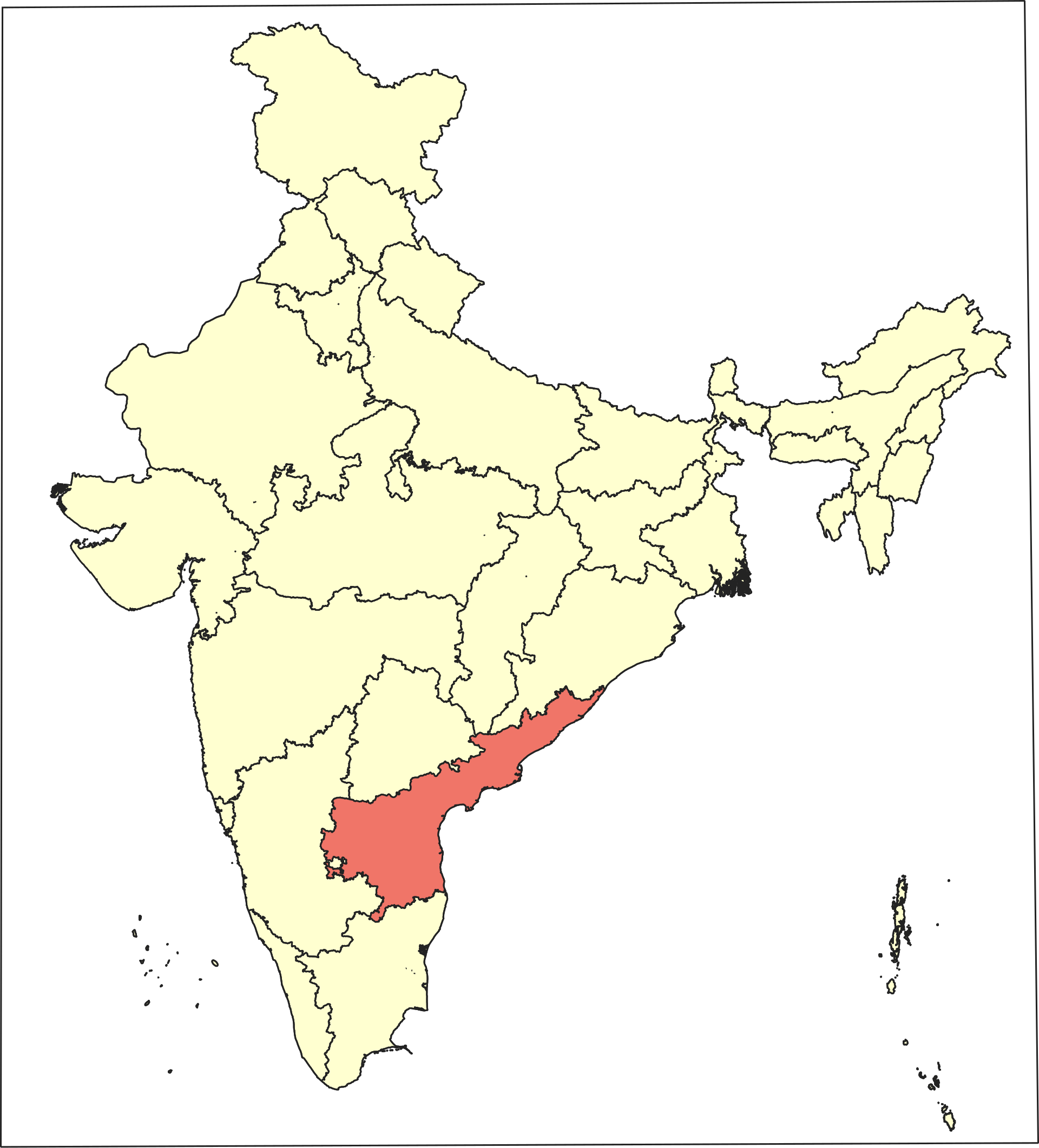
Position matched with OpenStreetMap; the dashed outline shows its mapped extent. Other numbered pins are the day's other places — tap one to open it.
Why in the news
A State-level consultation discussed making the father's name optional in official documents. The discussion focused on preventing children from being excluded because of their family circumstances.
Read the full analysis: Andhra Pradesh Weighs Optional Father’s Name: Child Dignity and Inclusive DocumentationCapital
Amaravati
Coastal water body
Bay of Bengal
Major rivers
Godavari, Krishna and Pennar
Major hill system
Eastern Ghats
Ramsar site
Kolleru Lake
Location
- Lies on India's eastern coast, with the Bay of Bengal to the east.
- Borders Odisha and Chhattisgarh towards the north and Telangana towards the north-west.
- Adjoins Karnataka to the west and Tamil Nadu to the south.
- The Godavari and Krishna cross the state before entering the Bay of Bengal.
Bordering states
- Odisha
- Chhattisgarh
- Telangana
- Karnataka
- Tamil Nadu
Key features
- Eastern Ghats
- Discontinuous hill ranges run broadly parallel to the coast and are cut by major rivers.
- Coastal plains
- Low-lying plains along the Bay of Bengal include extensive alluvial and deltaic tracts.
- Godavari–Krishna deltas
- These river-built coastal lowlands support intensive agriculture and irrigation networks.
- Rayalaseema
- The southern interior region has rocky uplands and generally drier conditions than the coastal delta belt.
- Pennar basin
- The Pennar drains parts of the southern interior and flows east into the Bay of Bengal.
Flora, fauna & ecology
- Wetlands
- Kolleru is a freshwater lake between the Krishna and Godavari deltas; Pulicat is a brackish lagoon shared with Tamil Nadu.
- Mangroves
- The Godavari estuarine region supports mangrove ecosystems, including those protected in Coringa Wildlife Sanctuary.
- Red sanders
- Southern Eastern Ghats forests support red sanders, a tree endemic to this part of India.
- Coastal hazards
- The coast is exposed to Bay of Bengal cyclones, storm surges and associated flooding.
History & significance
- Andhra Pradesh was formed in 1956 by combining Andhra State with the Telugu-speaking Telangana region of Hyderabad State.
- Telangana became a separate state on 2 June 2014, leaving the present-day Andhra Pradesh.
UPSC angle
- GS I: Locate the state's neighbours, Eastern Ghats, coastal plains and major east-flowing rivers.
- GS III: Compare freshwater lakes, brackish lagoons and mangrove ecosystems using Kolleru, Pulicat and Coringa.
- GS III: Link coastal physiography with cyclone, storm-surge and flood vulnerability.
- GS II: Connect the consultation with child rights, inclusive documentation and barriers to access to public services.
Also locate on your map
- Amaravati
- Godavari delta
- Krishna delta
- Kolleru Lake
- Pulicat Lake
- Coringa Wildlife Sanctuary
- Nallamala Hills
- Sriharikota
Test yourself
Q1. Which one of the following states does NOT share a land boundary with Andhra Pradesh?
Q2. With reference to wetlands associated with Andhra Pradesh, consider the following statements: 1. Kolleru is a freshwater lake between the Krishna and Godavari deltas. 2. Pulicat is a brackish lagoon shared by Andhra Pradesh and Tamil Nadu. Which of the statements given above is/are correct?
Sources
Background maps and imagery © Esri and partners (English labels); place positions checked with OpenStreetMap (ODbL). Boundaries are for study reference only. Prepared by Pragnya IAS Academy for exam revision.