
Black Sea
South-eastern Europe–Western Asia
Black Sea: Food shipment security mooted as a confidence-building measure
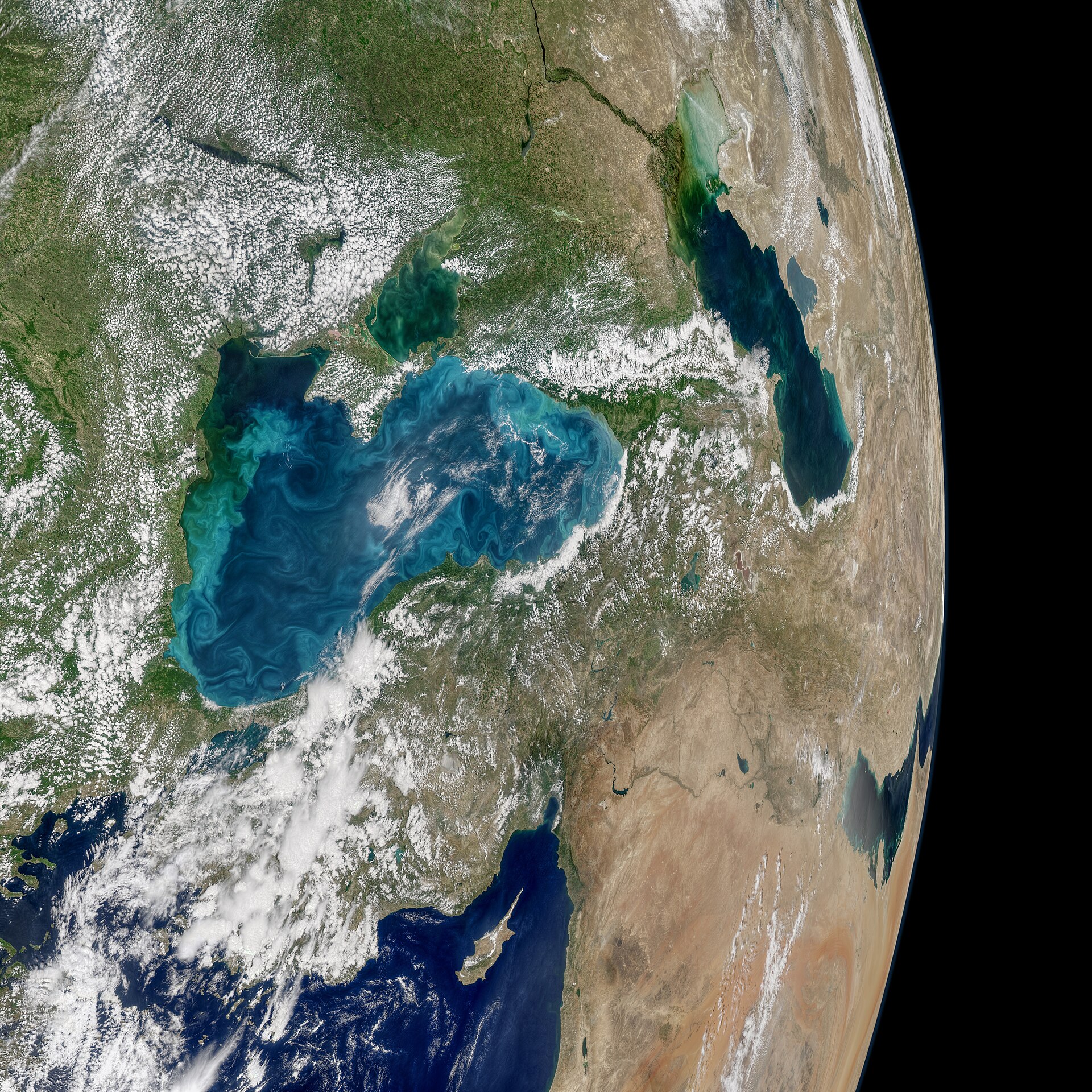
The Black Sea is a semi-enclosed sea between south-eastern Europe and western Asia. It connects to the Mediterranean through the Bosporus, Sea of Marmara and Dardanelles.
Position matched with OpenStreetMap; the dashed outline shows its mapped extent. Other numbered pins are the day's other places — tap one to open it.
Why in the news
The supplied reports cover U.S.-mediated Russia–Ukraine peace talks in Abu Dhabi and related diplomatic efforts. In this context, protecting Black Sea food shipments is identified as a potential confidence-building measure, not a reported agreement.
Read the full analysis: Ukraine Peace Talks: Security Guarantees, Black Sea Food Routes and IndiaCoastal countries
Six
Largest river inflow
Danube
Strait towards the Sea of Marmara
Bosporus
Strait towards the Sea of Azov
Kerch Strait
Location
- Lies north of Türkiye and south of Ukraine, between the Balkan region and the Caucasus.
- Romania and Bulgaria lie along its western shore; Georgia lies on its eastern shore.
- The Bosporus links its south-western end to the Sea of Marmara.
- The Kerch Strait connects its north-eastern sector with the Sea of Azov.
Bordering countries
- Türkiye
- Bulgaria
- Romania
- Ukraine
- Russia
- Georgia
Key features
- Mediterranean connection
- The outward route runs through the Bosporus, Sea of Marmara, Dardanelles and Aegean Sea.
- Major river inflows
- The Danube, Dniester and Dnieper discharge into the Black Sea.
- Continental shelf
- The north-western shelf is broad, contrasting with narrower shelves along much of the southern and eastern margins.
- Water stratification
- Less saline surface water overlies denser, saltier deep water, limiting vertical mixing.
- Deep-water chemistry
- Most deep water lacks dissolved oxygen and contains hydrogen sulphide.
- Crimean Peninsula
- Projects into the sea from the north; the Kerch Strait lies at its eastern end.
Flora, fauna & ecology
- Danube Delta
- Extensive wetlands at the river mouth support fish, migratory birds and reed-bed ecosystems.
- Marine productivity
- Phytoplankton blooms occur in surface waters; oxygen-dependent marine life is largely confined to the upper oxygenated layer.
History & significance
- Ancient Greek settlements developed around its shores, linking maritime trade with the Eurasian hinterland.
- The 1936 Montreux Convention governs passage through the Turkish Straits.
UPSC angle
- Prelims map work: identify the six coastal countries and distinguish them from nearby landlocked countries.
- Trace the sea route from the Black Sea to the Mediterranean and distinguish the Bosporus from the Dardanelles.
- Physical geography: examine salinity stratification, restricted circulation and deep-water anoxia.
- GS II and GS III: connect maritime security and diplomatic confidence-building with food shipment routes and global food security.
Also locate on your map
- Sea of Azov
- Kerch Strait
- Crimean Peninsula
- Bosporus
- Sea of Marmara
- Dardanelles
- Aegean Sea
- Danube Delta
Test yourself
Q1. Which of the following sets consists entirely of countries bordering the Black Sea?
Q2. A vessel travelling from the Black Sea to the Aegean Sea follows which sequence?
Sources
- The Hindu: Ukraine’s Zelenskyy says he is pleased with messages from U.S. envoys on diplomatic efforts to end war
- The Hindu: U.S.-mediated talks on ending war between Russia, Ukraine begin in Abu Dhabi
- The Hindu: G7 attention in Paris turns to Ukraine while U.S.-mediated talks get underway in Abu Dhabi
- The Hindu: Past talks involving Russia and Ukraine have yielded little progress toward peace
Background maps and imagery © Esri and partners (English labels); place positions checked with OpenStreetMap (ODbL). Boundaries are for study reference only. Prepared by Pragnya IAS Academy for exam revision.