
Delhi
Northern India
Delhi: Post-Deepavali pollution surge raises questions over PM2.5 data and AQI readings
Delhi is a Union Territory, officially the National Capital Territory of Delhi, in northern India. It encompasses New Delhi, India's capital, and lies along the Yamuna at the interface of the alluvial plains and the Delhi Ridge.
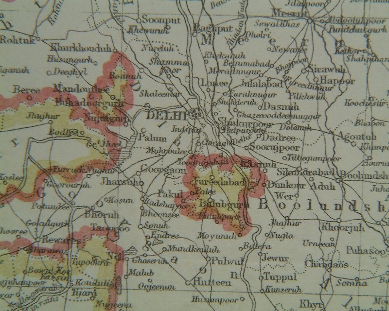
Position matched with OpenStreetMap; the dashed outline shows its mapped extent. Other numbered pins are the day's other places — tap one to open it.
Why in the news
Reports highlighted missing PM2.5 observations at several government monitoring stations during Delhi's Deepavali pollution peak. Another report contrasted an AQI of 370 with readings of around 1,000 on some platforms, raising questions about comparability. Political allegations over data manipulation and Punjab stubble burning accompanied the controversy; these remain allegations, not established findings.
Read the full analysis: Delhi Pollution: PM2.5 Data Gaps, AQI Differences and Monitoring AccountabilityOfficial name
National Capital Territory of Delhi
Administrative status
Union Territory with a legislature
India's capital
New Delhi, within the NCT of Delhi
Principal river
Yamuna
River basin
Ganga
Major rocky landform
Delhi Ridge
Location
- Situated in northern India, between Haryana and Uttar Pradesh.
- Haryana borders Delhi on the north, west and south; Uttar Pradesh lies along its eastern boundary.
- The Yamuna flows broadly north–south through eastern Delhi before continuing towards Uttar Pradesh.
- The Delhi Ridge extends into the territory from the Aravalli system to the south-west.
Bordering states
- Haryana
- Uttar Pradesh
Key features
- Yamuna floodplain
- Low-lying alluvial terrain along the river supports groundwater recharge and is exposed to flooding.
- Delhi Ridge
- A rocky extension of the Aravalli system, composed largely of quartzite.
- Alluvial plains
- Much of Delhi occupies relatively level terrain formed by river-deposited sediments.
- Drainage
- Delhi lies within the Yamuna sub-basin of the Ganga river basin.
Flora, fauna & ecology
- Seasonal climate
- Hot summers, a monsoon rainfall season and cool winters produce marked seasonal contrasts.
- Winter pollution conditions
- Weak winds and temperature inversions can restrict vertical mixing and trap pollutants near the surface.
- Ridge vegetation
- The ridge supports dry thorn and scrub vegetation, with widespread invasive Prosopis juliflora.
- Riverine habitats
- Yamuna floodplain wetlands and associated habitats support waterbirds and other aquatic life.
History & significance
- New Delhi was formally inaugurated as the capital in 1931.
UPSC angle
- Physical geography: locate Delhi's state boundaries, Yamuna floodplain and Aravalli-linked ridge.
- Climatology: connect winter inversions, wind speed and atmospheric mixing with pollution accumulation.
- Environment: distinguish pollutant concentrations from AQI values; check the scale, averaging period and monitoring coverage before comparing readings.
- Regional planning: distinguish the NCT of Delhi from the wider National Capital Region, which includes areas of neighbouring states.
Also locate on your map
- Yamuna River
- Aravalli Range
- Gurugram
- Faridabad
- Noida
- Ghaziabad
- Asola Bhatti Wildlife Sanctuary
Test yourself
Q1. Which pair of states shares boundaries with the National Capital Territory of Delhi?
Q2. With reference to Delhi's physical geography, consider the following statements: 1. The Delhi Ridge is an extension of the Aravalli system. 2. The Yamuna belongs to the Ganga river basin. Which of the statements given above is/are correct?
Sources
- The Hindu: At peak of air pollution on Deepavali, data goes missing at several government monitoring stations in Delhi
- The Hindu: Delhi AQI row: AAP alleges data fraud, BJP fires back over Punjab stubble ‘conspiracy’
- Indian Express: Delhi’s AQI is 370, but some platforms show 1,000: Why do readings differ?
- Times of India: Delhi pollution on Diwali rockets to worst in 5 years
Background maps and imagery © Esri and partners (English labels); place positions checked with OpenStreetMap (ODbL). Boundaries are for study reference only. Prepared by Pragnya IAS Academy for exam revision.