
Yemen
South-western Arabian Peninsula, West Asia
Yemen: Houthi gains prompt Saudi Arabia to replace military commander
Yemen occupies the south-western corner of the Arabian Peninsula, overlooking the Red Sea and the Gulf of Aden. Its territory includes the Socotra archipelago in the Arabian Sea.
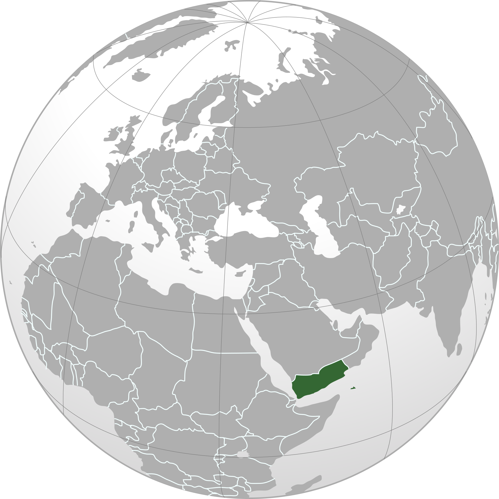
Position matched with OpenStreetMap; the dashed outline shows its mapped extent. Other numbered pins are the day's other places — tap one to open it.
Why in the news
The Hindu reports that rapid Houthi gains against the Saudi-backed Yemeni government have drawn Saudi Arabia back into confrontation and prompted the replacement of its military commander. The report links the renewed fighting in Yemen’s previously frozen civil war to the U.S.–Iran conflict.
Capital
Sana’a
Largest island
Socotra
Highest point
Jabal an-Nabi Shu‘ayb
Major southern port
Aden
Land neighbours
Saudi Arabia and Oman
Unification
1990
Location
- Situated at the south-western end of the Arabian Peninsula, south of Saudi Arabia and west of Oman.
- Faces the Red Sea to the west and the Gulf of Aden to the south.
- Overlooks the Bab el-Mandeb Strait, opposite Djibouti and Eritrea in the Horn of Africa.
- The Socotra archipelago lies offshore in the Arabian Sea, east of the Horn of Africa.
Bordering countries
- Saudi Arabia
- Oman
Key features
- Bab el-Mandeb Strait
- Connects the Red Sea with the Gulf of Aden, forming a strategic gateway on the Suez Canal maritime route.
- Tihamah coastal plain
- A hot, low-lying plain extends along Yemen’s Red Sea coast.
- Western highlands
- Rugged mountains rise sharply inland from the coastal plain and support terraced cultivation.
- Eastern interior
- Plateaux and wadis extend towards the arid interior and the Rub al Khali along the northern frontier.
- Hadhramaut
- An eastern plateau region marked by the extensive Wadi Hadhramaut valley system.
- Socotra archipelago
- An offshore island group renowned for its distinctive landscapes and high biological endemism.
Flora, fauna & ecology
- Climate
- Much of Yemen is arid, while the western highlands receive more seasonal rainfall than the coastal plains and interior deserts.
- Socotra endemism
- Socotra supports distinctive endemic plants, including the dragon’s blood tree.
- Mountain agriculture
- Terraced slopes in the highlands conserve soil and water and support crops, including coffee.
History & significance
- Ancient southern Arabian kingdoms, including Saba, flourished in present-day Yemen.
- North Yemen and South Yemen united in 1990 to form the Republic of Yemen.
UPSC angle
- Prelims mapping: identify Yemen’s land neighbours, adjoining seas and position opposite the Horn of Africa.
- GS I: relate highland relief, aridity and seasonal rainfall to terraced agriculture and settlement.
- GS II: examine Yemen’s conflict within West Asian geopolitics and regional security.
- GS III: connect Bab el-Mandeb with maritime chokepoints, shipping security and the Suez Canal route.
- Environment: revise island endemism and the conservation significance of Socotra.
Also locate on your map
- Bab el-Mandeb Strait
- Gulf of Aden
- Red Sea
- Socotra
- Djibouti
- Oman
- Rub al Khali
- Suez Canal
Test yourself
Q1. Which of the following pairs comprises the only countries sharing land borders with Yemen?
Q2. The Bab el-Mandeb Strait, adjoining Yemen, connects which two water bodies?
Sources
Background maps and imagery © Esri and partners (English labels); place positions checked with OpenStreetMap (ODbL). Boundaries are for study reference only. Prepared by Pragnya IAS Academy for exam revision.