
Cyclone Arnab: Formation, Naming and Coastal Disaster Preparedness
Revise the static topic: UPSC Geography notes · UPSC Disaster Management notes
In short: According to the supplied reports, IMD forecasts Cyclone Arnab to cross the Andhra Pradesh–Yanam coast between Bapatla and Visakhapatnam, close to Yanam, by the forenoon of October 28, 2026. Fishing restrictions, boat returns and power-sector mobilisation illustrate how cyclone warnings must translate into early protective action, targeted evacuation and continuity of essential services.
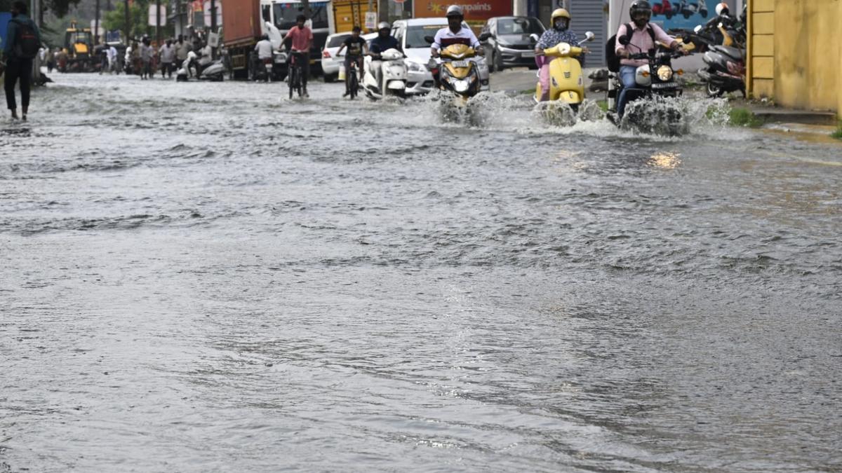
Photo from the source report: Cyclone Arnab: Formation, Naming and Coastal Disaster Preparedness
Image: The Hindu
Why in news
As reported on October 26, IMD issued a red message cyclone warning for Andhra Pradesh and adjoining south Odisha coasts. Andhra Pradesh activated preparedness measures, while Odisha mobilised resources and imposed precautionary restrictions.
115–125 kmph
Forecast maximum sustained winds at crossing
140 kmph
Forecast gust speed
Over 4,800
Fishing boats reported returned along Kakinada coast
41
APEPDCL control rooms opened
4,056
Personnel arranged in contractor teams
13
Countries participating in regional cyclone naming
Background
Tropical cyclones are organised, rotating low-pressure systems that develop over warm tropical oceans. India's eastern coast faces cyclone hazards from the Bay of Bengal, with low-lying coastal settlements, deltas, fishing communities and infrastructure exposed to strong winds, storm surge and heavy rainfall. IMD provides cyclone forecasting and warning services, while disaster management authorities, district administrations, local bodies and sectoral agencies organise protective action. Yanam is part of the Union Territory of Puducherry and lies in the Godavari delta region adjoining Andhra Pradesh.
What the warning says—and what remains a forecast
The supplied reports place Arnab over the east-central and adjoining west-central Bay of Bengal, moving generally west-northwestwards. IMD projected intensification into a very severe cyclonic storm by October 27 and coastal crossing near Yanam by the forenoon of October 28.
The reported crossing forecast gives maximum sustained winds of 115–125 kmph, gusting to 140 kmph. These are forecast conditions, not observed landfall measurements. The live reports contain different position estimates and some inconsistent calendar references; operational decisions should therefore use the latest time-stamped IMD bulletin rather than combine updates into a single position.
Andhra Pradesh directed continuous vigilance, and fishing boats returned to landing centres along the Kakinada coast. Odisha restricted sea fishing and access to selected tourist locations. No completed landfall or completed population evacuation is established by the supplied material.
- A forecast landfall corridor identifies an area of concern; it does not mean that hazardous conditions will remain confined to that corridor.
- Sustained wind and gust speed are different measurements and should not be used interchangeably.
- Cyclone classification is based on maximum sustained wind speed; basin-specific official classifications should be used.
Infographic
Understand formation
Warm seas, moisture, rotation and weak shear support development.
Communicate clearly
Names identify storms; current bulletins specify hazards and uncertainty.
Forecast impacts
Combine hazards with exposure and vulnerability.
Evacuate inclusively
Move at-risk people early with accessible transport and safe shelters.
Protect lifelines
Maintain power, water, healthcare and communications.
Recover resiliently
Restore safely and reduce future risk through better planning.
AI-assisted infographic by Pragnya IAS Academy, based on the cited sources.
How tropical cyclones form and intensify
Warm ocean water supplies heat and moisture through evaporation. Moist air rises around a pre-existing disturbance, cools and condenses; the release of latent heat sustains convection and strengthens the warm-core circulation. Falling central pressure encourages further inflow, while the Coriolis force helps organise rotation.
Development is favoured by a sufficiently deep warm-water layer, moist air, weak vertical wind shear and effective upper-level outflow. Weak shear allows the circulation to remain vertically organised. Cyclones seldom form very close to the equator because the Coriolis force is too weak there.
Post-monsoon conditions can favour cyclone development over the Bay of Bengal. The storm's eventual impact depends not only on its intensity but also on its track, size, rainfall distribution, coastal shape, bathymetry and the timing of tides. These general mechanisms explain cyclone risk; the sources do not establish the contribution of each factor to Arnab's intensification.
- Strong winds damage roofs, trees, electricity networks and exposed coastal assets.
- Storm surge is an abnormal rise of sea level driven mainly by cyclone winds pushing water towards the coast, with low pressure also contributing.
- Heavy rainfall can cause inland flooding even away from the landfall location.
- Coastal surge can obstruct river and drainage outflows, compounding rainfall-induced flooding.
How cyclone naming works
The Regional Specialised Meteorological Centre at New Delhi assigns names to tropical cyclones over the Bay of Bengal and Arabian Sea once they reach the relevant naming intensity. Names are drawn sequentially from an agreed regional list under the WMO/ESCAP Panel on Tropical Cyclones.
The participating countries are Bangladesh, India, Iran, Maldives, Myanmar, Oman, Pakistan, Qatar, Saudi Arabia, Sri Lanka, Thailand, the United Arab Emirates and Yemen. Naming supports clear communication between forecasters, disaster managers, the media and the public, particularly when multiple systems need to be distinguished.
A name does not indicate severity, expected landfall or the country likely to be affected. The supplied material does not establish which country proposed the name Arnab or its meaning; neither should be inferred.
- RSMC New Delhi names storms across its regional responsibility area, not only those approaching India.
- Naming and intensity classification are distinct functions.
- Regional terms such as hurricane and typhoon describe the same broad type of tropical weather system, but operational classifications differ across basins.
From impact-based forecasting to safe evacuation
Conventional forecasting describes expected weather; impact-based forecasting connects that weather with exposed people, assets and vulnerabilities. For example, a wind forecast becomes actionable when translated into likely roof damage, unsafe fishing conditions, blocked evacuation roads or interruption of hospital electricity supply.
District authorities should overlay wind, rainfall and surge forecasts with settlement maps, shelter capacity, road access and the location of vulnerable households. Evacuation decisions must account for the time needed to warn, transport and shelter people before dangerous conditions make movement unsafe.
Warnings should state the locality at risk, expected impact, required action and safe destination in accessible local-language formats. Forecast uncertainty should be communicated without weakening precautionary action. Fishing restrictions need harbour-level follow-up, while population evacuation requires transport, shelter management and assistance for people unable to move independently.
- Prioritise low-lying settlements, fragile housing and locations likely to lose road access.
- Provide assisted transport for older persons, persons with disabilities, pregnant women and patients requiring continuing care.
- Equip shelters with safe water, sanitation, essential medicines, lighting and arrangements for privacy and protection.
- Use redundant warning channels, including local volunteers and public announcements, because mobile networks may fail.
- Permit return only after checks for flooding, damaged structures, contaminated water and electrical hazards.
Coastal infrastructure resilience and continuity of governance
APEPDCL reported opening divisional and circle-level control rooms, arranging contractor teams and stocking electrical materials. It also sought support from another distribution utility. These are preparedness measures intended to shorten service disruption; they do not establish that damage has occurred or supply has already been restored.
Electricity is a lifeline for water pumping, communications, healthcare, shelters and emergency coordination. Resilience therefore requires both reducing physical damage and restoring critical services safely. Elevated electrical equipment in flood-prone locations, wind-resistant structures, network redundancy and tested backup power should complement emergency stockpiles.
The report on municipal elections highlights a wider governance challenge: disaster response and democratic processes can compete for personnel, buildings and transport. Election authorities and disaster managers should coordinate contingencies, but anticipated recovery should not be treated as proof that conditions will be safe.
- Prioritise hospitals, drinking-water systems, shelters and emergency communications during restoration.
- Isolate damaged electrical sections and verify safety before re-energising flooded areas.
- Select underground cabling or other network-hardening measures according to local wind, flood and maintenance risks.
- Protect mangroves and coastal wetlands as complementary buffers, not substitutes for safe siting, shelters or evacuation.
| Hazard or disruption | Likely impact | Priority response |
|---|---|---|
| Strong winds | Roof damage, falling trees and electricity-line failure | Secure loose objects, move people from unsafe buildings and stage repair teams |
| Storm surge | Coastal inundation and disruption of escape routes | Use inundation maps for early evacuation to safe shelters |
| Heavy rainfall | Urban waterlogging, river flooding and road isolation | Monitor drainage and rivers, protect access routes and prepare rescue resources |
| Rough seas | Danger to fishing vessels and coastal operations | Recall boats, suspend unsafe sea activity and verify harbour-level compliance |
| Power and communication failure | Disruption of healthcare, water supply and warnings | Maintain backup systems and restore critical services first |
- 1. IMD issues updated track, intensity and hazard forecasts.
- 2. Authorities combine hazard information with exposure and vulnerability maps.
- 3. District administrations identify priority settlements and activate evacuation arrangements.
- 4. Local agencies communicate actionable warnings and assist movement to shelters.
- 5. Utilities and response teams maintain essential services and undertake safe emergency operations.
- 6. Authorities assess damage, authorise safe return and incorporate lessons into resilient recovery.
October 2014
Cyclone Hudhud crossed the coast at Visakhapatnam and damaged electricity infrastructure, illustrating the need for utility preparedness.
October 26, 2026
The supplied reports described Arnab as a cyclonic storm and recorded coastal warnings, fishing precautions and utility mobilisation.
October 27, 2026 — forecast
IMD projected intensification into a very severe cyclonic storm.
October 28, 2026 — forecast
IMD projected coastal crossing between Bapatla and Visakhapatnam, close to Yanam, by the forenoon.
Significance, challenges & way forward
Significance
- Cyclone preparedness links atmospheric science with public administration, infrastructure planning and community participation.
- Reported fishing-boat returns demonstrate how warnings can trigger protective action before landfall.
- Utility mobilisation recognises that electricity failure can cascade into healthcare, water and communication failures.
- The Andhra Pradesh–Yanam coastal setting underscores the need for coordination across State and Union Territory jurisdictions.
- Impact-based forecasting helps allocate limited resources according to likely consequences rather than storm category alone.
Challenges
- Changes in track and intensity can alter the distribution of risk and require rapid revision of local plans.
- Multiple live updates can confuse the public unless warnings carry clear issue times and distinguish forecasts from observations.
- Fear of losing boats, livestock, property or income can discourage compliance with protective instructions.
- Simultaneous wind damage, rainfall flooding and coastal inundation can block rescue and restoration access.
- Telecommunication and electricity failures can interrupt last-mile warnings when they are most needed.
- A narrow focus on landfall can overlook inland flooding, livelihood disruption and prolonged service outages.
Way forward
- Maintain a common, time-stamped operational picture using the latest official forecasts and verified district reports.
- Link locally defined evacuation triggers to hazard exposure, transport requirements and the time remaining before conditions deteriorate.
- Audit shelters, evacuation routes, backup power and accessible transport before each cyclone season.
- Institutionalise mutual assistance between utilities and pre-position repair materials outside likely inundation zones.
- Apply risk-sensitive land-use planning and resilient design standards to coastal settlements and lifeline infrastructure.
- Combine ecosystem protection with engineered defences, safe siting and community preparedness.
- Conduct post-event reviews that examine warning reach, evacuation inclusion, restoration safety and livelihood recovery.
Key terms
- Tropical cyclone
- An organised, rotating, warm-core low-pressure system that develops over tropical or subtropical oceans.
- Latent heat
- Energy released during condensation that helps sustain deep convection and cyclone circulation.
- Vertical wind shear
- A change in wind speed or direction with height that can disrupt a cyclone's vertical organisation.
- Storm surge
- An abnormal rise in sea level associated with a storm, above the predicted astronomical tide.
- Impact-based forecasting
- Forecasting that combines expected hazards with exposure and vulnerability to describe likely consequences.
- RSMC New Delhi
- The IMD regional centre responsible for cyclone advisory services and naming in the Bay of Bengal and Arabian Sea.
- Landfall
- The crossing of the coastline by the centre of a tropical cyclone.
- Infrastructure resilience
- The ability of infrastructure to withstand disruption, maintain essential functions and recover safely.
Link with static syllabus
Prelims practice MCQs
Q1. With reference to tropical cyclone formation, consider the following statements: 1. Condensation of water vapour releases heat that helps sustain cyclone convection. 2. Strong vertical wind shear generally favours a vertically organised tropical cyclone. 3. The weak Coriolis force near the equator inhibits cyclone formation there. Which of the statements given above are correct?
Q2. With reference to cyclone naming in the northern Indian Ocean, consider the following statements: 1. RSMC New Delhi assigns names to cyclones over both the Bay of Bengal and the Arabian Sea. 2. A cyclone's name indicates the country where it is expected to make landfall. 3. Names are drawn from an agreed regional list. Which of the statements given above are correct?
Q3. Which of the following best illustrates impact-based cyclone forecasting?
Q4. Consider the following pairs: 1. Yanam — Union Territory of Puducherry 2. Storm surge — Abnormal rise in sea level associated with a storm 3. Landfall — Arrival of the first outer rainband at the coast Which of the pairs given above are correctly matched?
Mains practice questions
GS 3 · 15 marks · 250 words
Accurate cyclone forecasts are necessary but insufficient for reducing disaster losses. Discuss the role of impact-based forecasting, inclusive evacuation and resilient coastal infrastructure.
Frequently asked questions
Has Cyclone Arnab already made landfall?
The supplied October 26 reports describe a forecast crossing on October 28, 2026, not a completed landfall. The latest official IMD bulletin should guide operational decisions.
Who names cyclones affecting India?
RSMC New Delhi assigns names to qualifying cyclones over the Bay of Bengal and Arabian Sea from the agreed regional list. Naming is not restricted to storms expected to affect India.
Why can places away from landfall face serious damage?
A cyclone's wind field and rainbands extend beyond its centre, and rainfall can cause inland flooding. Coastal inundation also depends on local geography, tides and storm characteristics.
How does impact-based forecasting improve evacuation?
It identifies which settlements and people are likely to face specific consequences, such as inundation or loss of road access. Authorities can then prioritise warnings, transport and shelters before movement becomes unsafe.
Sources
- The Hindu: Cyclonic storm 'Arnab' to cross Andhra Pradesh-Yanam coast as very severe storm by October 28: IMD | LIVE
- The Hindu: How are tropical cyclones named?
- The Hindu: Cyclone Arnab: APEPDCL opens 41 control rooms, keeps 4,056 workers ready to restore power
- The Hindu: Cyclone Arnab threatens Andhra’s municipal polls; SEC hopes to hold them on schedule
Analysis prepared by the Pragnya IAS Academy current-affairs desk with AI assistance from the cited reports. Verify figures with the original sources.
Turn current affairs into marks
Join Pragnya IAS Academy's mentorship for daily answer-writing evaluation on stories like this — classroom programmes from a trusted name in IAS coaching in Hyderabad.