
Gaza Strip
Eastern Mediterranean, West Asia
Gaza Strip: Israel reports completion of central Gaza ground operation
The Gaza Strip is a narrow Palestinian coastal territory on the eastern Mediterranean Sea. It is geographically separate from the West Bank and borders Israel and Egypt.
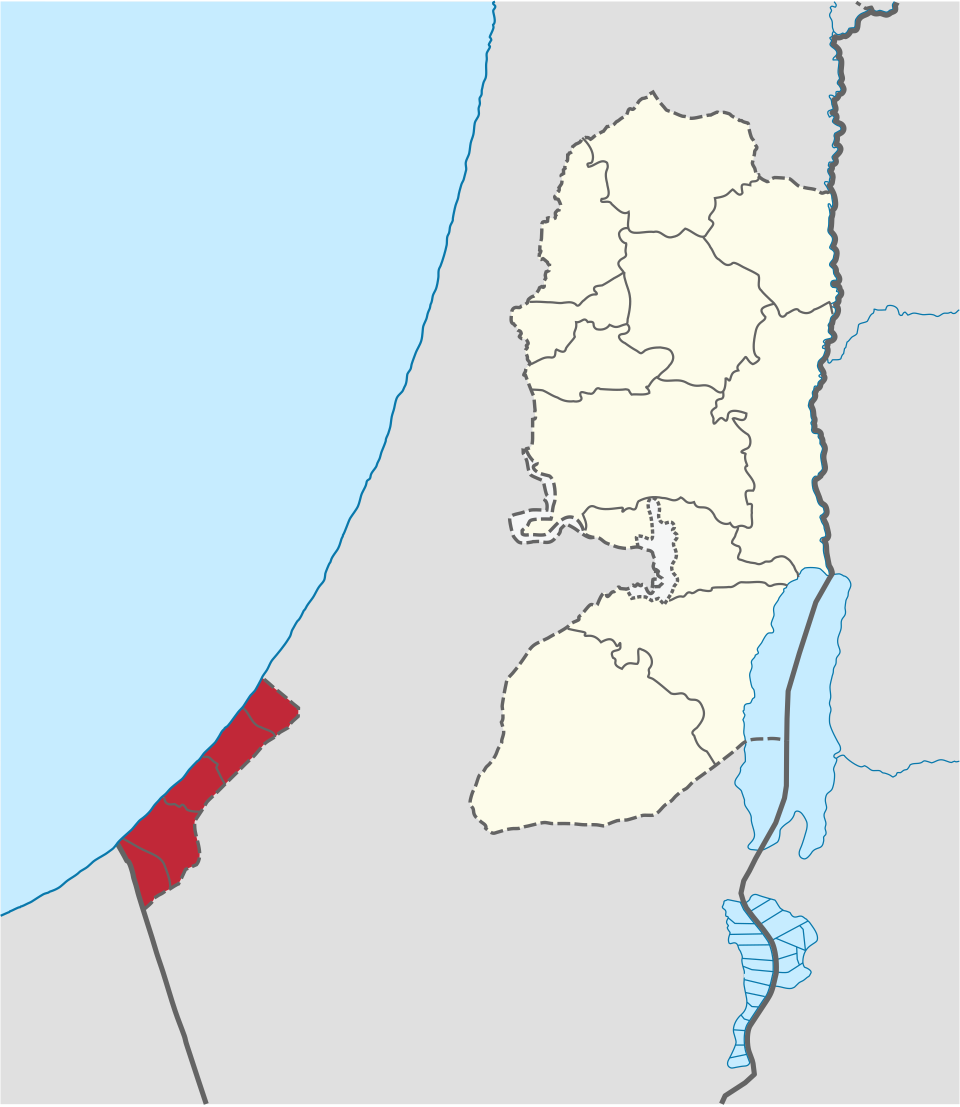
Position matched with OpenStreetMap. Other numbered pins are the day's other places — tap one to open it.
Why in the news
Israel's military said it had completed a ground operation in central Gaza, describing the incursion as a response to Hamas ceasefire violations in the area. Hamas denounced the operation as a blatant ceasefire violation.
Territory
Palestinian territory
Adjoining sea
Mediterranean Sea
Land neighbours
Israel and Egypt
Major city
Gaza City
Principal wadi
Wadi Gaza
Egypt border crossing
Rafah
Location
- Lies on the eastern shore of the Mediterranean Sea, in the south-western part of historical Palestine.
- Borders Israel to the north and east, and Egypt to the south-west.
- Adjoins Egypt's Sinai Peninsula near Rafah.
- Is separated from the West Bank by Israeli territory.
Bordering countries
- Israel
- Egypt
Key features
- Coastal plain
- A low-lying coastal strip with sandy terrain and no major mountain ranges.
- Mediterranean frontage
- Its western margin faces the Mediterranean Sea, not the Red Sea.
- Wadi Gaza
- A seasonal drainage system originating in the Negev region and reaching the Mediterranean through central Gaza.
- Coastal aquifer
- Groundwater occurs in the coastal aquifer system extending along the Mediterranean coastal plain.
- Coastal dunes
- Sand dunes and sandy ridges are characteristic elements of the coastal landscape.
Flora, fauna & ecology
- Climate
- Mediterranean conditions with semi-arid influence: hot, dry summers and mild winters with seasonal rainfall.
- Wetland habitat
- Wadi Gaza's coastal wetland provides habitat for migratory birds.
- Groundwater vulnerability
- Over-extraction and seawater intrusion threaten the quality of coastal groundwater.
History & significance
- Egypt administered the Gaza Strip following the 1948 Arab–Israeli war.
- Israel captured the Gaza Strip during the 1967 Arab–Israeli war.
- Israel withdrew its settlements and permanent military installations from within Gaza in 2005.
UPSC angle
- Prelims map work: distinguish Gaza from the West Bank and locate its borders with Israel and Egypt.
- GS I physical geography: coastal plains, seasonal wadis, aquifers and seawater intrusion.
- GS II international relations: the Israel–Palestine conflict and the regional significance of Egypt and the Rafah crossing.
- Environment: coastal wetlands, migratory bird habitats and freshwater stress.
Also locate on your map
- West Bank
- Israel
- Egypt
- Sinai Peninsula
- Mediterranean Sea
- Negev
- Rafah
Test yourself
Q1. Which of the following pairs comprises the countries sharing land boundaries with the Gaza Strip?
Q2. With reference to the geography of the Gaza Strip, consider the following statements: 1. Its western coast faces the Mediterranean Sea. 2. It is geographically contiguous with the West Bank. 3. Wadi Gaza drains towards the Mediterranean Sea. Which of the statements given above are correct?
Sources
Background maps and imagery © Esri and partners (English labels); place positions checked with OpenStreetMap (ODbL). Boundaries are for study reference only. Prepared by Pragnya IAS Academy for exam revision.