
Pallikaranai Marsh
Chennai, Tamil Nadu
Pallikaranai Marsh: CREDAI to challenge 1-km construction restriction
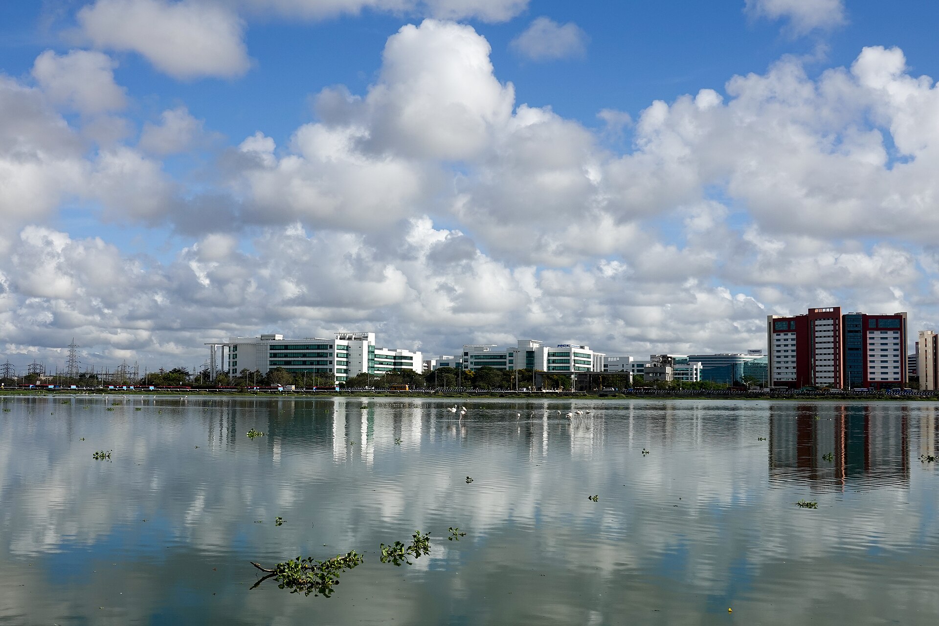
Pallikaranai Marsh is a low-lying coastal wetland in southern Chennai, Tamil Nadu, recognised as a Ramsar site. It supports waterbirds and plays an important role in the city's drainage and flood buffering.
Position matched with OpenStreetMap; the dashed outline shows its mapped extent. Other numbered pins are the day's other places — tap one to open it.
Why in the news
According to The Hindu, CREDAI Chennai plans to approach the Supreme Court against the one-kilometre construction restriction around Pallikaranai marshland. The proposed challenge brings urban development, wetland protection and Chennai's flood resilience into focus.
Read the full analysis: Pallikaranai Construction Restrictions: Ramsar Protection and Urban Flood ResilienceState
Tamil Nadu
City
Chennai
International designation
Ramsar site
Ramsar designation year
2022
Coastal plain
Coromandel Coast
Drainage channel
Okkiyam Maduvu
Location
- Located in southern Chennai, on Tamil Nadu's Coromandel Coast.
- Lies inland, west of the Bay of Bengal, within Chennai's metropolitan landscape.
- Forms part of a low-lying drainage system connected to the Buckingham Canal through the Okkiyam Maduvu channel.
Nearby localities
- Velachery
- Perungudi
- Sholinganallur
- Thoraipakkam
Key features
- Coastal setting
- Occupies low-lying terrain on the coastal plain adjoining the Bay of Bengal.
- Wetland hydrology
- Receives runoff from surrounding catchments; its inundation varies with rainfall and drainage conditions.
- Drainage connection
- Okkiyam Maduvu links the marsh's drainage to the Buckingham Canal.
- Flood buffering
- Stores and slows stormwater, helping moderate flooding in surrounding urban areas.
- Urban interface
- The wetland lies amid densely developed residential, transport and information-technology corridors.
Flora, fauna & ecology
- Waterbird habitat
- Shallow water and marsh vegetation provide feeding and resting habitats for resident and migratory waterbirds, including flamingos.
- Seasonal rainfall
- The northeast monsoon is especially important to Chennai's rainfall and the marsh's seasonal water regime.
- Conservation pressures
- Encroachment, waste dumping and polluted inflows threaten wetland habitat and drainage functions.
UPSC angle
- Physical geography: locate Chennai's coastal wetlands and trace their drainage links towards the Bay of Bengal.
- Environment: revise Ramsar designation, wetland ecosystem services and the principle of wise use.
- Disaster management: examine how wetland loss and obstructed drainage increase urban flood risk.
- Governance: distinguish international conservation recognition from specific domestic construction restrictions and judicial directions.
Also locate on your map
- Buckingham Canal
- Okkiyam Maduvu
- Adyar River
- Cooum River
- Muttukadu backwaters
- Pulicat Lake
Test yourself
Q1. Pallikaranai Marsh is located in which of the following geographical settings?
Q2. Which channel connects the drainage of Pallikaranai Marsh to the Buckingham Canal?
Sources
Background maps and imagery © Esri and partners (English labels); place positions checked with OpenStreetMap (ODbL). Boundaries are for study reference only. Prepared by Pragnya IAS Academy for exam revision.