
Somalia
Horn of Africa, Eastern Africa
Somalia: US reverses course to fund UN military support for another year
Somalia is a country in the Horn of Africa, with coastlines along the Gulf of Aden and the Indian Ocean. Its landscape includes northern highlands, extensive dry plateaus and southern riverine plains.
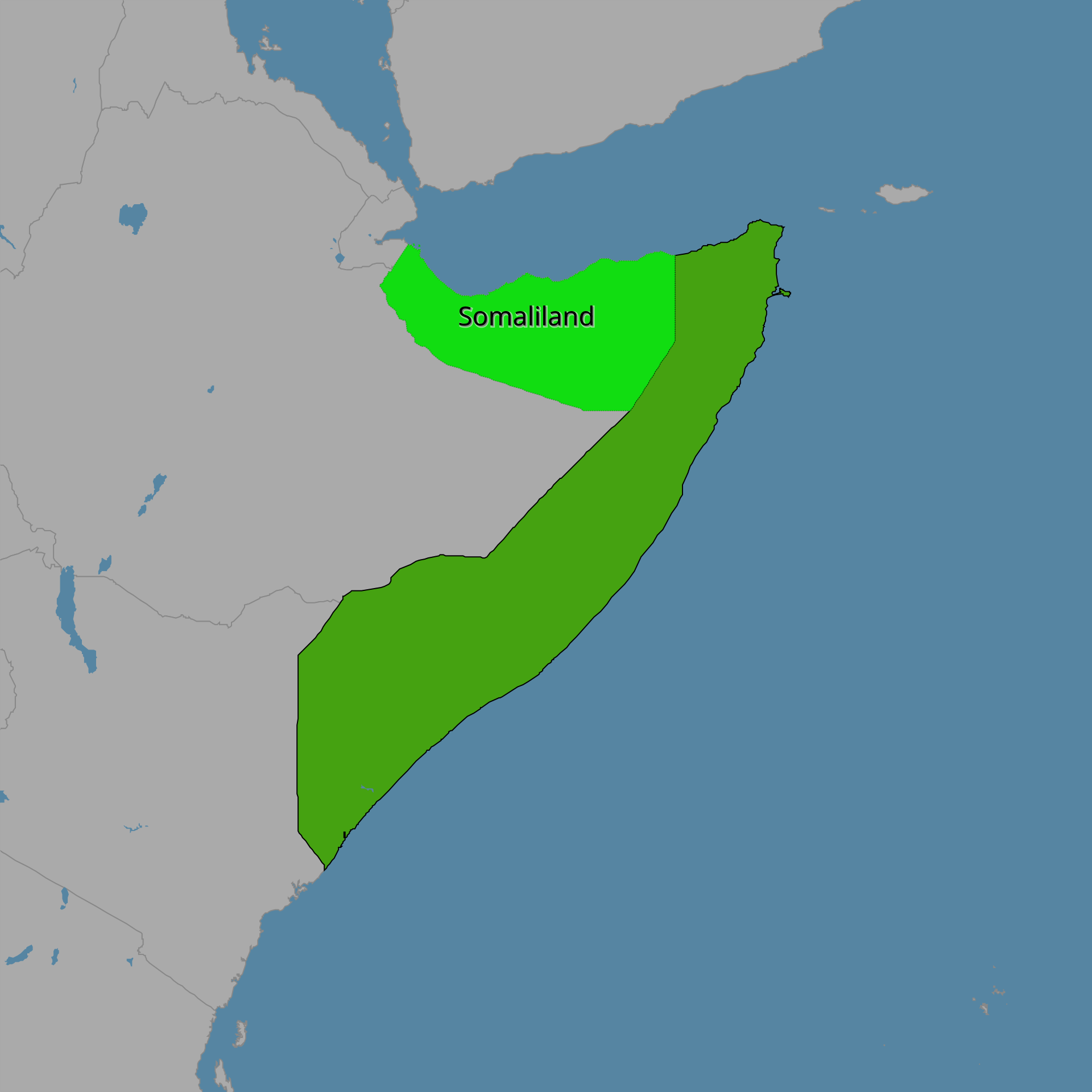
Position matched with OpenStreetMap; the dashed outline shows its mapped extent. Other numbered pins are the day's other places — tap one to open it.
Why in the news
The United States reversed course to fund UN military support in Somalia for another year. The Al-Qaeda-linked Al-Shabaab continues to control large swathes of central Somalia despite the African Union military campaign, which the report described as unlikely to continue without United Nations Support Office in Somalia (UNSOS) support.
Capital
Mogadishu
Continent
Africa
Regional setting
Horn of Africa
Major rivers
Jubba and Shabelle
Northern maritime frontage
Gulf of Aden
Eastern maritime frontage
Indian Ocean
Location
- Occupies the easternmost part of mainland Africa, projecting into the western Indian Ocean.
- Faces the Gulf of Aden to the north and the Indian Ocean to the east and south-east.
- Lies opposite Yemen across the Gulf of Aden.
Bordering countries
- Djibouti
- Ethiopia
- Kenya
Key features
- Horn of Africa
- Forms the eastern projection of the African mainland between the Gulf of Aden and the Indian Ocean.
- Northern highlands
- The northern mountain belt rises sharply above the Gulf of Aden coastal plain.
- Guban coastal plain
- A hot, arid lowland belt extends along the northern coast below the highlands.
- Jubba and Shabelle rivers
- Both originate in the Ethiopian Highlands and flow into southern Somalia; the Jubba reaches the Indian Ocean near Kismayo.
- Cape Guardafui
- A prominent cape at the north-eastern tip of the Horn, near the transition between the Gulf of Aden and the Indian Ocean.
Flora, fauna & ecology
- Dryland ecosystems
- Arid and semi-arid conditions support thorn scrub, grasslands and drought-adapted vegetation across much of the country.
- Riverine environments
- The Jubba and Shabelle valleys support irrigated agriculture and riverine vegetation within the otherwise dry southern landscape.
- Monsoon influence
- Seasonally reversing monsoon winds influence coastal conditions and rainfall patterns.
History & significance
- In 1960, former British Somaliland and the Italian-administered Trust Territory of Somaliland united to form the Somali Republic.
UPSC angle
- Map the Horn of Africa, Somalia’s three land neighbours and Yemen across the Gulf of Aden.
- Relate the northern coast to the Gulf of Aden–Bab-el-Mandeb–Red Sea shipping corridor; Somalia does not directly border the Red Sea.
- Trace the Jubba and Shabelle from the Ethiopian Highlands into Somalia to understand transboundary drainage and dryland agriculture.
- Link GS II international relations with African Union operations, UN logistical support and regional security in the Horn of Africa.
Also locate on your map
- Gulf of Aden
- Bab-el-Mandeb Strait
- Yemen
- Djibouti
- Ethiopian Highlands
- Cape Guardafui
- Mogadishu
- Kismayo
Test yourself
Q1. Which of the following sets consists exclusively of countries sharing a land boundary with Somalia?
Q2. With reference to Somalia’s geography, consider the following statements: 1. Its northern coast faces the Gulf of Aden. 2. The Jubba and Shabelle rivers originate in the Ethiopian Highlands. 3. The Equator crosses its territory. Which of the statements given above are correct?
Sources
Background maps and imagery © Esri and partners (English labels); place positions checked with OpenStreetMap (ODbL). Boundaries are for study reference only. Prepared by Pragnya IAS Academy for exam revision.