
Thirupparankundram Hill
Madurai district, Tamil Nadu
Thirupparankundram Hill: Tamil Nadu disputes summit Deepam custom in Supreme Court
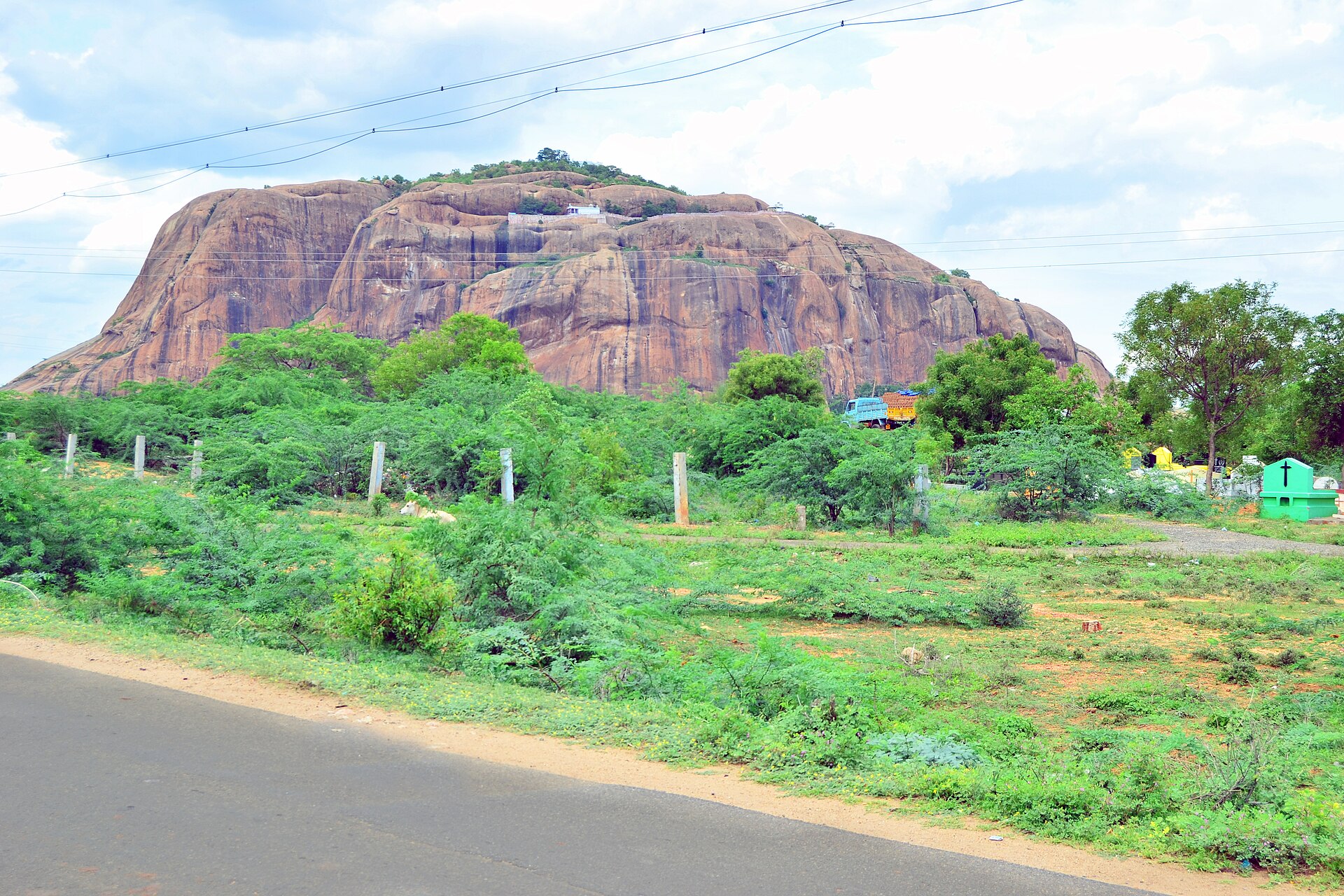
Thirupparankundram Hill is a prominent rocky hill on the south-western outskirts of Madurai, Tamil Nadu. It is a sacred landscape associated with a rock-cut Murugan temple and a hilltop dargah.
Approximate location — this pin marks the general area, not an exact surveyed point. Other numbered pins are the day's other places.
Why in the news
Tamil Nadu told the Supreme Court that there was no established practice, custom or prior claim of lighting the Karthigai Deepam on the hill’s summit or at the disputed stone pillar described as the deepathoon. The government said the lamp had been lit only at the deepa mandapam for over 150 years.
Country
India
State
Tamil Nadu
District
Madurai
Nearby river
Vaigai
Principal temple
Subramaniaswamy Temple
Religious significance
One of the six sacred abodes of Murugan
Location
- Located at Thirupparankundram on the south-western outskirts of Madurai in southern Tamil Nadu.
- Lies south of the Vaigai River, which flows through Madurai.
- Situated inland, within the rocky hill-and-plain landscape of southern peninsular India.
Key features
- Rocky relief
- A prominent rocky outcrop rising above the surrounding built-up areas and plains.
- Regional setting
- An inland hill near Madurai, distinct from the high mountain ranges of the Western Ghats.
- Rock-cut heritage
- The Subramaniaswamy Temple at the hill’s foot incorporates rock-cut architecture.
- Sacred landscape
- Hindu shrines and a hilltop dargah occupy different parts of the hill.
History & significance
- The hill’s rock-cut temple has associations with the Pandya period.
- The hill also preserves Jain heritage, reflecting its layered religious history.
UPSC angle
- Prelims map work: locate Thirupparankundram relative to Madurai, the Vaigai River and the Western Ghats.
- GS I geography: distinguish isolated rocky hills of the peninsular interior from major mountain ranges.
- GS I art and culture: connect Pandya rock-cut architecture, Murugan worship and Jain heritage.
- Current affairs: distinguish the state government’s submission about ritual practice from an established judicial finding.
Also locate on your map
- Madurai
- Vaigai River
- Samanar Hills
- Alagar Hills
- Western Ghats
- Palani Hills
Test yourself
Q1. Which of the following correctly describes the location of Thirupparankundram Hill?
Sources
Background maps and imagery © Esri and partners (English labels); place positions checked with OpenStreetMap (ODbL). Boundaries are for study reference only. Prepared by Pragnya IAS Academy for exam revision.