
Yamuna River
Northern India
Yamuna River: Chhath foam images renew scrutiny of persistent pollution
The Yamuna is a major Himalayan river and a right-bank tributary of the Ganga. It rises in Uttarakhand and flows past Delhi, Mathura and Agra before joining the Ganga at Prayagraj.
Position matched with OpenStreetMap. Other numbered pins are the day's other places — tap one to open it.
Why in the news
Images of Chhath devotees standing amid toxic foam have renewed scrutiny of pollution in the Yamuna’s Delhi stretch despite decades of court interventions and cleanup projects. Experts cited in the reporting emphasise that increasing river flow alone is insufficient without stopping untreated sewage and waste from entering the river.
River system
Ganga basin
Source
Yamunotri Glacier, Uttarakhand
Confluence
Ganga at Prayagraj, Uttar Pradesh
Length
About 1,376 km
Major cities on its banks
Delhi, Mathura, Agra and Prayagraj
Location
- Originates at the Yamunotri Glacier near the Bandarpunch massif in Uttarkashi district, Uttarakhand.
- Descends from the Himalayas into the northern plains near the Hathnikund–Yamunanagar area.
- Flows along parts of the Haryana–Uttar Pradesh boundary and through Delhi before continuing through Uttar Pradesh.
- Joins the Ganga at Prayagraj; the land between the two rivers forms the Ganga–Yamuna Doab.
Major tributaries
- Tons
- Hindon
- Chambal
- Betwa
- Ken
Key features
- Himalayan headwaters
- The upper river drains mountainous terrain and receives snowmelt and rainfall.
- Right-bank tributary
- The Yamuna joins the Ganga from its right bank at Prayagraj.
- Ganga–Yamuna Doab
- This extensive alluvial interfluve lies between the Ganga and Yamuna in Uttar Pradesh.
- Peninsular tributaries
- The Chambal, Betwa and Ken bring drainage from the Peninsular uplands into the Yamuna.
- Alluvial floodplain
- Its plains course includes meanders, sandbars and floodplain deposits shaped by river flow and flooding.
Flora, fauna & ecology
- Floodplain habitats
- River channels, wetlands and sandbars support aquatic life and waterbirds.
- Seasonal flow
- Monsoon rainfall strongly influences river discharge, while Himalayan snowmelt contributes to headwater flows.
- Urban pollution stress
- Untreated sewage and waste entering the Delhi stretch are central concerns highlighted in the reporting.
History & significance
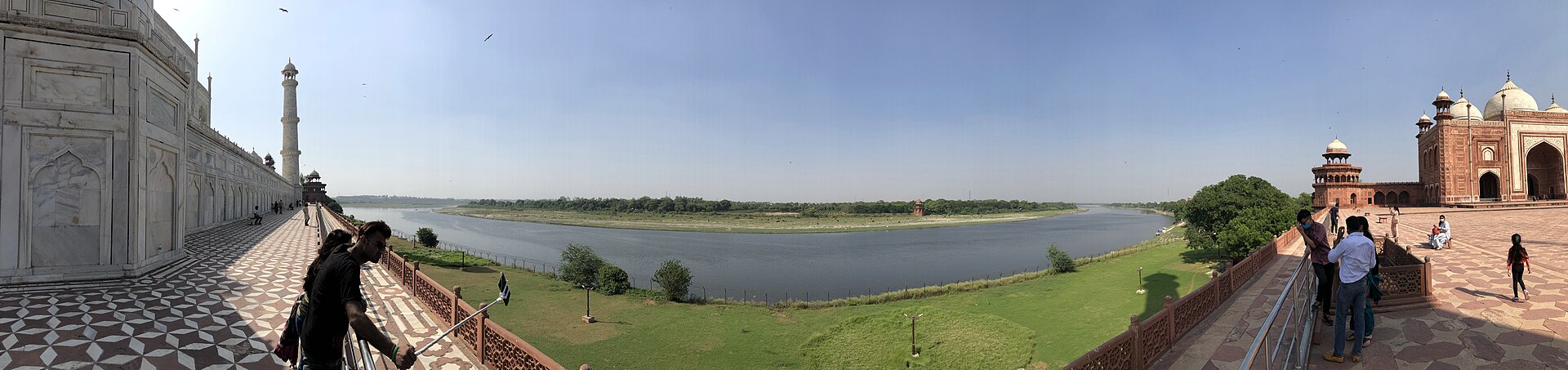
- The Taj Mahal at Agra stands on the Yamuna’s bank, illustrating the river’s importance in Mughal urban and architectural landscapes.
UPSC angle
- Physical geography: trace the Yamuna from its Himalayan source to its confluence with the Ganga.
- Drainage mapping: distinguish Himalayan tributaries such as the Tons from Peninsular tributaries such as the Chambal, Betwa and Ken.
- Geomorphology: identify the Ganga–Yamuna Doab and understand alluvial floodplain processes.
- Environment and governance: connect sewage treatment, environmental flows and floodplain protection with urban river restoration.
Also locate on your map
- Yamunotri
- Hathnikund Barrage
- Delhi
- Mathura
- Agra
- Prayagraj
- Chambal River
- Ganga–Yamuna Doab
Test yourself
Q1. Which of the following sets consists entirely of tributaries of the Yamuna?
Q2. With reference to the Yamuna River, consider the following statements: 1. It originates in Uttarakhand. 2. It joins the Ganga at Prayagraj as a right-bank tributary. 3. The Ganga–Yamuna Doab lies between the Yamuna and Chambal rivers. Which of the statements given above are correct?
Sources
- The Hindu: Every Chhath, the same question returns: Why is the Yamuna still polluted?
- Times of India: 'Not AI, this is Yamuna': AAP, BJP lock horns over Chhath celebrations in Delhi 'amid toxic foam'
Background maps and imagery © Esri and partners (English labels); place positions checked with OpenStreetMap (ODbL). Boundaries are for study reference only. Prepared by Pragnya IAS Academy for exam revision.