
Taiwan
East Asia, Western Pacific
Taiwan: Reported visits in spying case spotlight semiconductor and strategic importance
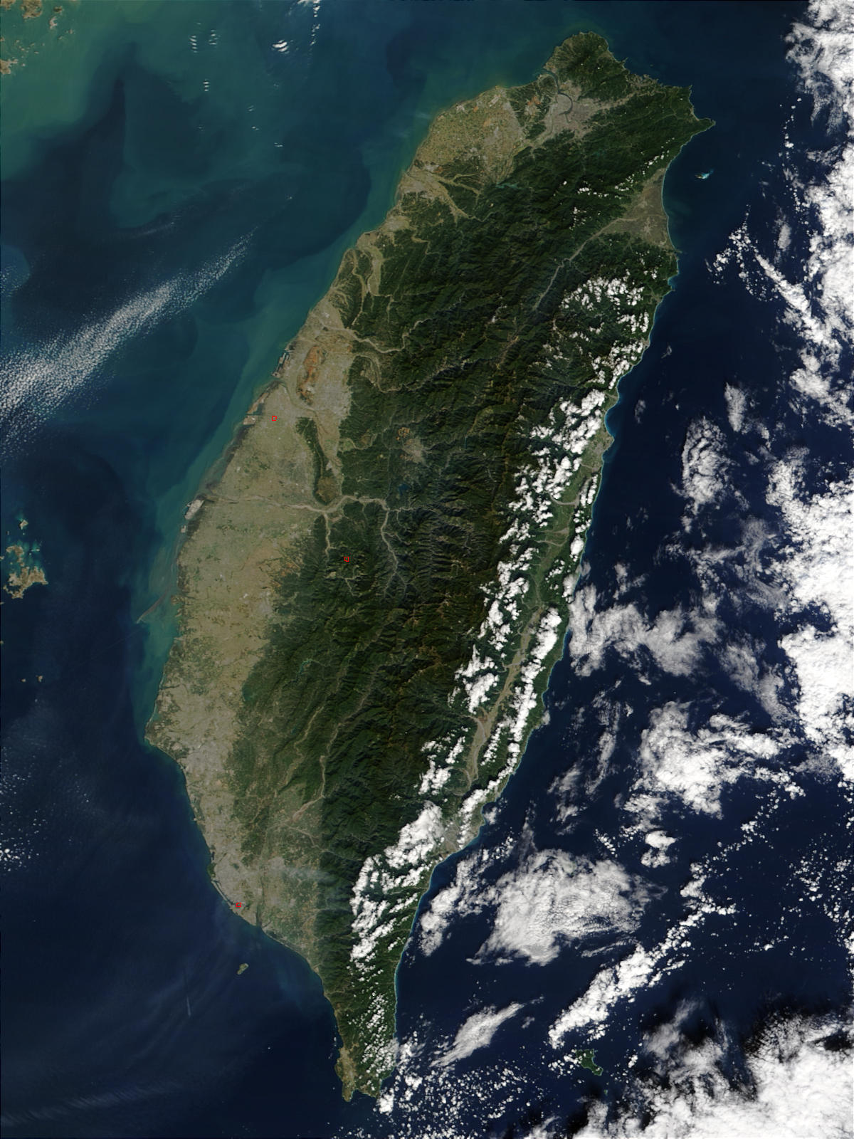
Taiwan is a mountainous island in the western Pacific, separated from mainland China by the Taiwan Strait. It is self-governed, while China claims it as part of its territory.
Position matched with OpenStreetMap; the dashed outline shows its mapped extent. Other numbered pins are the day's other places — tap one to open it.
Why in the news
According to an official cited by The Hindu, Alice Huang, accused of spying on Nvidia's chief, entered Taiwan eight times during 2024–25. The report highlights Taiwan's dominant role in the global semiconductor industry and its position at the centre of strategic competition between the United States and China.
Principal administrative centre
Taipei
Highest point
Yushan — 3,952 metres
Longest river
Zhuoshui River
Major latitude
Tropic of Cancer
Strait towards mainland China
Taiwan Strait
Location
- Lies off the southeastern coast of mainland China, across the Taiwan Strait from Fujian province.
- Located southwest of Japan's Ryukyu Islands and north of the Philippines.
- Faces the Philippine Sea to the east; the Luzon Strait separates it from Luzon to the south.
- The Tropic of Cancer crosses the southern part of the island.
Surrounding seas and straits
- Taiwan Strait — west
- East China Sea — north
- Philippine Sea — east
- Luzon Strait — south
- South China Sea — southwest
Key features
- Mountainous interior
- Mountain ranges dominate the island, with the Central Mountain Range extending broadly north–south.
- Western plains
- Broad western coastal plains contrast with the steep, narrow eastern coastal belt.
- Yushan
- Yushan, also called Jade Mountain, is Taiwan's highest peak at 3,952 metres.
- Active tectonic setting
- Taiwan lies in the complex convergence zone of the Eurasian and Philippine Sea plates and experiences frequent earthquakes.
- River systems
- Steep relief produces generally short, fast-flowing rivers; the Zhuoshui is the island's longest river.
Flora, fauna & ecology
- Climate
- Taiwan has a humid monsoonal climate, broadly subtropical in the north and tropical in the south, with cooler conditions at altitude.
- Typhoons
- Western Pacific typhoons bring heavy rainfall and can trigger floods and landslides.
- Altitudinal ecosystems
- Vegetation ranges from low-elevation broadleaf forests to montane conifer forests and high-altitude alpine vegetation.
- Endemic fauna
- Notable endemic birds include the Taiwan blue magpie and Mikado pheasant.
History & significance
- Taiwan was under Japanese rule from 1895 to 1945.
UPSC angle
- GS I: Locate Taiwan, the Ryukyu island chain, Luzon and the adjoining seas and straits.
- GS I: Relate plate convergence to mountain building, earthquakes and steep river gradients.
- GS II: Examine the Taiwan issue within United States–China strategic competition.
- GS III: Link semiconductor supply-chain concentration with economic security; study earthquake and typhoon risks.
Also locate on your map
- Taiwan Strait
- Fujian
- Penghu Islands
- Ryukyu Islands
- Luzon Strait
- Luzon
- Philippine Sea
- Hsinchu
Test yourself
Q1. Which of the following straits separates Taiwan from mainland China?
Q2. With reference to Taiwan's physical geography, consider the following statements: 1. The Tropic of Cancer crosses the island. 2. Its broad coastal plains lie mainly along the eastern coast. 3. It lies in the convergence zone of the Eurasian and Philippine Sea plates. Which of the statements given above are correct?
Sources
Background maps and imagery © Esri and partners (English labels); place positions checked with OpenStreetMap (ODbL). Boundaries are for study reference only. Prepared by Pragnya IAS Academy for exam revision.