
Delhi–National Capital Region
Northern India
Delhi–National Capital Region: Centre calls for coordinated air-pollution enforcement
The National Capital Region (NCR) is an inter-state planning region comprising the National Capital Territory of Delhi and parts of Haryana, Uttar Pradesh and Rajasthan. It extends beyond Delhi’s administrative boundary and continuous urban area.
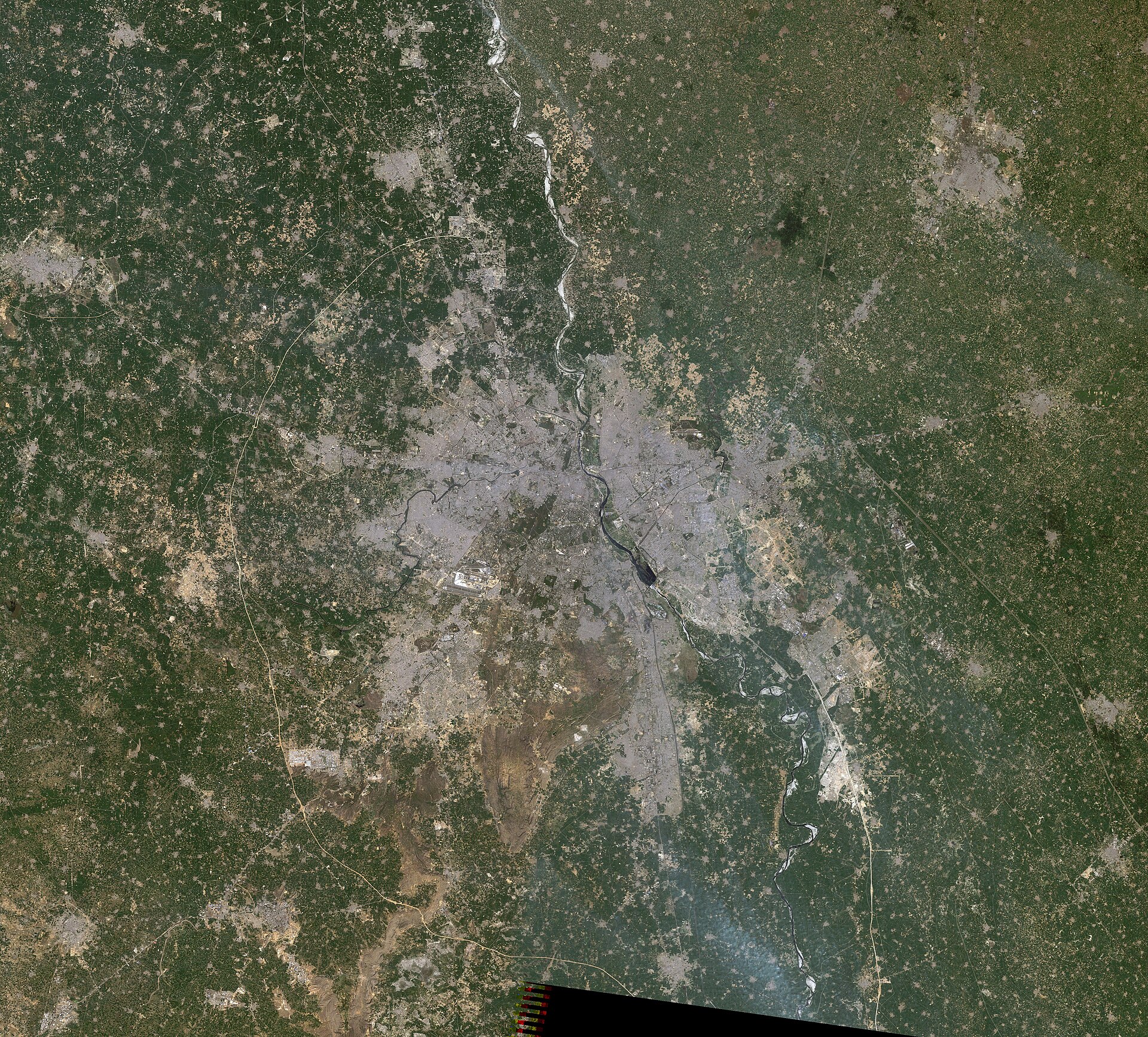
Position matched with OpenStreetMap; the dashed outline shows its mapped extent. Other numbered pins are the day's other places — tap one to open it.
Why in the news
The Centre has directed Delhi-NCR agencies to strengthen coordinated enforcement of air-pollution controls, stressing that polluted air does not recognise State boundaries. Reports also highlight instructions to designate officers to track pollution curbs, underlining the need for cross-boundary airshed management.
Read the full analysis: Delhi-NCR Air Pollution: Airshed Governance, Coordinated Enforcement and AccountabilityCountry
India
Regional core
National Capital Territory of Delhi
Constituent jurisdictions
Delhi and parts of Haryana, Uttar Pradesh and Rajasthan
Major river
Yamuna
Hill system
Aravalli
Planning legislation
National Capital Region Planning Board Act, 1985
Location
- Centred on Delhi in northern India, with constituent areas in Haryana, Uttar Pradesh and Rajasthan.
- Delhi lies along the Yamuna; Haryana adjoins Delhi on the north, west and south, while Uttar Pradesh lies to its east.
- The wider NCR extends into north-eastern Rajasthan, beyond Delhi’s immediate urban surroundings.
- The region spans alluvial plains and the northern reaches of the Aravalli hill system.
Constituent territories
- National Capital Territory of Delhi
- Parts of Haryana
- Parts of Uttar Pradesh
- Parts of Rajasthan
Key features
- Alluvial plains
- Much of the region occupies low-relief plains formed by river-borne sediments.
- Yamuna floodplain
- The Yamuna flows through Delhi, creating a floodplain important for drainage, groundwater recharge and flood regulation.
- Delhi Ridge
- A rocky northern extension of the Aravalli system forms a distinctive upland feature within Delhi.
- Hindon River
- This tributary of the Yamuna flows through the eastern NCR, including the Ghaziabad area.
- Regional airshed
- Winds transport pollutants across administrative boundaries, connecting urban, industrial and rural emission sources.
Flora, fauna & ecology
- Seasonal climate
- The region experiences hot summers, a summer monsoon and cool winters, with increasing dryness towards its south-western parts.
- Winter pollution accumulation
- Low wind speeds and temperature inversions can restrict atmospheric mixing and allow pollutants to accumulate near the surface.
- Habitat mosaic
- River floodplains, wetlands, ridge forests and scrub habitats support biodiversity within a heavily urbanised landscape.
History & significance
- The National Capital Region Planning Board Act, 1985 provided a statutory framework for coordinated regional planning across constituent jurisdictions.
UPSC angle
- Indian geography: distinguish the NCT of Delhi, the Delhi urban agglomeration and the wider inter-state NCR.
- Climatology: connect winter inversions, weak winds and restricted vertical mixing with pollution episodes.
- Environment and governance: examine why airshed-based pollution control requires coordination across State and local boundaries.
- Urban geography: relate regional planning to transport, industrial location, floodplain protection and urban expansion.
Also locate on your map
- Yamuna River
- Hindon River
- Delhi Ridge
- Aravalli Range
- Gurugram
- Ghaziabad
- Noida
- Alwar
Test yourself
Q1. Which of the following correctly describes the territorial composition of India’s National Capital Region?
Q2. With reference to the physical geography of Delhi-NCR, consider the following statements: 1. The Delhi Ridge is a northern extension of the Aravalli system. 2. The Hindon is a tributary of the Yamuna. Which of the statements given above is/are correct?
Sources
- The Hindu: Air pollution does not recognise State boundaries, coordinated action required: Union Minister
- Indian Express: Centre asks states to fix officers to track pollution curbs, seals 191 units
- Times of India: From odd-even to cloud seeding: Why Delhi's pollution battle remains unfinished
- The Hindu: ‘Abki baar, AQI 400-paar’: Congress takes a swipe at Modi over Delhi pollution
Background maps and imagery © Esri and partners (English labels); place positions checked with OpenStreetMap (ODbL). Boundaries are for study reference only. Prepared by Pragnya IAS Academy for exam revision.