
Eastern Ghats
Eastern Peninsular India
Eastern Ghats: Odisha landslides highlight fragile hill ecology
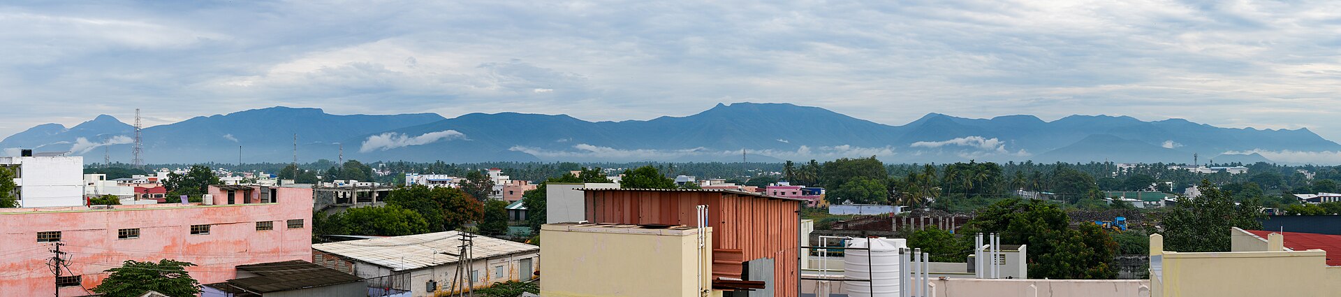
The Eastern Ghats are an ancient, discontinuous hill system along the eastern side of Peninsular India. Major east-flowing rivers cut across these hills before reaching the Bay of Bengal.
Position matched with OpenStreetMap. Other numbered pins are the day's other places — tap one to open it.
Why in the news
The Hindu reports that two landslides triggered by Cyclone Arnab killed 10 people in Odisha, drawing attention to the fragile ecology of the Eastern Ghats. The report examines threats from climate extremes, deforestation and unplanned development in the hills.
Country
India
Physiographic setting
Eastern margin of the Peninsular Plateau
General alignment
Broadly north-east–south-west
Major rivers crossing the system
Mahanadi, Godavari, Krishna and Kaveri
Southern junction
Nilgiri Hills
Location
- Extend broadly from Odisha through Andhra Pradesh into Tamil Nadu, along the eastern margin of the Peninsular Plateau.
- Lie largely west of the Eastern Coastal Plains, inland from the Bay of Bengal.
- Include hill tracts of southern Odisha, including Gajapati district.
- Meet the Western Ghats in the Nilgiri Hills in southern India.
Adjoining geographical regions
- Deccan Plateau to the west
- Eastern Coastal Plains to the east
- Western Ghats at the Nilgiri junction
Key features
- Discontinuous hill system
- Separate hill blocks and intervening river valleys distinguish the Eastern Ghats from the more continuous Western Ghats.
- Ancient crystalline rocks
- Much of the system consists of ancient metamorphic rocks, including gneisses, charnockites and khondalites.
- River gaps
- The Mahanadi, Godavari, Krishna and Kaveri interrupt the hill system along its north–south extent.
- Uneven relief
- Elevated plateaus, steep local slopes and deeply dissected valleys produce varied terrain.
- Named hill ranges
- The Nallamala, Palkonda and Shevaroy hills are associated with the Eastern Ghats system.
Flora, fauna & ecology
- Forest types
- Dry and moist deciduous forests occur widely, with scrub and locally evergreen or semi-evergreen vegetation depending on rainfall and elevation.
- Monsoon influence
- Rainfall varies along the range; Bay of Bengal cyclones can bring intense rain to eastern hill catchments.
- Slope stability
- Forest cover helps protect soil; vegetation loss and slope disturbance can increase erosion and landslide susceptibility.
UPSC angle
- Physical geography: compare the continuity, relief and river crossings of the Eastern and Western Ghats.
- Disaster management: examine how intense rainfall, deforestation and unplanned hill development interact to increase landslide risk.
- Environment: link forest conservation and catchment protection with soil stability and ecosystem resilience.
- Map practice: locate the Odisha hill tracts, major river gaps and constituent ranges of the Eastern Ghats.
Also locate on your map
- Mahendragiri
- Gajapati district
- Nallamala Hills
- Shevaroy Hills
- Nilgiri Hills
- Godavari River
- Krishna River
- Chilika Lake
Test yourself
Q1. Which of the following best describes the Eastern Ghats?
Q2. The Eastern Ghats and Western Ghats meet in which of the following hill regions?
Sources
Background maps and imagery © Esri and partners (English labels); place positions checked with OpenStreetMap (ODbL). Boundaries are for study reference only. Prepared by Pragnya IAS Academy for exam revision.