
Cyclone Akvan: Bay of Bengal Cyclogenesis, Evacuations and Coastal Resilience
Revise the static topic: UPSC Geography notes · UPSC Disaster Management notes
In short: Severe Cyclonic Storm Akvan was forecast to cross the north Andhra Pradesh–south Odisha coast near Gopalpur by noon on November 20, 2026, prompting mass evacuations and emergency deployments. The episode highlights how favourable ocean–atmosphere conditions can support successive cyclones, and why accurate forecasts must translate into inclusive evacuation and resilient coastal services.
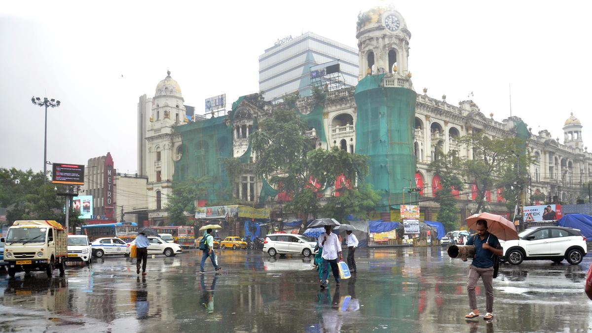
Photo from the source report: Cyclone Akvan: Bay of Bengal Cyclogenesis, Evacuations and Coastal Resilience
Image: The Hindu
Why in news
The supplied reports describe over three lakh evacuations and deployment of 423 rescue teams in Odisha, alongside rainfall alerts across neighbouring States. They report a forecast landfall, not a confirmed landfall or a final assessment of losses.
Over 3 lakh
People evacuated in Odisha, as reported in updates
423
Rescue teams deployed in Odisha
90–100 km/h
Forecast maximum sustained landfall winds
110 km/h
Forecast gust speed
0.5–1.0 metre
Forecast surge above astronomical tide on specified Andhra coasts
941
Identified landslip-prone places in Odisha
Background
A tropical cyclone is an organised low-pressure system over tropical waters, with rotating winds and deep convection powered largely by heat and moisture from the ocean. In the Northern Hemisphere, its circulation is anticlockwise. The Bay of Bengal is an important North Indian Ocean cyclone basin, with favourable conditions commonly occurring during pre-monsoon and post-monsoon periods. Its adjoining low-lying coasts, deltas, settlements and infrastructure face overlapping risks from destructive winds, storm surge and heavy rainfall. In India, the India Meteorological Department provides cyclone forecasts and warnings, while disaster-management authorities and local administrations organise preparedness and response.
What the forecasts and preparedness reports establish
Akvan was reported over the west-central Bay of Bengal on November 19 and was expected to move north-northwestwards towards the coast near Gopalpur. The forecast indicated maximum sustained winds of 90–100 km/h, gusting to 110 km/h, around landfall. Red alerts were issued for Srikakulam and Vizianagaram, while heavy rainfall warnings extended into Odisha and southern West Bengal.
Odisha undertook large-scale evacuation, positioned rescue personnel, secured vulnerable roads and prepared essential services. Earlier reporting recorded around 2.98 lakh people relocated; subsequent updates reported over three lakh. These are evolving operational snapshots, not separate evacuation totals.
- The administration reported moving 4,200 pregnant women to secure locations, illustrating the importance of targeted evacuation.
- Authorities barricaded vulnerable ghat roads because cyclone-related rainfall could trigger landslides inland.
- Rail services were cancelled or rescheduled, fishermen were advised against entering specified sea areas, and Gopalpur Port was instructed to secure machinery and ships.
- The reported forecast surge of 0.5–1.0 metre applied to specified Andhra Pradesh coastal districts and should not be generalised to the entire eastern coast.
Infographic
Ocean energy
Warm water and freshwater stratification can support favourable surface conditions.
Atmospheric support
Moisture and weak shear aid organisation; steering winds influence movement.
Compound hazards
Wind, surge, rainfall and landslides create overlapping risks.
Protective action
Actionable warnings must lead to inclusive evacuation and safe shelter.
Resilient lifelines
Protected power, water, telecom and transport systems limit cascading failures.
AI-assisted infographic by Pragnya IAS Academy, based on the cited sources.
Why ocean–atmosphere conditions can favour successive cyclones
Warm seawater supplies heat and moisture to a developing disturbance. As moist air rises and condenses, latent heat release sustains convection and helps reinforce the low-pressure circulation. Cyclogenesis also requires a sufficiently moist atmosphere, an initial disturbance, adequate Coriolis influence and relatively weak vertical wind shear; warm water alone is insufficient.
The supplied explainer identifies warm seas, river-fed surface waters that retain heat near the surface, and steering winds as contributors to the unusual post-monsoon sequence affecting Andhra Pradesh. Freshwater lowers surface salinity and strengthens density stratification, which can inhibit mixing with cooler subsurface water and help preserve warm near-surface conditions. This is a favourable influence, not an automatic trigger.
Weak shear helps thunderstorms remain organised around the circulation, while large-scale steering winds influence where an established storm travels. The source frames Akvan as Andhra Pradesh’s third cyclone in a month, but does not provide a complete event chronology. A short sequence cannot by itself establish a long-term increase in cyclone frequency or attribute this particular storm to climate change.
- Formation, intensification and landfall track are distinct processes and should be explained separately.
- Cyclones can cool the ocean through mixing and upwelling, so repeated storms require continued favourable conditions rather than merely the presence of an earlier cyclone.
- Climate change can influence cyclone-related hazards, but event-specific attribution requires dedicated evidence.
A multi-hazard event, not merely a wind emergency
Storm surge is an abnormal rise in sea level caused mainly by cyclone winds pushing water towards the shore, with low atmospheric pressure also contributing. Its consequences depend on coastal shape, bathymetry, tidal conditions, waves and exposure. A surge forecast above the astronomical tide is not equivalent to a uniform inland flood depth.
Heavy rainfall can simultaneously cause urban waterlogging, river flooding and slope failure. Coastal inundation may also obstruct drainage towards the sea. The identification of landslip-prone places and closure of hill roads in Odisha show why preparedness must extend beyond the immediate shoreline.
Infrastructure failures can cascade: damaged electricity supply may disrupt water pumping, telecommunications, hospitals and transport. Consequently, evacuation planning must consider both direct exposure to the cyclone and the possibility that essential services become unavailable.
- The landfall point does not define the full impact area; rain bands and rough seas can affect distant districts.
- Reservoir drawdown can create flood-storage space, but releases require downstream warnings and coordination with rainfall and river forecasts.
- Rainfall alert colours should not be confused with the wind-based classification of cyclone intensity.
Early warning and evacuation: strengths and limits
The reported measures demonstrate a chain from forecasting to action: district alerts, evacuation, rescue deployment, transport restrictions and emergency communications. Satellite phones, mobile telecom units, backup generators and activation instructions for Intra Circle Roaming sought to preserve communication if normal networks failed.
Effective warning is more than issuing a bulletin. People must receive it, understand their location-specific risk, trust the messenger and have transport and safe shelter available. Fishing communities, migrants, persons with disabilities, older people and those requiring medical care need differentiated support.
Evacuation totals and team deployments measure preparedness inputs, not final effectiveness. A credible evaluation must examine whether all exposed groups reached safe shelter in time, whether shelters remained functional and accessible, and how quickly essential services were restored. The supplied material does not establish these outcomes.
- Warnings should state expected impacts and required action, rather than only wind speed or storm category.
- Multiple communication channels reduce dependence on a single mobile network or electricity source.
- Repeated alerts require clear explanation of changing forecasts to maintain public trust and reduce warning fatigue.
From emergency response to resilient coastal development
The Disaster Management Act, 2005 provides India’s institutional framework for disaster management, including national, State and district authorities and the National Disaster Response Force. IMD’s technical warnings must be translated into coordinated action by State administrations, district authorities, local bodies and infrastructure operators.
Long-term resilience requires risk-sensitive land use, maintained evacuation routes, accessible cyclone shelters and protection of critical facilities. Structural measures should be combined with mangrove, wetland and dune conservation where ecologically appropriate. Natural buffers can reduce some coastal impacts but cannot replace evacuation or engineered safety.
Infrastructure choices must be site-specific. Stronger overhead electricity systems, flood-protected substations, appropriately designed underground services, backup water supply and telecom redundancy all require maintenance and realistic failure planning. Coastal Regulation Zone controls and building requirements matter only when reflected in local development decisions.
- Hospitals, shelters and emergency operation centres should retain power, water and communication during network failures.
- Drainage investments should account for intense rainfall occurring alongside elevated coastal water levels.
- Recovery should reduce future exposure rather than recreate the same vulnerabilities.
| Hazard or disruption | Risk pathway | Priority response |
|---|---|---|
| Destructive winds | Damage to roofs, poles, telecom towers and port equipment | Wind-resistant construction, equipment securing and network redundancy |
| Storm surge | Seawater inundation of low-lying coastal settlements | Risk-based evacuation, elevated shelters and coastal buffers |
| Heavy rainfall | Urban waterlogging and river flooding | Drainage maintenance, catchment monitoring and coordinated reservoir operation |
| Landslides | Rain-saturated slopes threaten settlements and hill roads | Slope-risk mapping, precautionary road closure and targeted relocation |
| Essential-service failure | Power disruption cascades into water, healthcare and communications | Protected critical assets, backup supplies and restoration protocols |
- 1. Observe ocean and atmospheric conditions and track the developing system.
- 2. Forecast the track, intensity and location-specific wind, rainfall and surge hazards.
- 3. Identify exposed settlements, vulnerable people and critical infrastructure.
- 4. Communicate actionable warnings through accessible, redundant channels.
- 5. Evacuate exposed populations and secure shelters and essential services.
- 6. Verify safety, restore lifelines and assess performance after the event.
November 18, 2026
Rainfall began overnight in Kolkata and other southern West Bengal districts under the weather system’s influence.
November 19, 2026
Reports placed Akvan over the Bay of Bengal as authorities intensified evacuation, rescue deployment and transport precautions.
November 20, 2026
IMD forecast a coastal crossing near Gopalpur by noon; the supplied material does not confirm the actual landfall.
November 21, 2026
The reported West Bengal heavy-rainfall outlook and advisory against fishing in specified Bay of Bengal waters extended until this date.
Significance, challenges & way forward
Significance
- The event connects physical geography with disaster governance by showing how ocean conditions become societal risk through coastal exposure.
- Precautionary evacuation and rescue deployment illustrate the shift from reactive relief towards anticipatory action.
- Telecom backup measures recognise communication as a lifeline for warnings, rescue coordination and restoration.
- Inland landslide precautions underline the need for multi-hazard planning beyond coastal districts.
- Repeated cyclone threats make continuity of livelihoods and public services a core resilience objective.
Challenges
- Uncertainty in track and intensity complicates decisions on evacuation areas, transport shutdowns and resource deployment.
- Warnings may fail to reach people at sea, isolated settlements or groups facing language, disability or connectivity barriers.
- Fear of losing livestock, fishing assets and household property can discourage timely evacuation.
- Simultaneous surge, rainfall and infrastructure failure can overwhelm drainage, shelters and emergency services.
- Repeated disruptions can strain household savings, public resources and confidence in warnings.
- Reported preparedness figures do not reveal shelter quality, evacuation completeness or actual service continuity.
Way forward
- Link forecasts to predefined local action protocols while updating decisions as the track and impact outlook change.
- Maintain participatory risk maps covering surge zones, floodplains, unstable slopes and evacuation bottlenecks.
- Provide accessible transport, healthcare, sanitation and arrangements for livestock and essential livelihood assets.
- Audit shelters and critical facilities for structural safety, backup power, drinking water and communication redundancy.
- Combine ecosystem conservation with risk-sensitive land use and site-appropriate engineering.
- Coordinate reservoir operations and drainage management with downstream communities and coastal flood forecasts.
- Publish post-event reviews assessing warning reach, evacuation inclusion, service outages and recovery quality rather than deployment totals alone.
Key terms
- Cyclogenesis
- The development or strengthening of a cyclonic atmospheric circulation.
- Vertical wind shear
- Change in wind speed or direction with height; strong shear can disrupt tropical cyclone organisation.
- Latent heat
- Energy released when water vapour condenses, helping sustain deep convection in a cyclone.
- Salinity stratification
- Layering of seawater by density associated with salinity differences, which can inhibit vertical mixing.
- Steering winds
- Large-scale atmospheric flows that influence the movement of a tropical cyclone.
- Storm surge
- An abnormal rise in sea level above the predicted astronomical tide due to a storm.
- Impact-based warning
- A warning explaining likely consequences for people, infrastructure and activities, alongside the weather hazard.
- Intra Circle Roaming
- An arrangement enabling subscribers to use another participating operator’s network within the same telecom service area.
Link with static syllabus
Prelims practice MCQs
Q1. With reference to tropical cyclone development, consider the following statements: 1. Warm ocean water can supply heat and moisture to support deep convection. 2. Strong vertical wind shear generally helps maintain an upright, organised cyclone circulation. 3. Latent heat released during condensation helps sustain convection. Which of the statements given above are correct?
Q2. Consider the following statements about coastal flooding during a cyclone: 1. Storm surge is measured relative to the predicted astronomical tide. 2. Coastal bathymetry and shoreline shape can influence surge impacts. 3. Forecast surge height necessarily equals flood depth at every inland location. Which of the statements given above are correct?
Q3. Which of the following best explains how river discharge can sometimes help preserve warm surface waters in the Bay of Bengal?
Q4. With reference to cyclone disaster management in India, consider the following statements: 1. IMD provides cyclone forecasts and warnings. 2. The Disaster Management Act, 2005 provides the institutional framework for national, State and district disaster-management authorities. 3. Impact-based warnings should explain likely consequences and required protective action. Which of the statements given above are correct?
Mains practice questions
GS 3 · 15 marks · 250 words
Explain the ocean–atmosphere conditions that favour successive cyclones in the Bay of Bengal. Using the reported preparedness for Cyclone Akvan, evaluate the role of early warning, evacuation and resilient coastal infrastructure.
Frequently asked questions
Had Cyclone Akvan made landfall according to the supplied material?
The reports forecast landfall near Gopalpur by noon on November 20, 2026. They do not confirm the actual landfall time, observed landfall intensity or subsequent losses.
Why can the Bay of Bengal experience successive cyclones?
Successive disturbances can develop when warm ocean conditions, atmospheric moisture and favourable circulation persist. Freshwater stratification may help retain surface warmth, while steering winds influence which coasts are threatened.
Does a rainfall red alert mean the cyclone belongs to the highest intensity category?
No. A rainfall alert communicates the seriousness of the forecast weather situation and required preparedness; cyclone intensity classification is based on maximum sustained wind speed.
Why is evacuation alone insufficient for coastal resilience?
Evacuation reduces immediate exposure, but people also need safe shelters, functioning healthcare, water, power and communications. Resilient infrastructure and risk-sensitive development reduce disruption and support durable recovery.
Sources
- The Hindu: Several Bengal districts under alert as cyclone Akvan likely to bring heavy rainfall
- The Hindu: Cyclone ‘Akvan’ updates: Three lakh evacuated, 423 rescue teams deployed as cyclone heads to Odisha
- The Hindu: Akvan may spare most of Andhra Pradesh; red alert issued for Srikakulam, Vizianagaram
- The Hindu: Cyclone Akvan: why is Andhra Pradesh facing a third cyclone in a month?
Analysis prepared by the Pragnya IAS Academy current-affairs desk with AI assistance from the cited reports. Verify figures with the original sources.
Turn current affairs into marks
Join Pragnya IAS Academy's mentorship for daily answer-writing evaluation on stories like this — classroom programmes from a trusted name in IAS coaching in Hyderabad.