
NVS-03 and NavIC: Atomic Clocks, Constellation Readiness and Strategic Autonomy
Revise the static topic: UPSC Science & Technology notes
In short: ISRO launched NVS-03 aboard GSLV-F18 from Sriharikota on October 30, 2026, strengthening India’s regional satellite navigation system, NavIC. The supplied reports describe the mission as restoring its minimum four-satellite operational configuration; its indigenous atomic clock and additional L1 signals support more resilient positioning, navigation and timing services.
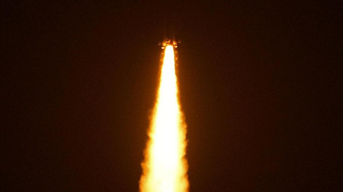
Photo from the source report: NVS-03 and NavIC: Atomic Clocks, Constellation Readiness and Strategic Autonomy
Image: The Hindu
Why in news
NVS-03 was successfully injected into its intended Geosynchronous Transfer Orbit. ISRO also disclosed propulsion-system precautions adopted after the NVS-02 setback and outlined further launches to strengthen the constellation.
4 satellites
Minimum operational configuration reported
7 satellites
Full constellation envisaged
1,500 km
Coverage beyond India’s boundary
2,250 kg
NVS-03 mass
12 years
NVS-03 mission life
64,000
Fishing vessels tracked, as reported by ISRO
Background
NavIC, or Navigation with Indian Constellation, is India’s independent regional satellite navigation system, developed under the Indian Regional Navigation Satellite System programme. Unlike global systems such as GPS, NavIC is designed primarily for India and its surrounding region. Its architecture combines satellites in geostationary and inclined geosynchronous orbits, ground facilities for monitoring and control, and user receivers. Satellite navigation depends on accurately timed radio signals rather than satellite imagery: receivers use these signals to estimate their location and time.
What NVS-03 adds—and what launch success establishes
NVS-03 is the third satellite in ISRO’s next-generation navigation satellite series. It carries an indigenous rubidium atomic clock alongside imported clocks and transmits in the L1 band in addition to the existing L5 and S bands. These features address timing self-reliance, service continuity and receiver compatibility.
The reports describe NVS-03 as restoring NavIC from three operational satellites to its minimum four-satellite configuration after clock failures in older satellites and NVS-02’s failure to reach its final orbit. However, injection into a transfer orbit is technically distinct from final orbital placement, payload testing and service commissioning. The supplied material reports restoration but does not separately document these commissioning milestones.
- The mission was launched from the Satish Dhawan Space Centre at Sriharikota, Andhra Pradesh.
- NVS-03 has a stated mission life of 12 years.
- A successful launch strengthens the programme, but sustained service readiness also depends on satellite health, orbital placement and ground-system validation.
Infographic
Constellation
Healthy satellites, suitable geometry and timely replenishment.
Precise timing
Reliable atomic clocks supported by ground monitoring.
Mission assurance
Validated propulsion, final orbital placement and commissioning.
User adoption
Compatible receivers, affordable devices and application integration.
Resilience
Interference protection, secure infrastructure and backup capability.
AI-assisted infographic by Pragnya IAS Academy, based on the cited sources.
NavIC architecture: why four satellites are a minimum, not the final goal
NavIC’s space segment uses geostationary and inclined geosynchronous satellites to serve its regional coverage area. Geostationary satellites appear fixed over the equator, while inclined geosynchronous satellites change their apparent position in the sky. The ground segment monitors satellite orbits and clocks and maintains navigation information; the user segment consists of compatible receivers.
For a conventional standalone navigation solution, a receiver must determine its spatial position and correct the error in its own clock. Signals from at least four suitably placed, healthy satellites allow these unknowns to be resolved. This is a mathematical minimum, not a guarantee of reliable reception or high accuracy everywhere.
The envisaged seven-satellite constellation provides a stronger basis for availability, geometry and continuity. Satellite visibility, signal blockage, orbital geometry and equipment health remain important even when the minimum satellite count is met.
- Operational satellites are not the same as the cumulative number of satellites launched.
- Standalone capability means deriving a navigation solution without depending on another satellite navigation constellation.
- A full constellation and replacement capacity reduce vulnerability to individual satellite failures.
Atomic clocks and L1 signals: the technological core
Navigation satellites transmit signals containing precise timing and orbital information. A receiver estimates signal travel time and converts it into an apparent distance, called a pseudorange. Because radio signals travel at the speed of light, timing errors directly affect distance estimates and therefore positioning accuracy.
Atomic clocks use stable atomic transitions as frequency references. Older IRNSS satellites experienced failures of imported Swiss clocks. NVS-03 carries an indigenous rubidium atomic clock developed by ISRO’s Space Applications Centre, strengthening domestic capability in a critical subsystem. Nevertheless, an onboard atomic clock does not eliminate receiver-clock error, atmospheric effects or the need for ground-based corrections.
The addition of L1 signals improves the prospects for integration with widely used navigation receiver technology. Frequency compatibility alone does not make every phone NavIC-ready: suitable antennas, chipsets, firmware and validated service availability are also required. The ISRO chief linked wider civilian mobile integration to completion of the full constellation.
- NavIC’s open service supports civilian positioning and navigation.
- Its encrypted restricted service supports authorised users, including the military.
- Indigenous clocks improve technological control, but their reliability must be demonstrated through sustained operation.
NVS-02 lessons: propulsion reliability is navigation reliability
According to the supplied report, NVS-02, launched in 2025, could not reach its final orbit because the drive signal did not reach the pyro valve in the oxidiser line of its orbit-raising engine. The investigation identified disengagement of connector contacts in the main and redundant paths as the most likely cause.
For NVS-03, ISRO flew the satellite with three pyro valves already open. The ISRO chief stated that the configuration was validated through vibration and shock testing by a national-level committee chaired by former ISRO chief Kiran Kumar.
The broader engineering lesson is that duplicated systems do not necessarily provide effective redundancy if both paths can be affected by a shared vulnerability. End-to-end testing must therefore examine connectors, electrical commands, valves and propulsion together, rather than validating each component in isolation.
- Pyro valves are pyrotechnically actuated devices used to control fluid flow in spacecraft propulsion systems.
- Reaching the intended transfer orbit does not by itself establish successful orbit raising.
- Mission assurance requires both reliable launch vehicles and dependable spacecraft subsystems.
Strategic autonomy and civilian value
Independent positioning, navigation and timing services reduce reliance on foreign-controlled infrastructure during geopolitical crises. NavIC’s restricted service supports defence navigation and operations, while domestic control over clocks, ground systems and service management strengthens technological sovereignty. Independence, however, does not make satellite signals immune to jamming or spoofing.
Civilian applications include transport tracking, fisheries, mapping and logistics. The ISRO chief reported real-time tracking of 10,400 locomotives and 64,000 fishing vessels, and the installation of 15 lakh tracking devices across vehicles. These figures indicate the reported scale of tracking applications, not proof that every device operates exclusively on NavIC.
Satellite-derived timing also has relevance for synchronising telecommunications, power systems and financial infrastructure. The supplied reports connect NavIC’s origins to concerns over GPS access during the Kargil conflict; the specific denial claim should remain qualified as reported rather than treated as an undisputed historical fact.
- Under the Pradhan Mantri Matsya Sampada Yojana, ISRO reported a target of extending fishing-vessel tracking to 1 lakh vessels within the next six months.
- NavIC provides positioning and timing inputs; remote tracking also requires a communication link to transmit location data.
- Interoperability with other navigation systems can improve user resilience without surrendering sovereign capability.
| Aspect | Meaning | Important qualification |
|---|---|---|
| Transfer-orbit injection | The launch vehicle places the satellite in an intermediate orbit. | Final orbit raising and service commissioning are separate milestones. |
| Four-satellite minimum | Enables a conventional standalone position-and-clock solution with suitable signals. | Satellite health, visibility and geometry still determine usable service. |
| Seven-satellite constellation | The full constellation envisaged for NavIC’s regional service. | Replacement planning remains necessary as satellites age. |
| L1 compatibility | Broadens compatibility with widely used receiver technology. | A shared frequency band alone does not ensure handset support. |
| Indigenous atomic clock | Strengthens domestic control over precise space-based timing. | It does not by itself eliminate all positioning errors. |
- 1. Ground facilities monitor satellite orbits and clocks and update navigation information.
- 2. Satellite atomic clocks provide stable timing references for broadcast signals.
- 3. A compatible receiver reads signal transmission times and orbital information.
- 4. Signal travel times are converted into pseudorange estimates.
- 5. Signals from sufficiently many suitably placed satellites resolve position and receiver-clock error.
- 6. Position and timing outputs support navigation, synchronisation and tracking applications.
2013–2018
First-generation IRNSS satellites were launched to establish India’s regional navigation capability.
2025
NVS-02 was launched but failed to reach its final orbit.
February 2026
ISRO reported the investigation’s finding that connector-contact disengagement was the most likely cause of NVS-02’s pyro-valve command failure.
October 30, 2026
NVS-03 was launched aboard GSLV-F18 and injected into its intended Geosynchronous Transfer Orbit, according to the main launch reports.
October 31, 2026
ISRO explained NVS-03’s propulsion precautions and outlined plans to launch NVS-04 in five months and NVS-05 in 10 months.
Significance, challenges & way forward
Significance
- NavIC provides sovereign control over a critical navigation and timing capability within India’s region.
- Indigenous atomic-clock development reduces dependence on imported high-precision timing components.
- L1 signals create a stronger pathway towards mass-market receiver integration.
- Reliable regional navigation can improve the efficiency and safety of transport, fisheries and logistics.
- Domestic PNT capability supports defence preparedness and continuity of critical infrastructure.
Challenges
- A minimum operational constellation offers limited resilience to additional satellite or clock failures.
- Clock reliability, propulsion performance and ground-system accuracy must be sustained throughout satellite life.
- Signal blockage, unfavourable geometry and atmospheric effects can degrade positioning performance.
- Jamming and spoofing remain threats even when the satellite constellation is domestically controlled.
- Affordable compatible devices and reliable communication links are necessary to translate satellite capability into widespread tracking services.
- Launch announcements must be distinguished from verified commissioning and measurable service availability.
Way forward
- Complete and replenish the constellation while planning replacements before ageing satellites become unusable.
- Publish clear milestones for final orbital placement, payload validation and operational service availability.
- Strengthen indigenous clock production, reliability testing and long-term performance monitoring.
- Test propulsion command chains end to end and assess shared vulnerabilities across redundant systems.
- Work with chipset, handset and vehicle-device manufacturers on affordable NavIC integration and interoperability.
- Develop interference monitoring, resilient receivers and backup navigation or timing arrangements for critical users.
- Evaluate civilian deployment through service reliability, user safety and accessibility rather than device installation alone.
Key terms
- PNT
- Positioning, navigation and timing: services that establish location, support movement and provide precise time references.
- Rubidium atomic clock
- A precision clock that uses atomic transitions in rubidium as a stable frequency reference.
- Pseudorange
- An apparent satellite-to-receiver distance derived from signal timing and affected by clock and propagation errors.
- Geostationary orbit
- A circular equatorial orbit in which a satellite appears fixed relative to the Earth’s surface.
- Geosynchronous Transfer Orbit
- An intermediate elliptical orbit from which a spacecraft can manoeuvre towards its final geosynchronous orbit.
- Satellite geometry
- The relative arrangement of visible satellites in the sky, which influences positioning accuracy.
- Jamming
- Interference that disrupts a receiver’s ability to detect or use legitimate navigation signals.
- Spoofing
- Transmission of deceptive signals intended to make a receiver calculate an incorrect position or time.
Link with static syllabus
Prelims practice MCQs
Q1. With reference to NavIC, consider the following statements: 1. It is designed primarily to serve India and its surrounding region. 2. It provides an open service and an encrypted restricted service. 3. It determines user location primarily through satellite photographs. Which of the statements given above are correct?
Q2. Why are signals from at least four suitably placed satellites normally required for a standalone satellite-navigation solution?
Q3. With reference to NVS-03, consider the following statements: 1. It carries an indigenous rubidium atomic clock alongside imported clocks. 2. It transmits L1 signals in addition to L5 and S-band signals. 3. L1 transmission alone makes every existing smartphone NavIC-compatible. Which of the statements given above are correct?
Q4. Consider the following pairs: 1. Pyro valve — Control of fluid flow in spacecraft propulsion 2. Pseudorange — Apparent distance inferred from signal travel time 3. Geosynchronous Transfer Orbit — Mandatory final operational orbit of a navigation satellite Which of the pairs given above are correctly matched?
Mains practice questions
GS 3 · 15 marks · 250 words
Independent positioning, navigation and timing services are strategic infrastructure. Discuss how NVS-03 strengthens India’s capabilities and explain why constellation restoration alone is insufficient for navigation sovereignty.
Frequently asked questions
Is NavIC a global alternative to GPS?
NavIC is a regional system designed to cover India and an area extending 1,500 kilometres beyond its boundary. GPS provides global coverage.
Why does NavIC need seven satellites if four can provide a position?
Four suitably placed satellites provide the conventional minimum for resolving position and receiver-clock error. The full constellation strengthens availability and geometry and reduces vulnerability to individual failures.
Does NVS-03 make NavIC immediately available on every smartphone?
No. L1 signals improve compatibility prospects, but phones still need suitable hardware and software; the ISRO chief linked wider civilian mobile integration to completion of the constellation.
Does NavIC itself transmit a fishing vessel’s location to authorities?
NavIC enables a compatible onboard receiver to determine position and time. Sending that information to authorities requires a separate communication link.
Sources
- The Hindu: ISRO NVS-03 launch: 5 things to know about India’s new navigation satellite
- The Hindu: Launch of NVS-03: PM Modi congratulates scientists, engineers at ISRO
- The Hindu: To overcome technical hurdles, ISRO flew NVS-03 satellite with pyro valves open: Narayanan
- The Hindu: Why is ISRO’s NVS-03 satellite launch crucial? | Explained
Analysis prepared by the Pragnya IAS Academy current-affairs desk with AI assistance from the cited reports. Verify figures with the original sources.
Turn current affairs into marks
Join Pragnya IAS Academy's mentorship for daily answer-writing evaluation on stories like this — classroom programmes from a trusted name in IAS coaching in Hyderabad.