
Cyclone Murasu Near Ongole: Cyclone Science, Preparedness and Coastal Resilience
Revise the static topic: UPSC Geography notes · UPSC Disaster Management notes
In short: Severe Cyclonic Storm Murasu began making landfall near Ongole in Andhra Pradesh early on November 3, 2026, bringing strong winds and warnings of heavy rainfall and coastal inundation. The event highlights why cyclone preparedness must translate forecasts into timely evacuation, coordinated response and protection of essential coastal infrastructure.
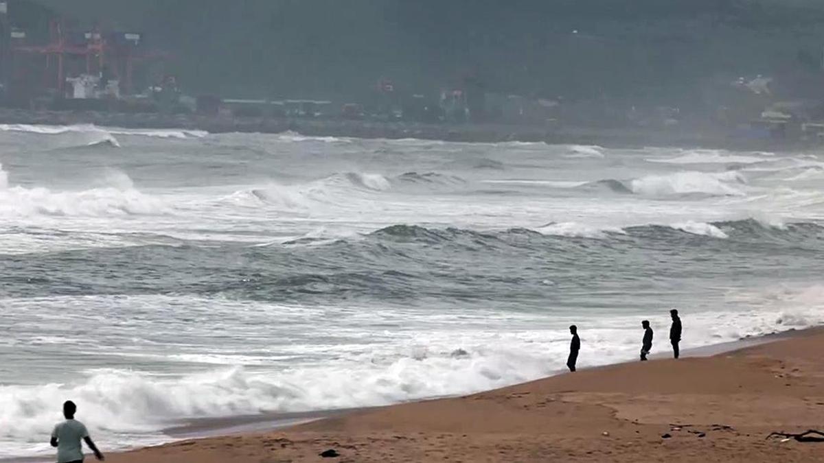
Reported landfall of Cyclone Murasu near Ongole highlights the importance of timely evacuation and preparedness for damaging winds, heavy rain and coastal inundation.
Image: The Hindu
Why in news
The IMD reported that Murasu’s landfall process commenced near Ongole at 1 a.m. on November 3. Andhra Pradesh deployed disaster-response teams and activated citizen grievance reporting, while warnings identified low-lying coastal areas at risk from storm surge.
100–110 kmph
Landfall winds in the dedicated report
120 kmph
Reported gust speed
1.5–2 metres
Forecast surge above astronomical tide
3–4 hours
Forecast surge onset before landfall
6
NDRF teams deployed
7
SDRF teams deployed
Background
Tropical cyclones are organised low-pressure systems that develop over warm tropical oceans, drawing energy from oceanic heat and the release of latent heat during condensation. Their main hazards are destructive winds, intense rainfall and storm surge. India’s Bay of Bengal coastline includes low-lying coastal plains, deltas and densely settled areas where these hazards can overlap. The India Meteorological Department provides cyclone forecasts and warnings, while national, state and district disaster-management institutions coordinate preparedness, response and recovery.
What the reports establish
Murasu developed from a deep depression over the Bay of Bengal into a cyclonic storm on November 1 and subsequently intensified into a severe cyclonic storm. Its landfall process began near Ongole on November 3. The supplied early-morning reports describe an ongoing process, not a confirmed completion of landfall.
The dedicated landfall report gives winds of 100–110 kmph, gusting to 120 kmph. The live update separately reports observed maximum sustained winds of 110–120 kmph. These differing descriptions should not be merged into a single definitive sustained-wind estimate; the latest authoritative IMD bulletin should guide operational decisions.
The warning anticipated storm surge of about 1.5–2 metres above the astronomical tide, with peak surge expected in Bapatla and parts of Krishna and Prakasam. It also indicated that inundation could begin before landfall, making advance evacuation critical.
- Andhra Pradesh reported deployment of NDRF and SDRF teams in districts likely to be affected.
- Odisha expedited evacuation from vulnerable areas, according to the supplied reporting.
- School and college closures were announced in NTR and Guntur districts.
- Mana Mitra enabled residents to report outages, fallen trees, waterlogging and other cyclone-related disruptions.
Infographic
Understand
Track wind, rainfall, surge and their interactions.
Warn
Deliver local, actionable messages through redundant channels.
Evacuate
Move exposed communities before routes become unsafe.
Coordinate
Connect administration, responders and essential-service agencies.
Strengthen
Protect lifelines, enforce safer construction and conserve coastal buffers.
Recover
Restore services safely and rebuild with lower future risk.
AI-assisted infographic by Pragnya IAS Academy, based on the cited sources.
How tropical cyclones form and intensify
Cyclogenesis requires warm ocean water, adequate moisture, a pre-existing atmospheric disturbance, sufficient Coriolis force and relatively weak vertical wind shear. Surface air converges towards a low-pressure centre and rises; condensation releases latent heat, sustaining convection and helping deepen the low-pressure system.
The resulting pressure gradient drives stronger winds, while continuing exchanges of heat and moisture between the ocean and atmosphere support the circulation. In the Northern Hemisphere, cyclonic circulation is anticlockwise. Strong vertical wind shear can displace thunderstorms away from the centre and disrupt intensification.
In a mature cyclone, the eyewall surrounding the relatively calm eye generally contains the strongest winds and intense convection. Outer rainbands can affect areas well before the centre reaches the coast. After landfall, loss of oceanic energy supply and increased friction generally weaken the circulation, but dangerous rainfall and flooding can continue inland.
- Landfall refers to the cyclone’s centre crossing the coastline; hazardous weather can precede and follow this crossing.
- Intensity categories are based on sustained wind speed, not gust speed or rainfall totals.
- Observed intensity alone does not determine losses: exposure, vulnerability, storm size and local geography also matter.
Why coastal risk is a compound hazard
Storm surge is an abnormal rise in sea level generated mainly by cyclone-driven winds, with low atmospheric pressure also contributing. It is distinct from the astronomical tide. Coastal water levels and inundation depend on their interaction, alongside waves, coastal shape and nearshore bathymetry.
Heavy rainfall can coincide with elevated coastal water levels, restricting drainage into the sea and worsening flooding. Fallen trees and damaged electricity or telecommunications networks can then obstruct rescue and interrupt water supply, healthcare and transport. The reported tree falls and stranded vehicle near Ongole illustrate such cascading disruptions.
- Low-lying settlements require inundation-based planning rather than reliance on distance from the forecast landfall point alone.
- Inland districts need rainfall, river-flood and drainage preparedness even when they face no direct storm-surge threat.
- A temporary lull during passage of the eye must not be mistaken for an official all-clear.
Preparedness: From forecasts to protective action
Forecasting saves lives only when warnings specify who is at risk, what action is required and when it must be completed. Murasu’s forecast of surge beginning before landfall shows why evacuation deadlines should be linked to the earliest expected dangerous conditions, not merely the predicted time of coastal crossing.
District administrations should integrate IMD warnings with local inundation maps, shelter capacity, transport availability and lists of people needing assistance. Response-force deployment is an important input, but the supplied reports do not establish evacuation coverage, shelter adequacy or the effectiveness of last-mile warning delivery.
Mana Mitra offers a useful channel for reporting local disruptions. However, digital reporting must supplement rather than replace sirens, public announcements, radio, community volunteers and accessible offline assistance because electricity, mobile connectivity or digital access may fail.
- Prioritise assisted evacuation for persons with disabilities, older persons, pregnant women and people requiring continuing medical care.
- Provide safe shelter, drinking water, sanitation, essential medicines and arrangements for livestock.
- Use acknowledged task assignments so that a received warning or grievance results in a verified field response.
- Communicate clearly with fishing communities and harbour authorities about restrictions and safe return.
Governance and resilient infrastructure
The Disaster Management Act provides the institutional framework for national, state and district disaster management. IMD supplies meteorological warnings; disaster-management authorities and district administrations translate them into preparedness and response, supported by NDRF, SDRF, local bodies and sectoral departments.
Inter-agency coordination must connect rescue with electricity restoration, healthcare, road clearance, water supply and telecommunications. The reported request for assistance from neighbouring states for power restoration underlines the value of pre-arranged mutual aid and interoperable procedures.
Long-term resilience requires cyclone-resistant construction, risk-sensitive land use, protected critical equipment, dependable drainage and redundant essential services. Mangroves, dunes and wetlands can reduce coastal exposure where ecologically appropriate, but cannot substitute for evacuation or engineered protection in highly exposed locations.
- Strengthen roofs, connections and structural detailing through enforceable building standards.
- Elevate or flood-protect critical equipment and provide backup power for shelters, hospitals and communication facilities.
- Assess underground cabling selectively, accounting for flooding, maintenance access and local conditions.
- Restore infrastructure to a more resilient standard rather than reproducing pre-disaster vulnerabilities.
| Hazard | Mechanism | Priority action |
|---|---|---|
| Destructive winds | Strong pressure gradients produce damaging winds and gusts. | Secure buildings, protect power infrastructure and restrict exposed travel. |
| Storm surge | Cyclonic winds and low pressure raise coastal sea level above the predicted tide. | Evacuate mapped inundation zones before routes become unsafe. |
| Heavy rainfall | Moist convection and rainbands generate intense precipitation. | Prepare drainage systems, monitor rivers and protect flood-prone settlements. |
| Compound flooding | Rainfall runoff coincides with elevated coastal water levels. | Integrate coastal, river and urban flood management. |
| Cascading service failures | Damage to one network disrupts dependent services. | Maintain backup power, alternative communications and coordinated restoration. |
- 1. IMD observes the system and issues track, intensity, rainfall and surge forecasts.
- 2. State and district authorities overlay warnings with exposure and vulnerability maps.
- 3. Local agencies communicate location-specific instructions through redundant channels.
- 4. Transport and shelter teams complete assisted evacuation before dangerous conditions begin.
- 5. Response agencies conduct rescue and prioritise essential-service restoration.
- 6. Authorities verify safe return and use post-event reviews to strengthen resilience.
November 1, 2026
A deep depression over the Bay of Bengal intensified into Cyclone Murasu.
November 2, 2026
Reports described intensification into a severe cyclonic storm, evacuation action in Odisha and transport disruptions.
November 3, 2026, 1 a.m.
The landfall process commenced near Ongole, according to the IMD information cited in the reports.
November 3, 2026, 3 a.m.
The live update reported that the northern inner spiral band had touched land and the wall cloud region was entering land.
Significance, challenges & way forward
Significance
- Murasu demonstrates that coastal protection requires planning for wind, rainfall and surge together rather than treating landfall as a single-point event.
- Advance warnings create a window for evacuation, school closures and pre-positioning of response resources.
- Inter-state assistance can strengthen restoration capacity when local utility networks are severely disrupted.
- Citizen reporting can improve situational awareness when integrated with accountable field-response systems.
- Resilient infrastructure protects livelihoods and continuity of essential services in addition to reducing immediate casualties.
Challenges
- Forecast uncertainty requires adaptable evacuation plans and clear communication without false precision.
- Surge arriving before landfall can cut evacuation routes earlier than residents expect.
- Digital-only communication risks excluding people without connectivity, electricity or accessible devices.
- Simultaneous infrastructure failures can delay rescue and extend disruption beyond the directly affected coastline.
- Deployment figures do not establish whether vulnerable households were reached or shelters functioned adequately.
- The supplied reports do not establish final damage, casualties or completed restoration, limiting outcome-based evaluation.
Way forward
- Issue impact-based warnings that identify threatened settlements, likely disruptions and deadlines for protective action.
- Link evacuation triggers to surge onset, route safety and local vulnerability rather than landfall timing alone.
- Audit cyclone shelters for structural safety, accessibility, sanitation and reliable backup services.
- Institutionalise joint exercises and mutual-aid arrangements among district administrations, response forces and utility agencies.
- Combine risk-sensitive land-use regulation and resilient construction with restoration of suitable coastal ecosystems.
- Evaluate preparedness through warning reach, assisted evacuation, shelter functionality and service-restoration performance.
Key terms
- Tropical cyclone
- An organised warm-core low-pressure system sustained by heat and moisture from tropical oceans.
- Latent heat
- Energy released when water vapour condenses, helping sustain cyclone convection.
- Vertical wind shear
- A change in wind speed or direction with height that can disrupt a cyclone’s vertical organisation.
- Eyewall
- The ring of intense convection around the eye, generally associated with the strongest winds.
- Storm surge
- An abnormal rise in coastal sea level caused by a storm above the predicted astronomical tide.
- Sustained wind and gust
- Sustained wind is averaged over a specified interval, whereas a gust is a brief peak in wind speed.
- Compound flooding
- Flooding produced or intensified by interacting drivers such as rainfall, river flow and elevated coastal water levels.
- Impact-based warning
- A warning explaining expected consequences and protective actions, not merely meteorological conditions.
Link with static syllabus
Prelims practice MCQs
Q1. With reference to tropical cyclone formation, consider the following statements: 1. Weak vertical wind shear generally favours an organised cyclone circulation. 2. Condensation releases latent heat that helps sustain convection. 3. The Coriolis force is strongest at the Equator. Which of the statements given above are correct?
Q2. With reference to cyclone-related coastal flooding, consider the following statements: 1. Storm surge and astronomical tide are identical phenomena. 2. Surge-related inundation can begin before the cyclone’s centre crosses the coast. 3. Elevated coastal water levels can obstruct drainage of rainfall runoff. Which of the statements given above are correct?
Q3. Which of the following most accurately describes cyclone landfall?
Q4. Consider the following institution-function pairs: 1. India Meteorological Department — Cyclone forecasts and warnings 2. National Disaster Response Force — Specialised disaster response 3. District administration — Local evacuation and relief coordination Which of the pairs given above are correctly matched?
Mains practice questions
GS 3 · 15 marks · 250 words
Cyclone risk reduction requires more than accurate forecasting. Discuss with reference to early warnings, evacuation, inter-agency coordination and resilient coastal infrastructure.
Frequently asked questions
Had Cyclone Murasu completed landfall in the supplied reports?
The reports establish that the landfall process began near Ongole at 1 a.m. on November 3, 2026. Their early-morning updates do not confirm its completion.
Why can evacuation be necessary before landfall?
Storm surge, strong winds and rainbands can arrive before the cyclone’s centre crosses the coast. Waiting until landfall may leave evacuation routes flooded or obstructed.
Does cyclone intensity capture the entire disaster risk?
No. Wind-based intensity does not fully capture rainfall, surge, local topography, population exposure or infrastructure vulnerability.
What is the role of Mana Mitra during Murasu?
The reported WhatsApp governance mechanism enables residents to submit cyclone-related grievances such as outages, fallen trees and waterlogging. Its effectiveness depends on connectivity and timely administrative follow-up.
Sources
- The Hindu: Cyclone Murasu Live updates: Landfall continues in A.P.; CM Naidu holds teleconference with District Collectors
- The Hindu: Severe Cyclone Murasu: Landfall commences near Ongole
- The Hindu: Cyclonic storm Murasu to make landfall close to Ongole
- The Hindu: Palnadu on high alert as Cyclone Murasu to bring heavy rain
Analysis prepared by the Pragnya IAS Academy current-affairs desk with AI assistance from the cited reports. Verify figures with the original sources.
Turn current affairs into marks
Join Pragnya IAS Academy's mentorship for daily answer-writing evaluation on stories like this — classroom programmes from a trusted name in IAS coaching in Hyderabad.