
Bhutan GLOF: Himalayan Cascading Hazards and India’s Downstream Preparedness
Revise the static topic: UPSC Geography notes · UPSC Disaster Management notes
In short: A glacial lake outburst at Shintaphu Tsho in Bhutan’s Gasa district on October 29, 2026 damaged infrastructure along the Mochhu and triggered downstream alerts and precautionary evacuations in India. A newly formed impoundment in Bhutan raised concern about a secondary outburst, highlighting the need for lake monitoring, transboundary early warning and evacuation-ready communities.
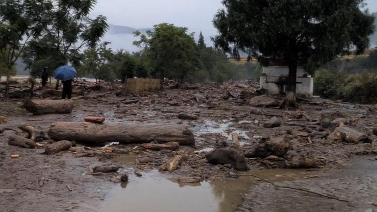
Infrastructure damage in Bhutan reported after a glacial lake outburst flood, illustrating the vulnerability of roads and bridges along mountain rivers.
Image: The Hindu
Why in news
Vulnerable areas in Assam and north Bengal were placed on alert after the Bhutan GLOF, with residents along the Sankosh shifted to safer locations. Subsequent reports indicated stable or receding river levels and no major disaster in the affected Indian districts, but continued vigilance remained necessary.
17
Bhutan lakes identified as potentially dangerous
Nearly 7.4 million cubic
Reported water release from Shintaphu Lake
Over 4,000
Evacuations reported by The Hindu
Around 12,000
Alipurduar relocations reported by Indian Express
Background
Glacial lakes form when meltwater collects in depressions associated with glaciers, sometimes behind moraines, ice or bedrock barriers. A glacial lake outburst flood is the sudden release of lake water following a breach, overtopping or another rapid drainage process. The Himalayas combine steep relief, unstable slopes, glacier change and settlements concentrated along river valleys, allowing an upstream disturbance to become a downstream disaster. In this case, the Mochhu joins the Phochhu at Punakha to form the Punatsangchhu, which flows along the Assam–West Bengal border as the Sankosh, also spelt Sonkosh.
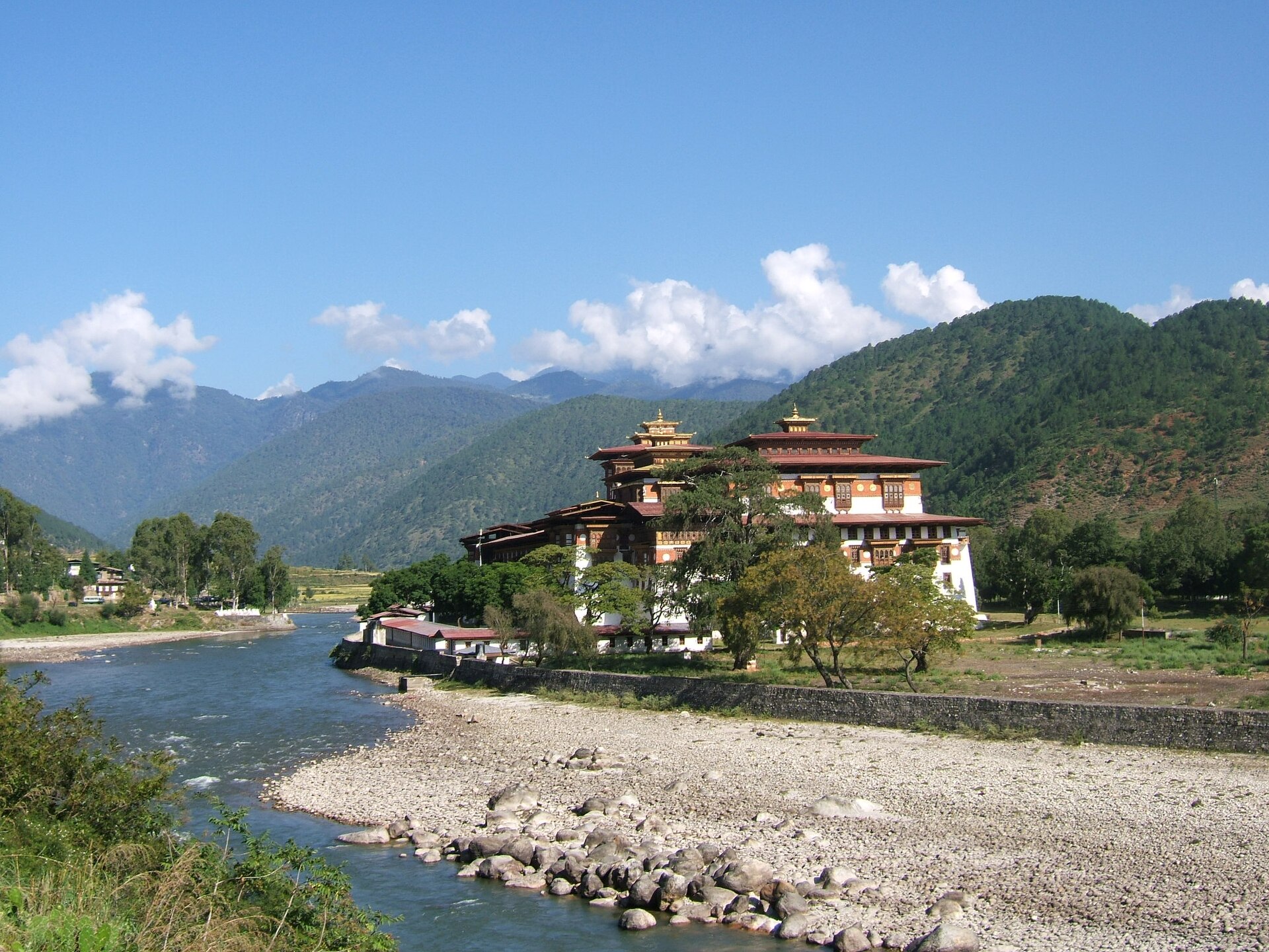
Reference view of Bhutan’s Punakha valley and Mo Chhu River in October 2006, showing the river-valley setting downstream of the high mountains; not an image of the reported outburst.
Image: Cfynn · CC BY-SA 3.0
What happened and what remains uncertain
The supplied reports identify the source lake as Shintaphu Tsho, with spelling variants including Shintapu and Sintaphu, in Bhutan’s Gasa district. The outburst damaged roads and public infrastructure, devastated facilities at Gasa Tshachu and washed away a Bailey bridge in Punakha built with Indian support. Bhutanese officials reported no human casualties as of October 30.
Water accumulation near Taktsemakhang downstream of Laya created concern about another sudden release. Personnel and residents at exposed locations were instructed to evacuate. In India, Dhubri and Kokrajhar in Assam and vulnerable areas of north Bengal were placed on alert.
Evacuation figures are not a single harmonised count: The Hindu reported over 4,000 people moved from locations in Kumargram and Tufanganj, while The Indian Express reported around 12,000 relocations in Alipurduar. Their timing and geographic coverage are not fully aligned, so the figures should neither be added nor treated as a verified final total.
- Nearly 7.4 million cubic metres of released water is a reported estimate, not a measurement independently established by this analysis.
- The precise trigger and breach mechanism at the source lake are not established in the supplied material.
- Initial reports of damaged lock gates do not establish that failure of an engineered dam caused the GLOF.
Infographic
Watch the source
Track lake growth, barrier condition and potential slope failures.
Track the cascade
Monitor river levels, debris and newly formed impoundments.
Share across borders
Exchange verified observations through redundant warning channels.
Enable evacuation
Connect local alerts with safe routes, shelters and inclusive assistance.
Verify safe return
Assess residual upstream hazards and damaged access before an all-clear.
AI-assisted infographic by Pragnya IAS Academy, based on the cited sources.
How Himalayan GLOFs develop
Glacier retreat can create or enlarge lakes where basin topography permits, while unconsolidated moraine barriers may remain vulnerable to erosion or internal instability. Potential triggers include ice or rock avalanches generating displacement waves, intense rainfall, rapid inflow, seepage-related failure and earthquake-induced disturbance. These are general mechanisms, not confirmed causes of this event.
Once water escapes, steep channels can accelerate the flood and enable it to entrain sediment, boulders and woody debris. The resulting flow may damage bridges, erode banks and alter channels. Downstream severity depends on the breach process, channel geometry, sediment supply and concurrent river conditions, not merely the lake’s volume.
- Lake size alone is insufficient for risk ranking; barrier condition, avalanche exposure and downstream population also matter.
- A GLOF differs from ordinary rainfall-driven flooding in its initiating mechanism, although both can interact.
- Glacier change is a long-term risk context; attributing this specific breach to climate change requires additional evidence.
Cascading hazards: why a falling river is not an automatic all-clear
The reported impoundment near Taktsemakhang illustrates a possible cascade: an initial outburst is followed by water accumulation and the prospect of another release. Sediment or debris can obstruct drainage in mountain valleys, although the exact formation mechanism and stability of this particular impoundment require field assessment.
Infrastructure damage can compound the physical hazard. A washed-away bridge or blocked road may interrupt evacuation, emergency access and supplies even where the main flood has passed. The forecast of heavy rainfall in Alipurduar added a potential compounding factor, but the supplied material does not establish that the forecast rainfall actually intensified flooding.
- Temporary water storage can delay part of the hazard and produce a later flood pulse.
- Receding water at one monitoring station does not prove that all upstream impoundments are stable.
- Return to evacuated settlements should follow an assessment of river conditions, secondary hazards and access safety.
Monitoring and transboundary warning: from detection to action
A robust monitoring system combines repeated satellite observations with field assessments of lake outlets and barriers, lake-level instruments, weather observations and downstream river gauges. Satellite mapping supports lake inventories and change detection; near-real-time instruments are needed to identify rapid changes and support operational warnings.
The supplied reports state that Bhutan’s National Centre for Hydrology and Meteorology was monitoring the Mochhu at Tashithang and that India had been informed. Indian authorities also reported continuing communication with Bhutan. The policy priority is to make such exchanges routine, redundant and linked to pre-agreed district actions.
Warnings must communicate what is happening, which settlements are exposed, what uncertainty remains and what people must do. A technical alert has limited value unless it reaches the last household through channels that function during power or telecommunications failures.
- Share time-stamped river levels, breach observations and information on secondary impoundments across the border.
- Use flood-routing scenarios to estimate possible arrival windows without presenting uncertain forecasts as guarantees.
- Maintain backup communication links and require acknowledgement of warnings by receiving control rooms.
- Combine public-address systems, local volunteers, mobile alerts and designated evacuation routes.
Evacuation preparedness and institutional responsibility
Under India’s Disaster Management Act, national, state and district institutions have complementary responsibilities for disaster planning and response. District administration is central to translating upstream warnings into local evacuation, shelter management and access control; the National and State Disaster Response Forces support specialised response.
Public-address warnings, designated shelters and precautionary relocation reported in north Bengal illustrate anticipatory action. Preparedness must also cover people with disabilities, older persons, children, tourists, isolated forest settlements and households reluctant to leave livestock or essential belongings.
- Map exposed settlements and safe routes using inundation scenarios rather than administrative boundaries alone.
- Pre-position essential supplies and verify that shelters remain accessible if roads or bridges fail.
- Conduct community drills and communicate the conditions for evacuation and safe return.
- Keep evacuation, shelter-occupancy and assistance records consistent to prevent omissions and double counting.
| Layer | Purpose | Priority action |
|---|---|---|
| Source-lake surveillance | Identify evolving lake and barrier instability | Combine satellite inventories with targeted field checks and instruments |
| River-corridor monitoring | Track flood movement and secondary impoundments | Maintain gauges and inspect suspected blockages where safe |
| Transboundary warning | Convert upstream observations into downstream lead time | Share verified alerts through redundant, acknowledged channels |
| Community preparedness | Reduce exposure before dangerous flows arrive | Use local warnings, accessible evacuation routes and ready shelters |
| Recovery and safe return | Prevent losses after the initial flood | Assess unstable banks, damaged crossings and residual upstream hazards |
- 1. A trigger or barrier instability causes rapid drainage from a glacial lake.
- 2. Released water moves through steep channels and entrains sediment and debris.
- 3. Flooding and erosion damage exposed infrastructure and riverbanks.
- 4. Obstruction or water accumulation may create a secondary impoundment.
- 5. Failure of that impoundment may generate another downstream flood pulse.
- 6. Continued monitoring, warnings and evacuation reduce exposure to successive hazards.
August 26, 2021
Flooding damaged Gasa Tshachu when the swollen Mochhu changed course towards the area; this was an earlier flood event, not identified in the source as a GLOF.
2022
A Bailey bridge was constructed in Punakha with Government of India support; it was subsequently washed away in the reported GLOF.
October 29, 2026
The glacial lake outburst in Gasa triggered flooding along the Mochhu and downstream alerts, including warnings in north Bengal.
October 30, 2026
Bhutanese officials reported infrastructure damage and concern over a new impoundment; Indian authorities reported evacuations, monitoring and stable conditions in north Bengal.
Significance, challenges & way forward
Significance
- The event demonstrates that Himalayan disaster risk follows river basins across international and state boundaries.
- Concern over a secondary impoundment shows why emergency monitoring must continue beyond the initial outburst.
- Precautionary evacuation can reduce exposure even when subsequent river levels stabilise and severe flooding does not occur.
- Damage to India-supported infrastructure in Bhutan highlights the importance of incorporating multi-hazard resilience into development cooperation.
- The case links physical geography with governance: detection must be matched by communication, local trust and practical evacuation capacity.
Challenges
- Remote terrain, severe weather and damaged access routes can delay inspection of source lakes and new impoundments.
- Uncertain breach behaviour and sediment movement complicate flood-arrival and inundation forecasts.
- Road and bridge failures may disable evacuation routes precisely when they are most needed.
- Fragmented observations and inconsistent reporting can weaken a shared operational picture across jurisdictions.
- Power and telecommunications failures can prevent warnings from reaching isolated riverbank communities.
- A stable downstream gauge reading can create false reassurance while upstream secondary hazards remain unresolved.
Way forward
- Prioritise glacial lakes using both physical hazard indicators and downstream exposure, rather than lake area alone.
- Institutionalise Bhutan–India protocols for rapid sharing of lake, river and secondary-impoundment observations with designated contact points.
- Develop joint basin-scale flood scenarios and connect warning thresholds to district evacuation and shelter plans.
- Audit bridges, roads and other valley infrastructure for flood, debris and blockage-related hazards.
- Practise inclusive evacuation through community drills, accessible shelters, backup communications and support for livestock-dependent households.
- Treat lake lowering or outlet engineering as site-specific options requiring specialist assessment, not universal remedies.
- Issue verified situation updates and explicit safe-return advice while reconciling evacuation figures across agencies.
Key terms
- Glacial lake outburst flood
- A sudden release of water from a glacial lake through a breach, overtopping or another rapid drainage process.
- Moraine
- An accumulation of debris transported or deposited by a glacier that can sometimes form a lake barrier.
- Displacement wave
- A wave generated when falling ice, rock or other material rapidly displaces lake water.
- Secondary impoundment
- A new accumulation of stored water created after an initial disturbance, potentially posing an additional outburst hazard.
- Cascading hazard
- A sequence in which one hazardous event triggers or amplifies another.
- Flood routing
- Estimation of how a flood wave moves and changes through a river channel or storage system.
- Last-mile warning
- Delivery of understandable and actionable risk information to the people who must take protective action.
- Residual risk
- Risk that remains despite protective measures or after the most visible phase of an emergency has passed.
Link with static syllabus
Prelims practice MCQs
Q1. With reference to glacial lake outburst floods, consider the following statements: 1. A rock or ice avalanche entering a lake can generate a wave capable of overtopping its barrier. 2. A GLOF can occur only when an engineered dam fails. 3. A GLOF can entrain sediment and damage downstream bridges. Which of the statements given above are correct?
Q2. Which of the following correctly describes the drainage connection relevant to the reported Bhutan GLOF?
Q3. Consider the following statements about monitoring a glacial lake outburst emergency: 1. Receding water at a downstream gauge conclusively establishes that every upstream secondary impoundment is safe. 2. Satellite observations and ground-based river gauges can perform complementary monitoring functions. 3. An effective warning should identify exposed locations and specify protective action. Which of the statements given above are correct?
Q4. In the context of mountain disasters, which of the following best illustrates a cascading hazard?
Mains practice questions
GS 3 · 15 marks · 250 words
Himalayan glacial lake outburst floods are transboundary, cascading disasters rather than isolated upstream events. Discuss with reference to the recent Bhutan outburst and suggest measures for downstream preparedness in India.
Frequently asked questions
Why did a glacial lake outburst in Bhutan trigger alerts in India?
The affected Mochhu connects through the Punatsangchhu to the Sankosh along the Assam–West Bengal border. Floodwater and debris can therefore propagate from Bhutan into downstream Indian river corridors.
Was climate change confirmed as the cause of this GLOF?
No. Glacier retreat and changing climate can influence glacial-lake risk, but the supplied reports do not establish the specific trigger or attribute this individual event to climate change.
Why was the newly formed impoundment a concern?
Stored water could be released suddenly if its confining conditions became unstable, creating a secondary flood pulse. Its stability required assessment even after downstream water levels began to recede.
How many people were evacuated in India?
The Hindu reported over 4,000 people moved from locations in Kumargram and Tufanganj, while The Indian Express reported around 12,000 relocations in Alipurduar. These differently scoped reports should not be added or presented as a single verified final total.
Sources
- The Hindu: Glacial Lake Outburst Flood damages roads, washes away bridge in Bhutan
- The Hindu: 4,000 moved to safety in Bengal after Bhutan glacial lake outburst triggers flood alert
- Indian Express: Assam, north Bengal districts on high alert; 12,000 evacuated from areas along Sankosh
- Indian Express: Bengal, Assam on high flood alert after glacial lake bursts in Bhutan
Analysis prepared by the Pragnya IAS Academy current-affairs desk with AI assistance from the cited reports. Verify figures with the original sources.
Turn current affairs into marks
Join Pragnya IAS Academy's mentorship for daily answer-writing evaluation on stories like this — classroom programmes from a trusted name in IAS coaching in Hyderabad.