
NavIC Restoration: NVS-03, Constellation Continuity and Sovereign Navigation
Revise the static topic: UPSC Science & Technology notes
In short: ISRO is slated to launch NVS-03 on October 30, potentially restoring NavIC’s standalone positioning service by bringing its operational navigation constellation to the minimum requirement of four satellites. Restoration depends on successful orbital deployment and commissioning, while sustained reliability requires timely satellite replacement, dependable atomic clocks and compatible receivers.
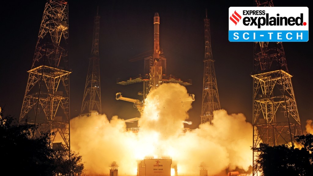
Reference image of an ISRO NavIC satellite, not a photograph of the planned NVS-03 launch. NVS-03 could help restore standalone positioning after successful orbital deployment and commissioning.
Image: Indian Express
Why in news
The reported NVS-03 launch comes after satellite ageing, atomic-clock failures and unsuccessful replacement missions left NavIC unable to provide standalone positioning. According to the government’s statement cited in the source, timing services remain functional.
7 satellites
Original constellation design
1,500 km
Coverage beyond India
3 satellites
Currently available for PNT
4 satellites
Minimum for basic positioning
10 metres
Reported full-constellation design accuracy
12 years
New-generation satellite mission life
Background
Navigation with Indian Constellation, or NavIC, is the operational name of the Indian Regional Navigation Satellite System developed by ISRO. Unlike a global navigation constellation, it is designed primarily for India and the surrounding region. Its architecture combines geostationary and inclined geosynchronous satellites with ground facilities that monitor satellite health, determine orbits and maintain timing information. User receivers process broadcast navigation signals to calculate position and time. NavIC provides an open Standard Positioning Service and a Restricted Service for authorised users, linking civilian utility with sovereign control over a strategically important infrastructure.
What NVS-03 could restore
The government’s statement cited in the source identifies IRNSS-1B, IRNSS-1I and NVS-01 as the satellites currently available for PNT services. This is below the minimum requirement for NavIC’s standalone positioning service, although timing service continues.
NVS-03 is intended to close this immediate operational gap. However, launch is only the beginning: the satellite must reach its intended operational orbit, pass in-orbit checks and be integrated into the navigation service before restoration can be confirmed.
- A successfully commissioned NVS-03 could restore the minimum satellite availability needed for basic standalone positioning.
- Minimum availability is not equivalent to full-constellation capability or adequate redundancy.
- The reported launch schedule should not be treated as evidence that positioning services have already resumed.
Infographic
Regional architecture
High-orbit satellites support coverage over India and its neighbourhood.
Operational restoration
NVS-03 could help meet the minimum positioning requirement after commissioning.
Constellation continuity
Timely replenishment and redundancy prevent service gaps.
Critical technology
Indigenous clocks and reliable propulsion underpin operational capability.
User ecosystem
L1 signals, compatible receivers and applications turn capability into utility.
Sovereign PNT
Independent services strengthen strategic autonomy and infrastructure resilience.
AI-assisted infographic by Pragnya IAS Academy, based on the cited sources.
How NavIC’s regional navigation architecture works
NavIC’s original constellation was designed around seven satellites covering India and a region extending up to 1,500 km around it. Geostationary satellites appear fixed over the equator, while inclined geosynchronous satellites change their apparent position during their orbit. Together, they support sustained visibility over the intended service region.
A receiver compares the transmission time encoded in satellite signals with their reception time to estimate distance. These measurements are called pseudoranges because they include receiver-clock error and other uncertainties. Signals from at least four suitably placed satellites ordinarily allow the receiver to solve for its position and clock offset.
Atomic clocks are therefore fundamental to navigation accuracy. Ordinary satellite positioning uses one-way broadcasts: the user receiver does not need to send a return signal to the satellite.
- The space segment broadcasts navigation signals and timing information.
- The ground segment monitors satellites and maintains orbit and clock information.
- The user segment consists of receivers, chipsets, antennas and applications.
- Regional orbital geometry can improve visibility, but terrain, obstructions and receiver quality still affect performance.
Why constellation continuity broke down
The source attributes the service shortfall to a combination of atomic-clock failures, ageing satellites and unsuccessful replenishment missions. Failures of imported atomic clocks impaired some early satellites, while much of the original constellation has reached the end of its stated mission life.
IRNSS-1H could not be deployed because its launch vehicle’s heat shield failed to open. NVS-02 reached its transfer orbit but could not perform the propulsion manoeuvres required to reach its intended operational orbit. The review cited in the source linked this to a signal failing to reach an oxidiser-line pyro valve, most likely because of a connector-contact problem.
The experience demonstrates that navigation reliability is an end-to-end systems challenge. Launch-vehicle performance, spacecraft propulsion, clock health, ground operations and replacement schedules must all function together.
- A satellite successfully inserted into a transfer orbit is not necessarily available for navigation service.
- Replacement launches must anticipate ageing rather than merely respond to service failures.
- The source reports that more thorough propulsion-system checks have followed the NVS-02 failure.
What the new generation changes
The source reports that the new generation, beginning with NVS-01, carries indigenously developed atomic clocks and has a longer mission life of 12 years. Domestic clock capability can reduce dependence on imported critical components, although operational reliability still requires rigorous qualification and sustained testing.
New-generation satellites add L1 signals to NavIC’s existing L5 and S-band signals. Since L1 is widely used in satellite navigation, this can make integration with compatible consumer devices and multi-constellation receivers easier, including low-power wearable devices.
Satellite capability alone does not ensure adoption. The CAG report cited in the source noted that consumer-receiver development began only in 2017, after the initial satellites had already spent part of their mission lives in orbit.
- L1 improves the prospects for interoperability but does not automatically make every existing device NavIC-compatible.
- Receiver design, antenna support, firmware and application integration remain necessary.
- Space-segment replenishment and user-segment development should proceed together.
Why sovereign PNT matters
Positioning, navigation and timing underpin transport, surveying, emergency response, defence operations and synchronised infrastructure. Sovereign control over a navigation system reduces strategic dependence on services operated by foreign governments, particularly during crises.
NavIC should be understood as an independent regional capability rather than a global replica of GPS. Its immediate policy priority is dependable service within its intended coverage area, while interoperability with other constellations can improve user resilience.
The source identifies railway tracking as an important application: around 8,700 trains are already equipped with the system against a stated goal of tracking around 12,000 trains. Such applications make service continuity and receiver readiness as important as technological demonstration.
- Sovereignty and interoperability are complementary rather than competing objectives.
- An indigenous constellation does not by itself eliminate vulnerability to jamming, spoofing or equipment failure.
- Reliable public infrastructure requires predictable service quality, not merely an available signal.
| Feature | NavIC | Global navigation systems | Japan’s QZSS |
|---|---|---|---|
| Service orientation | Independent regional navigation | Global positioning, navigation and timing | Regional system that complements and augments GPS |
| Geographical focus | India and surrounding region | Worldwide coverage | Asia-Oceania region |
| Examples | India’s IRNSS/NavIC | GPS, GLONASS, Galileo and BeiDou | Quasi-Zenith Satellite System |
| Orbital approach | Geostationary and inclined geosynchronous orbits | Predominantly medium Earth orbit; BeiDou also uses higher orbits | High-altitude orbits suited to regional visibility |
| Policy lesson | Sovereign regional capability requires continuous replenishment | Wide coverage requires sustained constellation management | Regional navigation architectures can complement global systems |
- 1. Launch and inject the satellite into its planned initial orbit.
- 2. Complete the manoeuvres required to reach the operational orbit.
- 3. Verify propulsion performance, atomic-clock health and navigation payload operation.
- 4. Integrate the satellite with ground monitoring and navigation-message generation.
- 5. Validate positioning performance with the operational constellation.
- 6. Maintain service through monitoring, redundancy and timely replenishment.
1999
According to the source, work on an indigenous navigation system began in the aftermath of the Kargil conflict.
July 2013
IRNSS-1A, the first satellite of the constellation, was launched.
2015
The source reports that the additional satellites needed to reach the initial minimum positioning requirement had been placed in orbit.
2017
Consumer-end receiver development began, according to the CAG findings cited in the source.
2018
The cited CAG report highlighted the lag between satellite deployment and receiver development.
Late 2025 onwards
NVS-03 remained in the launch pipeline, with the source reporting delays caused by multiple factors.
Earlier in 2026
The government informed Parliament that NavIC could not provide standalone positioning with the available satellites, while timing service remained functional.
October 30, 2026, scheduled
NVS-03 is slated for launch; restoration remains conditional on successful deployment and commissioning.
Significance, challenges & way forward
Significance
- An independently operated regional navigation service strengthens India’s strategic autonomy in civilian and defence applications.
- Reliable NavIC services can support transport tracking, surveying, disaster response and other location-dependent activities.
- Indigenous atomic-clock capability strengthens domestic expertise in a critical space-technology subsystem.
- L1 support can expand the ecosystem of compatible receivers and lower integration barriers.
- Restoration would demonstrate recovery capability, while sustained continuity would establish infrastructure reliability.
Challenges
- Operating at the minimum satellite requirement leaves limited resilience against another failure or maintenance-related loss.
- Ageing satellites and uncertain replacement schedules can turn individual technical failures into system-level service interruptions.
- Clock, connector and propulsion reliability require robust testing across the complete spacecraft system.
- Receiver availability and industry adoption can lag behind satellite deployment, reducing practical returns on investment.
- Regional coverage does not meet every global navigation requirement of Indian users.
- Jamming, spoofing and local signal obstruction remain risks even when the constellation is healthy.
Way forward
- Prioritise successful NVS-03 commissioning and validated service restoration rather than treating launch alone as the outcome.
- Adopt rolling replenishment plans that account for satellite ageing, launch delays and possible mission failures.
- Build operational redundancy beyond the minimum needed for positioning.
- Strengthen end-to-end testing of propulsion command chains, electrical connectors and navigation payloads.
- Develop receivers, chipsets and application standards alongside the space and ground segments.
- Encourage multi-constellation interoperability while retaining the ability to provide independent regional services.
- Provide clear public information on service availability, coverage and limitations to support dependable user adoption.
Key terms
- NavIC
- Navigation with Indian Constellation, the operational name of India’s regional satellite navigation system.
- PNT
- Positioning, navigation and timing services used to determine location, guide movement and provide precise time.
- Atomic clock
- A highly precise clock that uses an atomic transition as its frequency reference.
- Pseudorange
- A satellite-to-receiver distance estimate derived from signal travel time that includes clock and other errors.
- Geostationary orbit
- A circular equatorial geosynchronous orbit in which a satellite appears stationary relative to Earth.
- Inclined geosynchronous orbit
- An orbit matching Earth’s rotation period whose orbital plane is inclined to the equator.
- L1 signal
- A widely used satellite-navigation signal band added to the new generation of NavIC satellites.
- Constellation continuity
- Maintaining sufficient healthy, suitably placed satellites to deliver navigation services without interruption.
Link with static syllabus
Prelims practice MCQs
Q1. With reference to satellite-based positioning, consider the following statements: 1. An ordinary navigation receiver must transmit a return signal to each satellite to calculate its position. 2. Receiver-clock error is one of the unknowns addressed in satellite-based positioning. 3. Atomic-clock failure can impair a navigation satellite’s utility even if it remains in orbit. Which of the statements given above are correct?
Q2. With reference to NavIC’s architecture, consider the following statements: 1. NavIC is designed primarily as a regional navigation system. 2. Its architecture includes geostationary and inclined geosynchronous satellites. 3. Every geosynchronous satellite necessarily appears stationary over a fixed point on Earth. Which of the statements given above are correct?
Q3. What is the principal significance of adding L1 signals to new-generation NavIC satellites?
Q4. Consider the following pairs: 1. Galileo — European navigation system 2. GLONASS — Japanese regional navigation system 3. BeiDou — Chinese navigation system 4. QZSS — Russian global navigation system Which of the pairs given above are correctly matched?
Mains practice questions
GS 3 · 15 marks · 250 words
Restoring NavIC requires more than launching a replacement satellite. Discuss the importance of constellation continuity and a sovereign positioning, navigation and timing ecosystem for India.
Frequently asked questions
Will NVS-03 automatically restore NavIC after launch?
No. It must reach its operational orbit, pass in-orbit checks and be integrated into the constellation before restoration can be validated.
Has NavIC stopped providing every service?
No. The government’s statement cited in the source says standalone positioning is unavailable with the current constellation, but timing service remains functional.
How is NavIC different from GPS?
NavIC is an Indian-operated regional system focused on India and its neighbourhood, whereas the US-operated GPS provides global coverage. Compatible receivers can use signals from multiple constellations.
Why does a navigation receiver ordinarily need four satellites?
It must solve for its position in space and its clock offset using satellite signal measurements. Useful positioning also depends on satellite geometry, signal quality and valid navigation information.
Sources
Analysis prepared by the Pragnya IAS Academy current-affairs desk with AI assistance from the cited reports. Verify figures with the original sources.
Turn current affairs into marks
Join Pragnya IAS Academy's mentorship for daily answer-writing evaluation on stories like this — classroom programmes from a trusted name in IAS coaching in Hyderabad.