
Cyclone Arnab: Early Warnings, Inclusive Evacuations and Coastal Resilience
Revise the static topic: UPSC Geography notes · UPSC Disaster Management notes
In short: Cyclone Arnab crossed the Andhra Pradesh and Yanam coasts on October 28, 2026, after rapidly intensifying, with five cyclone-related deaths reported by the Andhra Pradesh Chief Minister. Large-scale evacuations helped protect people, but infrastructure damage and continuing rainfall threats underline the need to link early warnings with inclusive evacuation, inter-State coordination and resilient recovery.
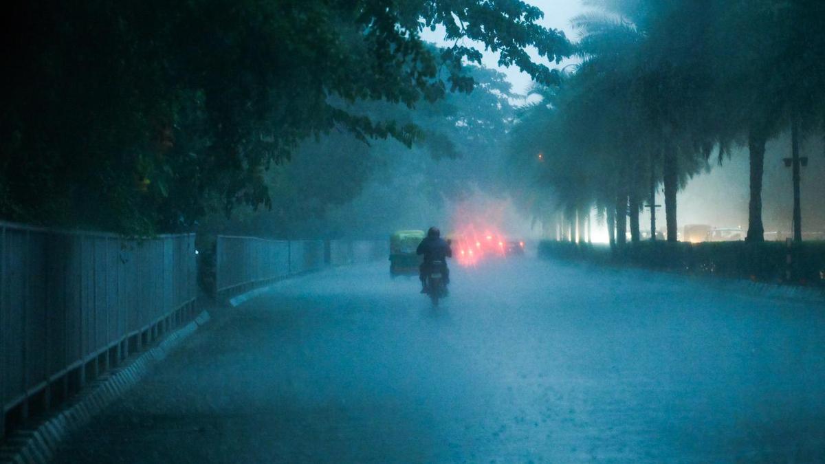
Photo from the source report: Cyclone Arnab: Early Warnings, Inclusive Evacuations and Coastal Resilience
Image: The Hindu
Why in news
Arnab weakened after landfall, but heavy rainfall threatened Odisha and areas farther inland. Telangana offered restoration support to Andhra Pradesh, while Odisha reported extensive evacuations and preventive transfers of pregnant women to health centres.
125–135 km/h
Core winds reported in the editorial
5
Deaths reported by Andhra Pradesh CM
About 57,000
People moved to Andhra relief camps
43,827
People evacuated in Odisha
2,245
Pregnant women shifted in Odisha
17
Odisha districts affected by heavy rain
Background
Tropical cyclones are organised low-pressure systems that draw energy from warm ocean waters and the release of latent heat during condensation. Their development requires sufficient ocean warmth, atmospheric moisture, a pre-existing disturbance, adequate Coriolis force and relatively low vertical wind shear. India's eastern coast faces cyclone hazards from the Bay of Bengal, including destructive winds, storm surge and intense rainfall. Under the Disaster Management Act, national, State and district institutions provide the framework for preparedness, response and recovery; the India Meteorological Department supplies cyclone warnings, while the Central Water Commission provides flood forecasting and related advisories.
What happened: landfall did not end the emergency
According to the supplied reports, Arnab crossed the Andhra Pradesh and Yanam coasts near Narsapur early on October 28 after intensifying into a very severe cyclonic storm. It subsequently weakened to a severe cyclonic storm, with further weakening forecast.
The Andhra Pradesh Chief Minister reported five deaths. The supplied Indian Express headline referred to a higher feared toll; a feared toll is not a confirmed count and should not be merged with the State's reported figure. Casualty and damage assessments remained provisional.
The risk shifted from coastal winds towards prolonged rainfall, inundation and infrastructure failures. Odisha reported widespread heavy rain, while the broader forecast extended the rainfall threat towards Chhattisgarh, Jharkhand and West Bengal.
- Reported fatal incidents involved falling trees, collapsing structures and electrical hazards, demonstrating that cyclone mortality extends beyond direct wind exposure.
- Transport closures and precautionary power shutdowns can save lives, but require arrangements for essential services and stranded people.
- Wind weakening does not automatically imply an end to river flooding or landslide risk.
Infographic
Anticipate
Account for rapid intensification and forecast uncertainty.
Warn
Explain local impacts and clear protective actions.
Include
Provide assisted evacuation and uninterrupted essential care.
Coordinate
Connect States, river agencies, responders and utilities.
Sustain
Protect critical services and restore them safely.
Rebuild
Reduce future infrastructure and livelihood vulnerability.
AI-assisted infographic by Pragnya IAS Academy, based on the cited sources.
Formation and rapid intensification: why forecasts face uncertainty
Warm ocean waters supply heat and moisture to a developing cyclone. Rising moist air condenses and releases latent heat, supporting convection and a pressure fall; surrounding air converges and rotates under the influence of the Coriolis force. Low vertical wind shear helps maintain the organised circulation.
Rapid intensification is a marked strengthening over a short period. High ocean heat content, moist air, favourable upper-level outflow and limited wind shear can support it. These are general enabling conditions, not verified measurements of Arnab's environment in the supplied reports.
The editorial reported that some models underestimated Arnab's eventual strength and that landfall began earlier than predicted. The resulting compression of the evacuation window shows why preparedness cannot depend on a single deterministic forecast.
- Use forecast ranges and regularly updated scenarios rather than treating a predicted track or landfall time as certain.
- Translate meteorological warnings into locality-specific consequences for housing, roads, electricity and evacuation routes.
- Do not attribute Arnab's intensification specifically to climate change without event-specific evidence.
Inclusive evacuation: moving people is only the first step
The NDRF reported that about 57,000 people had been moved to relief camps in Andhra Pradesh. Odisha reported evacuating 43,827 people and shifting 2,245 pregnant women to nearby health centres, illustrating the importance of anticipatory medical evacuation.
Effective evacuation must account for mobility, health, income and communication barriers. Pregnant women, children, older persons, persons with disabilities, migrant workers and people dependent on regular treatment may require different transport, shelter and continuity-of-care arrangements.
- Maintain locally verified assistance lists with privacy safeguards and arrangements to update them before emergencies.
- Provide accessible transport, assisted boarding and clear information in locally understood languages and formats.
- Ensure shelters have safe drinking water, sanitation, lighting, essential medicines and protection against abuse.
- Plan safe accommodation for livestock and protection of livelihood assets to reduce reluctance to evacuate.
- Allow return only after checks of buildings, roads, water quality and electrical safety.
Inter-State coordination: manage the rain footprint, not just the landfall point
Telangana's offer of restoration support to Andhra Pradesh demonstrates the value of mutual assistance, particularly for electricity restoration. Andhra Pradesh also sought a Central team to assess damage, connecting immediate response with subsequent loss assessment.
In Odisha, the Central Water Commission warned of rising river levels across several basins. The editorial highlighted the danger of further rain falling on incompletely drained soils: reduced infiltration can increase runoff, while saturation can destabilise slopes.
Cyclone management therefore requires coordination across meteorological, hydrological, electricity, transport, health and local government agencies. A State outside the landfall zone can still face serious rainfall and riverine risks.
- Share rainfall, river-level, reservoir and road-access information across relevant State and district boundaries.
- Pre-arrange mutual aid for utility crews, rescue teams, equipment and medical supplies.
- Link IMD warnings with CWC flood advisories and district-level evacuation triggers.
- Maintain common reporting formats for casualties, shelter occupancy, infrastructure outages and restoration priorities.
Beyond casualty reduction: protect services and livelihoods
The reports recorded widespread power disruption, damaged roads and houses, and inundated or damaged crops. These losses show why a favourable evacuation outcome cannot, by itself, establish comprehensive disaster resilience.
The editorial's call for a zero-disruption approach is best treated as an aspiration to minimise avoidable interruption, not a reason to avoid necessary safety shutdowns. The practical goal is to preserve essential services, restore them safely and prevent asset losses from pushing households into prolonged distress.
- Strengthen electricity distribution assets and provide backup power for hospitals, shelters, water supply and communications.
- Protect wetlands, mangroves and natural drainage while recognising that ecological buffers cannot replace safe buildings or evacuation.
- Use risk-sensitive land-use planning and cyclone-resistant construction suited to local hazards.
- Combine transparent damage assessment with timely livelihood assistance and resilient reconstruction.
| Hazard | Risk mechanism | Priority response |
|---|---|---|
| Destructive winds | Damage to roofs, trees, poles and exposed infrastructure | Evacuate unsafe structures, secure assets and suspend unsafe movement |
| Storm surge | Cyclone-driven abnormal rise of coastal sea level | Use coastal inundation warnings and evacuate exposed low-lying settlements |
| Intense rainfall | Waterlogging, river flooding and possible slope failure | Integrate rainfall forecasts with basin monitoring and terrain-specific alerts |
| Electrical damage | Snapped conductors and damaged installations create electrocution risks | Isolate unsafe circuits and restore supply only after safety checks |
| Livelihood disruption | Crop inundation, damaged equipment and interrupted market access | Assess losses promptly and support recovery with risk-reducing reconstruction |
- 1. Monitor the ocean, atmosphere and cyclone using observational systems and forecast models.
- 2. Combine wind and rainfall forecasts with flood, terrain and settlement exposure information.
- 3. Issue accessible, impact-based warnings with clear local actions and uncertainty information.
- 4. Evacuate exposed populations early, with assisted transport and preventive medical transfers.
- 5. Maintain shelter services and coordinated rescue, flood monitoring and utility safety operations.
- 6. Inspect affected areas, restore essential services safely and rebuild with lower future risk.
Before landfall
Arnab intensified rapidly; the editorial reported that some models underestimated its strength and that coastal approach was faster than expected.
Early October 28, 2026
Arnab crossed the Andhra Pradesh and Yanam coasts near Narsapur.
October 28, 2026
Andhra Pradesh reported cyclone-related deaths and widespread damage; Odisha reported evacuations and heavy rainfall across several districts.
October 28, 2026
Telangana offered restoration support to Andhra Pradesh, which sought a Central damage-assessment team.
October 29, 2026: forecast horizon
Reports anticipated continuing rainfall and squally conditions in parts of Odisha before weakening; these were forecasts, not verified subsequent outcomes.
Significance, challenges & way forward
Significance
- Large-scale evacuation demonstrates how preparedness can reduce exposure even when cyclone forecasts retain uncertainty.
- Preventive transfers of pregnant women show that disaster management must integrate public health rather than treat it as a separate relief function.
- Telangana's support offer illustrates the practical role of cooperative federalism in restoring damaged infrastructure.
- Continuing rainfall threats beyond landfall reinforce the need for multi-hazard and river-basin-based planning.
- Infrastructure and crop losses make livelihood security and continuity of essential services central measures of resilience.
Challenges
- Rapid intensification and changes in forward movement can sharply reduce the time available for evacuation.
- Night-time landfall complicates communication, transport and assistance to people with limited mobility.
- Previously saturated soils can amplify flooding and slope instability even after cyclone winds weaken.
- Electricity, communications, transport and water systems can fail together, producing cascading disruption.
- Households may resist evacuation when they fear theft, livestock losses or damage to livelihood assets.
- Evolving casualty and damage reports require careful verification to avoid misleading comparisons or double counting.
Way forward
- Adopt impact-based warnings that specify who is exposed, what may fail and which protective action is required.
- Set evacuation triggers early enough to accommodate forecast uncertainty and transport delays.
- Institutionalise accessible shelters, assisted evacuation and continuity of maternal and chronic-disease care.
- Create standing inter-State mutual-aid arrangements for utility restoration, rescue logistics and health support.
- Integrate rainfall, river, reservoir and local drainage information into shared operational decision-making.
- Prioritise resilient lifeline infrastructure alongside ecosystem protection and risk-sensitive land use.
- Evaluate response through casualties, service downtime, inclusion, livelihood recovery and the quality of reconstruction.
Key terms
- Rapid intensification
- A marked increase in a tropical cyclone's strength over a short period.
- Vertical wind shear
- A change in wind speed or direction with height that can disrupt a cyclone's organised structure.
- Ocean heat content
- Heat stored through the upper ocean, which influences the energy available to a cyclone.
- Landfall
- The crossing of a tropical cyclone's surface centre over a coastline.
- Storm surge
- An abnormal rise in sea level generated by a storm, above the predicted astronomical tide.
- Impact-based warning
- A warning that connects forecast hazards with likely effects on people, infrastructure and services.
- Compound disaster risk
- Risk arising when interacting or successive hazards and vulnerabilities intensify adverse consequences.
- Build Back Better
- Recovery and reconstruction that reduce future disaster risk rather than recreate earlier vulnerabilities.
Link with static syllabus
Prelims practice MCQs
Q1. With reference to tropical cyclones, consider the following statements: 1. Relatively low vertical wind shear generally favours the maintenance of an organised cyclone. 2. Latent heat released during condensation helps sustain cyclone convection. 3. Strong Coriolis force at the equator makes it especially favourable for cyclone formation. Which of the statements given above are correct?
Q2. Consider the following institution-function pairs: 1. India Meteorological Department: Cyclone forecasting and warnings 2. Central Water Commission: Flood forecasting and related advisories 3. National Disaster Response Force: Specialised disaster response Which of the pairs given above are correctly matched?
Q3. Why can flood risk remain serious after a cyclone weakens over land? 1. The circulation can continue transporting moisture and producing heavy rainfall. 2. Previously saturated soils can increase runoff from further rainfall. 3. A reduction in wind speed necessarily causes river levels to fall immediately. Select the correct answer.
Q4. Which of the following best describes an impact-based cyclone warning?
Mains practice questions
GS 3 · 15 marks · 250 words
Cyclone preparedness must move beyond reducing casualties to ensuring inclusive protection and continuity of essential services. Discuss with reference to Cyclone Arnab.
Frequently asked questions
Why was Cyclone Arnab difficult to manage despite forecasts?
The editorial reported rapid intensification, underestimation of strength by some models and an earlier-than-predicted start to landfall. These changes reduced the time available for protective action.
Why did Odisha remain at risk after Arnab crossed the Andhra Pradesh coast?
A cyclone's rainfall footprint extends beyond its landfall location. Further rainfall over wet catchments can increase river flooding and slope instability even as winds weaken.
What does inclusive cyclone evacuation involve?
It combines timely movement to safety with accessible transport, medical continuity and shelters suited to different needs. Odisha's preventive transfer of pregnant women is a reported example.
Was storm surge damage established in the supplied reports?
The supplied material establishes wind, rainfall, electrical and infrastructure impacts but does not establish a specific storm surge impact. Storm surge remains an important general cyclone hazard for preparedness.
Sources
- The Hindu: Cyclone ‘Arnab’ LIVE updates | Five killed in Andhra; Telangana extends support to Andhra for restoration works
- The Hindu: Hunker down: On Cyclone Arnab, its landfall
- The Hindu: Cyclone Arnab: 17 Odisha districts affected by heavy rain, Gajapati worst hit
- Indian Express: 7 feared dead as Cyclone Arnab batters Andhra; over 1 lakh evacuated across two states
Analysis prepared by the Pragnya IAS Academy current-affairs desk with AI assistance from the cited reports. Verify figures with the original sources.
Turn current affairs into marks
Join Pragnya IAS Academy's mentorship for daily answer-writing evaluation on stories like this — classroom programmes from a trusted name in IAS coaching in Hyderabad.