
NVS-03 Launch: NavIC Architecture, Atomic Clocks and India’s Navigation Autonomy
Revise the static topic: UPSC Science & Technology notes
In short: ISRO has announced the launch of NVS-03 on October 30 from Sriharikota to support continuity of India’s NavIC navigation services. Carrying an indigenous atomic clock alongside other atomic clocks, the satellite will test the effectiveness of corrective measures following NVS-02’s orbit-raising failure and strengthen the infrastructure for sovereign positioning, navigation and timing.
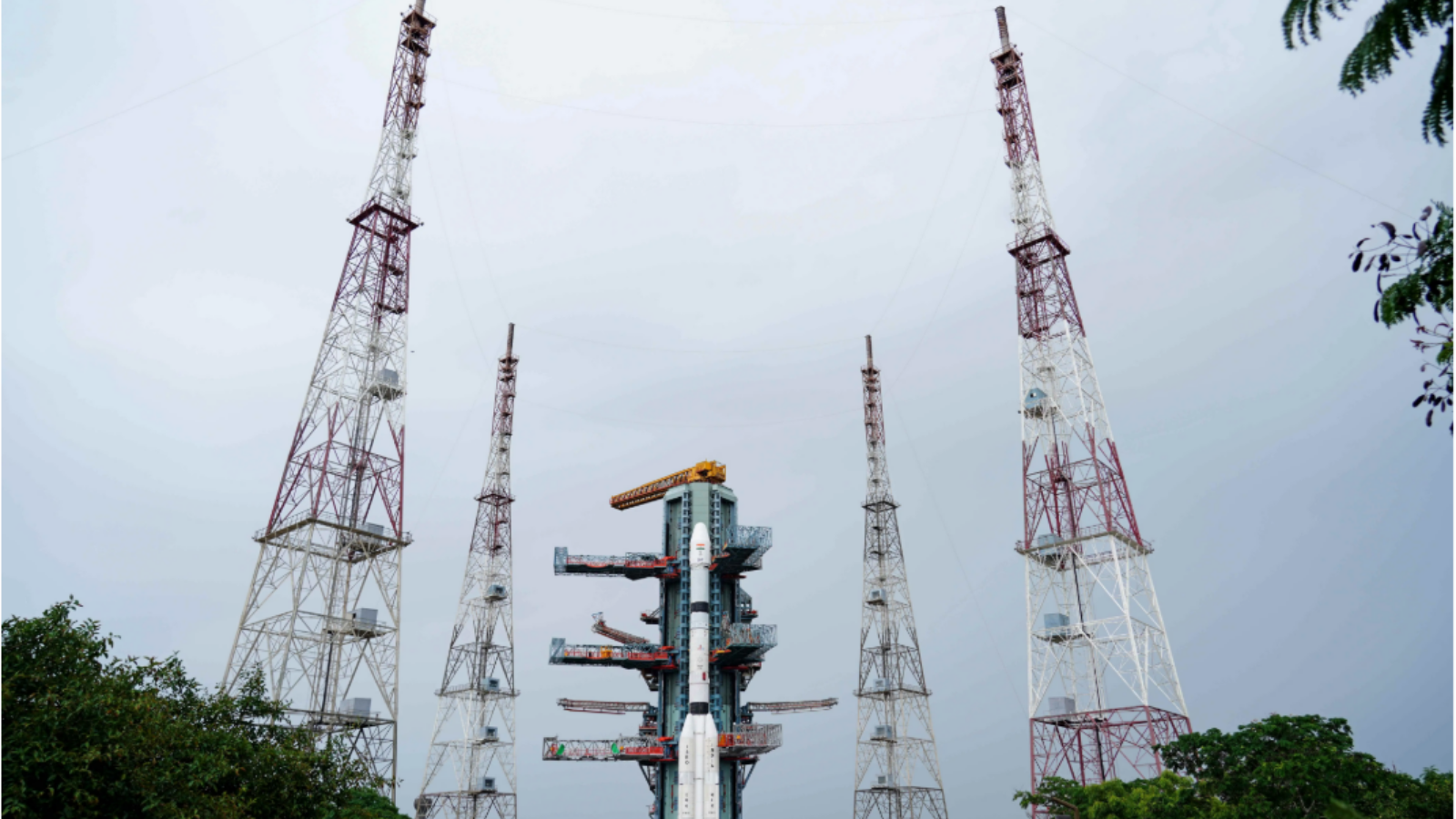
Photo from the source report: NVS-03 Launch: NavIC Architecture, Atomic Clocks and India’s Navigation Autonomy
Image: Indian Express
Why in news
NVS-03 is scheduled to launch aboard GSLV-F18 into a Geosynchronous Transfer Orbit. The mission follows corrective measures recommended by the Apex Committee that examined the shortcomings of NVS-02.
Third
Satellite in the next-generation navigation series
Around 2,250 kg
NVS-03 mass
1,500 km
Coverage beyond the Indian landmass
October 30
Scheduled launch
Background
Navigation with Indian Constellation, or NavIC, is India’s independent regional satellite navigation system, developed by ISRO and originally known as the Indian Regional Navigation Satellite System. Its architecture combines geostationary and inclined geosynchronous satellites with ground-control infrastructure and compatible user receivers. It provides a Standard Positioning Service for civilian users and a Restricted Service for authorised users. Unlike a global constellation such as GPS, NavIC is designed primarily for India and its surrounding region, making it an important component of sovereign positioning, navigation and timing infrastructure.
What is planned for NVS-03?
NVS-03 is the third satellite in the next-generation navigation series intended to maintain continuity of services provided by the IRNSS constellation. It weighs around 2,250 kg and will carry an indigenous atomic clock alongside other atomic clocks.
GSLV-F18 is scheduled to place the satellite in a Geosynchronous Transfer Orbit from Sriharikota’s second launchpad. Transfer-orbit injection is an intermediate milestone: orbit raising, payload checks and integration with the navigation system must follow before operational service can be established.
- The planned navigation coverage encompasses India and extends up to 1,500 km beyond the Indian landmass.
- As of this edition, the launch is scheduled; successful deployment and service commissioning have not been established.
- The mission’s significance lies in service continuity and deployment reliability, not merely in completing a launch.
Infographic
Continuity
Next-generation satellites replenish NavIC infrastructure.
Precision
Atomic clocks underpin signal-based ranging.
Reliability
Orbit raising and commissioning follow launch injection.
Adoption
Compatible receivers turn space capability into civilian services.
Autonomy
Indian-controlled services reduce exclusive foreign dependence.
Resilience
Interference safeguards and backup systems remain essential.
AI-assisted infographic by Pragnya IAS Academy, based on the cited sources.
NavIC architecture: space, ground and user segments
The space segment uses satellites in geostationary and inclined geosynchronous orbits. A geostationary satellite appears fixed over the equator, while an inclined geosynchronous satellite changes its apparent position in the sky. Together, these orbital arrangements support sustained visibility over the intended regional service area.
The ground segment monitors satellite health, determines orbital parameters, estimates clock behaviour and uploads navigation information. The user segment consists of receivers that process signals from multiple satellites to estimate position and receiver-clock error.
NavIC does not require a user to transmit their location to a satellite to obtain a navigation fix. Applications may separately use mobile or internet connectivity for maps, communication and location sharing.
- Space segment: Navigation satellites broadcast precise timing and orbital information.
- Ground segment: Control and monitoring facilities maintain the accuracy and health of the system.
- User segment: Compatible receivers convert satellite signals into positioning, navigation and timing outputs.
Why atomic clocks and next-generation satellites matter
Satellite navigation depends on measuring signal travel time. A receiver compares transmitted timing information with reception time to estimate its distance from satellites; consequently, clock errors translate into ranging errors. Atomic clocks provide highly stable timing, while ground monitoring helps estimate and correct clock deviations.
NVS-03’s indigenous atomic clock is therefore a strategically important subsystem. Domestic capability in such components can reduce dependence on external suppliers, although indigenising a clock alone does not establish complete self-reliance across the navigation ecosystem.
Next-generation satellites help replenish ageing space infrastructure and sustain service continuity. The next-generation NavIC design also incorporates L1 signals alongside the existing L5 and S-band signals, supporting broader receiver compatibility. Actual civilian adoption still depends on compatible chipsets, antennas, software and device integration.
- Clock stability is central to navigation performance, but orbit knowledge, signal propagation and receiver quality also matter.
- Multiple onboard clocks provide scope for redundancy, but system reliability also requires dependable power, control and ground infrastructure.
- Satellite modernisation and receiver adoption must advance together.
NVS-02’s lesson: orbit injection is not operational deployment
In January 2025, the NVS-02 mission encountered failure during orbit-raising operations after launch aboard GSLV-F15. According to the reported analysis, a drive signal did not reach the pyro valve in the engine’s oxidiser line, preventing the intended transition from an elliptical transfer orbit to a circular operational orbit.
This distinction is important: the reported problem was in the satellite’s orbit-raising chain, not evidence that every stage of the launch vehicle had failed. The NVS-03 launch is planned after corrective measures suggested by the Apex Committee that examined the earlier mission.
The broader engineering lesson is that a mission must be validated end to end. Launch-vehicle performance, spacecraft propulsion, command delivery, valve actuation, navigation payload health and service commissioning are separate but connected requirements.
- The supplied report does not specify the individual corrective measures adopted for NVS-03.
- Their operational effectiveness can be assessed only after the relevant deployment stages are completed.
Civilian utility and strategic autonomy
NavIC can support road and maritime navigation, fleet management, precision agriculture, surveying and disaster-response coordination. Its timing capability is also relevant to synchronisation in telecommunications, power systems and financial infrastructure, where suitable receivers and safeguards are available.
For strategic users, an Indian-controlled navigation service reduces exclusive dependence on foreign-controlled systems and enables sovereign control over service provision. However, ownership does not make satellite signals immune to jamming, spoofing or local reception constraints.
The strongest approach combines indigenous capability with interoperability. Multi-constellation receivers can improve signal availability and satellite geometry while retaining NavIC as a sovereign regional capability.
- Civilian value depends on affordable receivers, reliable performance and integration into everyday services.
- Strategic autonomy requires resilient ground systems, secure authorised-user services and dependable domestic supply chains.
- Regional coverage should not be confused with worldwide service availability.
| Feature | NavIC | GPS |
|---|---|---|
| System orientation | Indian regional navigation system | United States-operated global navigation system |
| Primary coverage | India and the surrounding region extending up to 1,500 km | Global coverage |
| Constellation architecture | Geostationary and inclined geosynchronous satellites | Primarily medium Earth orbit satellites |
| User requirements | NavIC-compatible receiver hardware and software | GPS-compatible receiver hardware and software |
| Relationship with other systems | Can be integrated into multi-constellation receivers | Can be integrated into multi-constellation receivers |
- 1. GSLV injects NVS-03 into a Geosynchronous Transfer Orbit.
- 2. Spacecraft propulsion raises and adjusts the orbit towards its intended operational configuration.
- 3. Ground controllers verify spacecraft systems, atomic clocks and navigation payload performance.
- 4. Ground infrastructure determines and updates orbital and clock information.
- 5. The satellite is integrated into navigation service operations after validation.
- 6. Compatible receivers combine satellite signals to estimate position and time.
January 2025
NVS-02, launched aboard GSLV-F15, encountered a failure during orbit-raising operations.
After the NVS-02 mission
An Apex Committee analysed the shortcomings and suggested corrective measures.
October 2026
ISRO announced the planned NVS-03 launch from Sriharikota.
October 30, 2026 — scheduled
GSLV-F18 is planned to inject NVS-03 into a Geosynchronous Transfer Orbit.
Significance, challenges & way forward
Significance
- NVS-03 is intended to strengthen continuity of India’s regional navigation services through constellation replenishment.
- An indigenous atomic clock advances domestic capability in a critical navigation subsystem.
- Sovereign positioning, navigation and timing infrastructure reduces exclusive reliance on foreign-controlled services.
- A wider NavIC-compatible device ecosystem can support transport efficiency, maritime safety, agriculture and emergency response.
- The mission provides an opportunity to validate corrective action after the NVS-02 orbit-raising failure.
Challenges
- Successful transfer-orbit injection must be followed by reliable orbit raising, payload validation and service commissioning.
- Satellite replenishment must be coordinated with ground-system readiness to maintain navigation service continuity.
- Limited receiver compatibility, integration costs and weak user awareness can constrain civilian adoption.
- Jamming, spoofing, multipath interference and signal blockage can affect performance even when satellites are functioning normally.
- Indigenisation must extend beyond individual components to testing capability, manufacturing quality and supply-chain resilience.
Way forward
- Validate corrective measures through end-to-end testing of command delivery, propulsion interfaces and deployment sequences.
- Maintain a coordinated satellite-replenishment and ground-modernisation strategy focused on service continuity.
- Support affordable NavIC-compatible chipsets and receiver integration through standards, testing facilities and industry collaboration.
- Encourage multi-constellation receivers while preserving sovereign control over NavIC’s core infrastructure and authorised services.
- Develop interference monitoring, anti-spoofing safeguards and alternative timing arrangements for critical infrastructure.
- Assess mission success through operational availability and user-service performance rather than launch completion alone.
Key terms
- NavIC
- Navigation with Indian Constellation, India’s independent regional satellite navigation system.
- Positioning, navigation and timing
- Services that determine location, support movement and provide precise time references.
- Atomic clock
- A clock that uses an atomic transition as a highly stable frequency reference.
- Geosynchronous orbit
- An orbit whose period matches Earth’s rotation relative to the stars.
- Geostationary orbit
- A circular, equatorial, prograde geosynchronous orbit in which a satellite appears fixed over Earth.
- Geosynchronous Transfer Orbit
- An elliptical intermediate orbit used to transfer a spacecraft towards a geosynchronous operational orbit.
- Pseudorange
- A signal-travel-time-based estimate of satellite-to-receiver distance that includes clock offsets and other errors.
- Spoofing
- Transmission of deceptive navigation signals intended to mislead a receiver about its position or time.
Link with static syllabus
Prelims practice MCQs
Q1. With reference to NavIC, consider the following statements: 1. It is designed primarily to provide regional navigation services. 2. Its architecture includes both geostationary and inclined geosynchronous satellites. 3. A user must transmit their location to a NavIC satellite to obtain a navigation fix. Which of the statements given above are correct?
Q2. Why are atomic clocks important in satellite navigation?
Q3. With reference to the NVS missions described in the report, consider the following statements: 1. NVS-03 is scheduled for injection into a Geosynchronous Transfer Orbit. 2. NVS-02 encountered a failure during orbit-raising operations. 3. Injection into a transfer orbit alone establishes that a navigation satellite is operational. Which of the statements given above are correct?
Q4. Consider the following statements about satellite orbits: 1. Every geostationary orbit is geosynchronous. 2. Every geosynchronous satellite appears fixed over a point on the equator. Which of the statements given above is/are correct?
Mains practice questions
GS 3 · 15 marks · 250 words
Explain the architecture of NavIC. How can next-generation navigation satellites strengthen India’s civilian infrastructure and strategic autonomy? Discuss the associated challenges.
Frequently asked questions
What is NVS-03 and when is it scheduled to launch?
NVS-03 is the third satellite in ISRO’s next-generation navigation series, intended to support NavIC service continuity. It is scheduled to launch on October 30 aboard GSLV-F18 from Sriharikota.
Is NavIC a global alternative to GPS?
NavIC is a regional system covering India and the surrounding region extending up to 1,500 km, whereas GPS provides global coverage. Compatible receivers can use NavIC alongside other satellite navigation systems.
Why does an indigenous atomic clock matter?
Navigation satellites require highly stable timing because signal travel time is used to estimate distance. An indigenous atomic clock strengthens domestic control over a critical subsystem and can reduce supplier dependence.
What went wrong with NVS-02?
The reported analysis found that a drive signal failed to reach the pyro valve in the engine’s oxidiser line during orbit raising. This prevented the intended transition from the elliptical transfer orbit to the circular operational orbit.
Sources
- Indian Express: ISRO to launch navigation satellite NVS-03 on Friday
Analysis prepared by the Pragnya IAS Academy current-affairs desk with AI assistance from the cited reports. Verify figures with the original sources.
Turn current affairs into marks
Join Pragnya IAS Academy's mentorship for daily answer-writing evaluation on stories like this — classroom programmes from a trusted name in IAS coaching in Hyderabad.