
InfoGraphix by Pragnya · Geography · Chapter 12
India: Location, Size and Neighbours
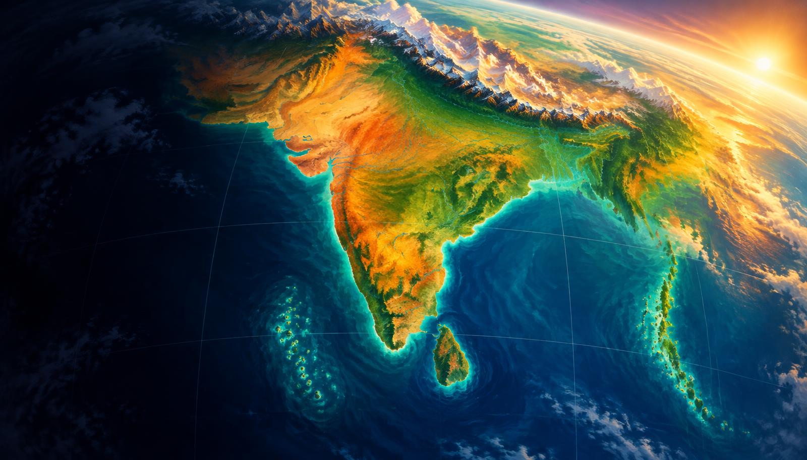
Locate India through coordinates, dimensions, neighbours and island passages. Connect this map to maritime rights, border management, climate and strategic opportunity.
- 18 visual topics
- 54 practice MCQs
- 54 flip cards
Three map-based learning stages
Topics 1–6
Locate and measure
Coordinates, tropics, time, area, extreme points and the official border-length inventory.
Topics 7–12
Read the border mosaic
State matching, Northeast connectivity, terrain-specific border management, the coastline update and maritime neighbours.
Topics 13–18
Connect islands to influence
Island channels, maritime zones, ocean strategy, historical connections and integrated revision.
A learning route from coordinates to strategy
Scroll the ribbon and tap any milestone to open its infographic.
Map
Coordinates
Begin with mainland and island scope.
Open topic →Sun
Latitude and time
Trace the Tropic and calculate local-time differences.
Open topic →Scale
Area and limits
Separate angular span, distance and territorial scope.
Open topic →Land
Neighbours
Learn lengths and border-state matrices.
Open topic →Link
Connectivity
Add Siliguri, Kaladan and differentiated border management.
Open topic →2025
Coastline revision
Use the revised total with its measurement context.
Open topic →Islands
Channel pairs
Follow Minicoy and the Andaman–Nicobar arc.
Open topic →Law
Maritime zones
Distinguish sovereignty from resource rights.
Open topic →Strategy
Location into capability
Balance sea-lane opportunity with resilience and cooperation.
Open topic →
Topic index
Follow the numbers in order, or jump to what you need.
0 of 18 revised on this device
- 1Location
Coordinates and Hemispheres
Mainland limits versus the island-inclusive map
India lies wholly north of the Equator and east of Greenwich. Its familiar mainland coordinates must be distinguished from the island-inclusive southern limit.
Open infographic - 2Location
The Tropic of Cancer Across India
Eight states, one west-to-east sequence
The Tropic of Cancer crosses eight Indian states and provides a useful first approximation to India’s tropical–subtropical contrast. It is not a boundary separating two uniform climates.
Open infographic - 3Time
Longitude and Indian Standard Time
82°30′E, UTC+5:30 and the four-minute rule
India’s nearly 30° longitudinal spread produces almost two hours of local solar-time difference. A single standard time synchronises national activity without eliminating that solar contrast.
Open infographic - 4Size
Area, Dimensions and Scale
3.287 million km² and unequal ground distances
India ranks seventh in area and occupies about 2.4% of the world’s land surface. Similar angular spreads in latitude and longitude do not translate into equal distances on Earth.
Open infographic - 5Map anchors
Extreme Points: Mainland, Islands and Claims
Indira Point is not Kanyakumari
Extreme-point questions demand more than a place-name list: mainland limits, island limits and territorial claims must be separated. Border settlements are often used as map anchors rather than exact geodetic endpoints.
Open infographic - 6Land borders
Seven Land Neighbours: Official Lengths
Bangladesh longest; Afghanistan shortest
Official MHA border lengths identify seven land neighbours and total 15,106.7 km. The Afghanistan segment belongs to India’s territorial claim and is not an operational border administered by India.
Open infographic - 7Land borders
Border States and Union Territories
Country-to-state matching without map shortcuts
A country-wise border matrix is the most reliable way to solve state–neighbour matching questions. Present-day Union Territory names matter after the 2019 reorganisation of Jammu and Kashmir.
Open infographic - 8Map practice
Three-Country States and Common Traps
West Bengal, Sikkim and Arunachal Pradesh
Three Indian states each touch three foreign countries: West Bengal, Sikkim and Arunachal Pradesh. Nearby Assam, Mizoram and Uttarakhand are useful counterexamples in elimination questions.
Open infographic - 9Connectivity
Siliguri Corridor and Northeast Connectivity
A narrow link needs several resilient alternatives
The Siliguri corridor in northern West Bengal connects the Northeast with the rest of India. Its narrow geography makes route redundancy, local development and diplomacy mutually reinforcing priorities.
Open infographic - 10Governance
Border Management: Terrain and Cooperation
Security, legal movement and border communities
India’s borders range from deserts and high mountains to rivers and forested hills. Effective management combines surveillance and infrastructure with legal trade, community trust and negotiated solutions.
Open infographic - 11Coasts
Coastline: The 2025 Measurement Update
11,098.81 km measures detail, not sudden growth
A 2025 official circular promulgated a revised Indian coastline length of 11,098.81 km, including islands. The increase over 7,516.6 km primarily reflects improved measurement scale and methodology.
Open infographic - 12Maritime map
Maritime Neighbours and the Sri Lanka Interface
Seven neighbours; Palk Bay to Gulf of Mannar
India’s standard maritime-neighbour list includes seven countries around the Arabian Sea and Bay of Bengal. Sri Lanka’s proximity makes straits, shallow waters, fisheries and ecological cooperation especially important.
Open infographic - 13Island channels
Lakshadweep: Eighth and Ninth Degree Channels
Minicoy is the anchor for both channel pairs
The Eight Degree and Nine Degree Channels are easiest to remember by fixing Minicoy on a map. One lies toward the Maldives; the other separates Minicoy from the main Lakshadweep group to its north.
Open infographic - 14Island channels
Andaman–Nicobar: Channels and Passages
Coco, Duncan, Ten Degree and Great Channel
The Andaman–Nicobar chain forms a north–south maritime arc near Southeast Asia. Its channels distinguish island groups and connect India’s map questions with approaches to major shipping routes.
Open infographic - 15Maritime law
Maritime Zones: Distance Is Not Sovereignty
12, 24 and 200 nautical miles from baselines
India’s maritime zones are measured from legal baselines, not simply from whichever beach is nearest. Territorial sovereignty, limited enforcement powers and resource-related sovereign rights apply to different zones.
Open infographic - 16Significance
Indian Ocean Location: Strategic Opportunity
Sea lanes, chokepoints and island responsibilities
India’s peninsula projects into the northern Indian Ocean between western energy suppliers and eastern production centres. This position offers strategic reach, but influence depends on capacity, partnerships and responsible conduct.
Open infographic - 17Significance
Location, Climate and Historical Connections
Passes, monsoons, ports and the Suez route
India’s location links continental and oceanic influences, helping explain monsoons, regional climates and long-distance exchange. Geography creates pathways and constraints, while technology and institutions shape the outcomes.
Open infographic - 18Revision
Chapter Quick Revision
Numbers, map pairs, traps and a Mains framework
Revise India’s extent, neighbours, island channels and maritime rights as a connected map. Attach dates and definitions to changing figures, then turn locational advantages into a balanced strategic argument.
Open infographic
Full reading notes in the Study Library
- Insolation →
- Monsoon mechanism →
- Population distribution →
- Islands →
- Himalayas →
- Roads →
- Inland waterways →
- Migration →
- Mountain passes →
- Coastal processes →
- Coastal Plains →
- Fisheries →
- Marine protected areas →
- Coral reefs →
- Marine resources →
- Ocean floor →
- Ports →
- Petroleum →
- Tropical cyclones →